Check out information shared by those familiar with the socio-environmental agenda. Authors such as Juliana Santilli, who unravels more on agrobiodiversity and addresses sustainability and food security. Lawyer and journalist, researcher at the Centre for Sustainable Development of the University of Brasília and PhD in Socio-Environmental Law, Juliana was a prosecutor in Public Prosecution Service of the Federal District and a founding partner of ISA. Michele de Sá, Ph.D. in Ecology, professor in the Department of Ecology and Zoology of the Federal University of Santa Catarina and a collaborator with the Horus Development and Environmental Conservation Institute, is a specialist in invasive species and provides us with examples of effective biodiversity volunteering. Marcelo Salazar, engineer, and Andre Villas-Bôas, indigenista, both advisers to ISA and for many years key actors in the development, defence and implementation of socio-environmental rights in Brazil, relate their experiences in and about the Terra do Meio.
Several other partners share with us their views on initiatives and challenges in other protected areas: on the Matupiri State Park, Sergio Sakagawa (head of park from 2010 to 2015 and MA in Protected Area Management), Henrique Pereira dos Santos (PhD, Federal University of Amazonas) and Juliane Franzen (MA Federal University of Paraná); on the Cabo Orange National Park, David Leonardo Bouças da Silva (MA, Centre for Sustainable Development, University of Brasília and professor of tourism and hospitality at the Federal University of Maranhão), Nádia Bandeira Sacenco Kornijezuc (PhD candidate, Centre for Sustainable Development, University of Brasília) and Caroline Jeanne Delelis (researcher at the Centre for Sustainable Development of the University of Brasília - Embassy of France; and on the Lower Rio Negro Mosaic, Thiago Mota Cardoso (formerly researcher at IPÊ-Institute of Ecological Research); as well as content on traditional populations and territories, environmental services, elements of biodiversity, SNUC and other topics.
Who are traditional populations?
Authorship: Manuela Carneiro da Cunha (Anthropologist, University of Chicago) & Mauro W. B. Almeida (Anthropologist, University of Campinas) (2010)
The use of the term “traditional populations” is deliberately broad. Such breadth should not however be mistaken for conceptual confusion. To define traditional populations by means of their adherence to tradition would go against current anthropological understanding. To define them as populations with a small environmental footprint, and thus claim they are ecologically sustainable, would simply be tautologous.
If we were to define them as populations outside the sphere of the market, it would be difficult to find any nowadays. In academic and legal texts categories are generally described by means of the properties or characteristics by which they are constituted. But social categories can also be described “by extension”, that is to say through the simple enumeration of the elements that make them up. For the time being we think it better to define “traditional populations” “by extension”, that is to say by listing their current “members” or the candidates for “membership”.
This approach is consistent with the emphasis we will give to the creation and appropriation of categories and, more importantly, it points to the formation of subjects by means of new practices.
This is no novelty. Terms such as “indian”, “indigenous”, “tribal”, “native”, “aborigine” are metropolitan creations, fruits of the colonial encounter. Despite being generic and artificial when they were created, little by little these terms were inhabited by real flesh and blood people. This is what can happen, though not inevitably, when they gain administrative or legal status. It should not be forgotten that what frequently happens is that the peoples who began inhabiting these categories by force have been capable of reclaiming these same categories, converting terms laden with prejudice into platforms for mobilization. In such cases deportation to a foreign conceptual territory ends up leading to the occupation and defence of this territory. It is at this point that the category which started out being defined “by extension” can be redefined analytically on the basis of its properties.
Initially the category brought together seringueiros (rubber-tappers) and castanheiros (Brazil nut collectors) from the Amazon region and then expanded to include other groups ranging from mussel collectors in Santa Catarina to collectors of babassu nuts in southern Maranhão and quilombolas in Tocantins.
What all these groups have in common is the fact that they have, at least in part, a history of low environmental impact and a current interest in retaining or recovering control over the territories they use. Above all, they are open to negotiation: in exchange for control of their territories they commit to providing environmental services
Although, as we will show, traditional populations have taken indigenous peoples as their model, the category of “traditional populations” does not include these. This divide derives from a fundamental legal distinction: indigenous territorial rights are unqualified as regards conservation, even when it can be seen that indigenous lands stand out as “islands” of environmental conservation in a context of accelerating devastation. In order to stress this specific characteristic of Brazilian legislation that distinguishes indigenous peoples from “traditional populations” we do not include the former in the latter category and, when referring to both, will use the expression “indigenous and traditional populations”.
Are Traditional Peoples really conservationists?
Those opposed to the participation of traditional populations in conservation argue that:
-
not all traditional societies are conservationists;
-
even those that currently are may change for the worse when they have access to markets.
For a long time there existed among anthropologists, conservationists, government officials and the populations themselves a presumption of inevitability in the relationship between traditional populations and the environment. A set of ideas which represent indigenous groups as naturally conservationist led to what has become known as “the myth of the good ecological savage”.1 It is obvious that natural conservationists do not exist; however, even when we change “natural” to ”cultural”, the question persists: can traditional populations be described as “cultural conservationists”?
Environmentalism can signify a set of practices or refer to an ideology. There are however three differing situations, which tend to be confused when a single term is used to designate all three. Firstly, you can have the ideology without its effective practice – we refer to the case of merely verbal support for conservation. Next there is the case in which both sustainable practices and cosmology are present.
Numerous indigenous Amazonian societies subscribe to a kind of Lavoisierist ideology in which nothing is lost and everything is recycled, including lives and souls. Such societies subscribe to an ideology of limited exploitation of natural resources, in which humans maintain the balance of the universe, which encompasses both the natural and the supernatural.
Values, dietary and hunting taboos, and institutional or supernatural sanctions provide the instruments with which to operate in accordance with this ideology. Such societies may easily be placed into the category of cultural conservationists. The example of the Peruvian Yagua immediately springs to mind 2.
Finally you can have cultural practices without ideology3. In this case we refer to populations that, despite not having an explicitly conservationist ideology, follow cultural rules on the uses of natural resources that, given their population density and the territory in which they are applied, are sustainable. It should be noted that, to conserve resources, a society is not required to completely avoid predation, merely to keep it within limits. If a society approves the slaughter of a tribe of monkeys, including its females and young, and such a massacre, however repugnant, does not affect the population stock, then the society is not infringing conservation practice. What should be asked is whether the habits in question are compatible with sustainable use, rather than whether they are morally wrong.
We may object to sport hunting in our society. The fact is that North American associations that started life as hunting associations, such as the National Wildlife Federation, were and are important for environmental conservation. In the same way indigenous groups may conserve and manage with creativity and competence the environment in which they live.
However this does not necessarily spring from a cosmology of natural balance but rather may be the result of considerations to do with maintaining resource stocks. Indigenous groups and some mobile groups such as seringueiros do in fact protect and maybe even enrich the biodiversity of neotropical forests. The Amazonian forests are dominated by species competing for access to sunlight. By opening small clearings in the forest, human groups create opportunities for less favoured species to gain a window of access to sunlight, as is also the case when a large tree falls 4.
The second argument is that, although traditional societies may have exploited their environments sustainably in the past, the frontier populations with whom they now interact will influence them in the direction of short-sighted resource uses. In the absence of adequate institutions and with little information about alternative opportunities, the wider economy will morally erode these social groups as a younger generation with an entrepreneurial spirit will enter into conflict with old customs and values of reciprocity. According to this line of argument, although the “traditional culture” may have practiced conservation in the past, the needs induced by the contact with a market economy will inevitably lead to cultural change and the over-exploitation of natural resources. It is true that there will certainly be changes, but not necessarily over-exploitation. For what the state of equilibrium prior to contact also implies is that, given certain structural conditions, traditional populations can play an important role in conservation.
Balée has undertaken a detailed review of the evidence that Amazonian societies enrich natural resources, whether these are rivers, soils, fauna or plant diversity4, 5, 6 e 7. What this scenario fails to recognize is that the situation has changed and with this the validity of past paradigms. Traditional populations are no longer outside the central economy nor are they simply on the periphery of the global system.
Traditional populations and their organizations do not deal simply with ranchers, loggers and prospectors. They have become partners with mainstream institutions such as the United Nations, the World Bank and powerful first world NGOs. Neither is the market in which traditional populations operate today the same as that of yesterday. Until recently, in order to obtain cash, indigenous societies supplied the market with primary products: raw materials such as rubber, Brazil-nuts, minerals and timber.
They have jumped the second stage of goods with added industrial value and have barely engaged with third generation goods and services. They have begun to participate in the information economy – fourth generation products – through adding value to local and indigenous knowledge 8, 9, 10, 11 e 12.
They have entered the emerging market for “existence values” such as biodiversity and natural landscapes. In 1994 there were buyers prepared to pay for titles to a square metre of Central American forest despite knowing that they would never be able to see this square meter.
Learn more about the question of payments for environmental services.
* An edited version of the text “Traditional populations and environmental conservation”, originally published in: ‘Biodiversity in the Brazilian Amazon: assessment and priority actions for conservation, sustainable use and benefit sharing’. João Paulo Capobianco et al.(org.). São Paulo: Estação Liberdade - Instituto Socioambiental, 2004 (540 pp).
Further information
- Decreto Federal Nº6.040 de 7 de fevereiro de 2000 - Institui a Política Nacional de Desenvolvimento Sustentável dos Povos e Comunidades Tradicionais.
References
- REDFORD, K.; STEARMAN A. M. "The Ecologically Noble Savage". Cultural Survival Quarterly, v. 15, n. 1, p. 46-8, 1991.
- CHAUMEIL, J.P. Voir, Savoir, Pouvoir. Le chamanisme chez les Yagua du Nord-Est Peruvien. Paris: Editions de l'Ecole des Hautes Etudes en Sciences Sociales, 1983, 352p.
- GONZALES, N. "We are not Conservationists". Cultural Survival Quarterly, Fall, p. 43-5, 1992, Interview conducted by Celina Chelala.
- BALÉE, W. Footprints of the Forest Kaapor Ethnobotani, the Historical Ecology of Plant Utilization by an Amazonian People. Nova Iorque: Columbia Univ. Press, 1994.
- BALEÉ, W. "The Cultura of Amazonian Forests. Advances in Economic Botany", 7, p. 1-21, 1989.
- ANDERSON, A. B. "Forest Management Strategies by Rural Inhabitants in the Amazon Estuary". In: GOMEI-POMPA, A.; WHITMORE, T. C.; HADLEY, M. (Orgs.). Rain forest regeneration and management. UNESCO, 1991. p. 351-60.
- KAPLAN, H.; KOPISCHKE, K. "Resource Use, Traditional Technology and Change Among Native Peoples of Lowland South America". In: REDFORD, K; PADOCH, C. (Orgs.). Conservation of Neotropical Forests: Working from Traditional Resource Use. Nova Iorque: Columbia Univ. Press, 1992, p. 83-107.
- CUNNIGHAM, A. B. "Indigenous Knowledge and Biodiversity: Global Commons or Regional Heritage?". Cultural Survival Quarterly, Summer, p. 1 - 4, 1991.
- NIJAR, G. S. In Defense of Local Community Knowledge and Biodiversity. Third World Network Paper, 1996, 62 p.
- BRUSH, S. "Indigenous Knowledge of Biological Resources and Intellectt Property Rights: the Role of Anthropology". American Anthropologist, 95, n. 3, p. 653-86, 1996.
- CUNHA, M. C. da et al. "Exploitable Knowledge Belongs to the Creators of a Debate". Social Anthropology, v. 6, n. 1, p. 109-26, 1998.
- CUNHA, M. C. da. "Populações tradicionais e a convenção da diversidade biológica". Revista do Instituto de Estudos Avançados, 1999. (Também publicado por: Populations Traditionnelles et Convention sur la Diversite Biologique: 1'exemple du Brasil. Journal d'Agriculture Traditionnelle et de Botaniq Appliquee, 1999).
What are environmental services?
Authorship: Henry Phillippe Ibanes de Novion (biologist, analyst of the MMA) (2010)
Every year, throughout the world, millions of people who produce food wait for the right time to plant their seeds.
They count on the right amount of rain to fill the rivers, which for their part carry indispensable nutrients for the plants to grow. They also count on the help of bees, butterflies, hummingbirds, and various other creatures that transport pollen to each of their plants, fertilizing them and providing fructification. With everything running smoothly, not raining too much – which could flood the plantation – or not raining too little – causing drought – after a few months they will have good production, from which they will be able to support their family, sell what remains, and buy what they need. The farmer – be he indigenous, quilombola, family, or not – works with nature and depends on its services in order to produce and live well.
For some time now, population increase, the growth of cities, the development of consistently bigger industries, and the necessity to produce in greater quantity has been significantly increasing the exploitation of nature and its resources. This sort of exploitation has been causing damage to the environment, which, nearly always, cannot recover and restore its functions, its nutrients, and the proper functioning of its natural cycles. The rivers, which used to bring clean water, are now consistently dirtier, transporting sewage and trash. If before the river used to run vigorously, now it runs slowly, as we consume more water than the river is capable of restoring, and, in addition, with the destruction of the riparian forests and of the headwaters that protect the rivers from siltation, sediments, like sand, run directly into the river, accumulating in its riverbed and making it difficult for water to pass. Pollinizers, such as bees and birds, in many places are disappearing, be it through the destruction of their natural habitats, be it through pollution and excessive use of agro-toxins.
This process of exploitation and destruction, at a much accelerated rate, affects the proper functioning of the natural cycles and their services.
The rains do not occur any longer at the correct time or with the correct intensity. Without the pollinizers, plants fruit less and production is affected. The rivers dry out, transport consistently fewer nutrients, impoverishing the soils. All these alterations in the proper functioning of nature’s services (rain, pollination, fertilization of soils) cause harm to everything and everyone that depends on nature, such as those who plant food.
This help from nature, on which we all depend, is given the name environmental service.
How many species, for example, are necessary for the maintenance of soil fertility? In one simple gram of soil, there are close to 30 thousand protozoans, 50 thousand algae, 400 fungi, and billions of bacteria. If we amplify this scale, we will find thousands of insects and worms 1.
Environmental service is the capacity of nature to supply quality of life and facilities, or rather, guarantee that life, as we know it, exists for everyone and with quality (pure air, clean, accessible water, fertile soils, forests rich in biodiversity, nutritious and abundant food, etc.), or rather, nature works (provides services) for the maintaining of life and its processes, and these services performed by nature are called environmental services. The environmental services provided by nature supply products such as food, natural medicines, fibers, water, oxygen, etc.; they also guarantee the proper functioning of the natural processes like climate control, water purification, rain cycles, climatic balance, the oxygen we breathe, the fertility of the soil, and the recycling of nutrients necessary, for example, for agriculture. In other words, environmental services are the activities, products, and processes that nature provides us and makes possible life as we know it without greater costs to humanity. Other examples of environmental services are: The production of oxygen and purification of air by plants; the stability of climatic conditions, with the moderation of temperatures, rains, and strength of winds and tides; and the production capacity of water and balance of the hydrological cycle, with control of flooding and droughts. Such services also correspond to the flow of materials, energy, and information of the stocks of natural capital.
Although there is no price established, environmental services are more valuable for the well-being and the very survival of humanity, as human activities depend on environmental services, such as, for example, agriculture (which demands fertile soil, pollination, rain, abundant water, etc.) and industry (which needs fuel, water, quality prime materials, etc.). How much work would it cost the farmer to perform the pollination services (that the bees do without charging), taking the pollen to all the plants in the field and orchard? How much time and effort would be necessary to transform all the organic material that exists in a forest into nutrients available to the plants, if there did not exist elements in nature (decomposers) that do this “for free”? How many machines would be necessary to provide the service of producing oxygen and purifying the air, a service that plants and algae do every day? How much are all these services that nature does worth? They are worth all the life on the planet.
The continuity or maintenance of these services, essential to the survival of all the species, depends, directly, on environmental conservation and preservation, as well as on practices that minimize the impacts of human actions on the environment.
Indigenous peoples and traditional communities, who have historically preserved the environment and used its resources and services in a conscious and sustainable way, are also responsible for supplying these environmental services, as they are what are called providers of environmental services. By permitting the environment to maintain its natural characteristics and keep on supplying environmental services, these peoples and communities guarantee the supply of environmental services that are used by everyone. The services of preserving nature and its characteristics, conserving biodiversity, supplying quality water (in that they preserve the forest at the headwaters and along the banks of the river) have a cost for the indigenous peoples and traditional communities, and thus the discussion has arisen on the mechanisms of remuneration or compensation for those who conserve and guarantee the supply of environmental services; this remuneration is called Payment for Environmental Service.
Notes and References
- G. Daily desenvolve esse exemplo, originalmente uma idéia de John Holdren, na introdução do livro por ela editado em 1997: Nature’s Services – Societal dependence on natural ecosystems. Island Press, Washington DC, p. 1-11.
Payment for environmental services
Authorship: Henry Phillippe Ibanes de Novion (biologist, analyst with the Ministry of the Environment) (2010)
The payment or compensation for environmental services consists of the transfer of resources (monetary or other) to whoever helps to maintain or produce environmental services. As the benefits of environmental services are enjoyed by all, the principle is that there is nothing fairer than people who contribute to the conservation and maintenance of environmental services receiving incentives. It is not enough to charge taxes to whoever pollutes a river or deforests a headwater; it is necessary to reward those who guarantee the offer of services voluntarily.
The definition of environmental services follows below, as well as more examples presented by the Federal Deputy Anselmo de Jesus of the Workers’ Party (PT) of Rondônia in his Legal Project Number 792 of 2007.
Art. 1. Environmental services are considered those that are presented as flows of material, energy, and information from a natural capital stock that with constructed capital and human services produce benefits to human beings, such as:
I – The goods produced and proportioned by the ecosystems, including foodstuffs, water, fuels, fibers, genetic resources, and natural medicines;
II – Services obtained from the regulation of the ecosystem processes, such as air quality, climate regulation, water regulation, water purification, control of erosion, regulation of human diseases, biological control, and mitigation of risks;
III – Non-material benefits that enrich quality of life, such as cultural diversity, religious and spiritual values, knowledge – both traditional and form - , inspirations, esthetic values, social relations, feeling of belonging, cultural heritage value, recreation, and ecotourism;
IV – Services necessary for producing all of the services, including primary production, soil formation, oxygen production, soil retention, pollination, habitat provision, and nutrient recycling.
Art. 2. All that which, in a voluntary fashion, employs efforts toward the application or development of the benefits set in Art. 1 of this law will make fair payment or compensation, according to that established in regulation.
In 1997, a group of researchers estimated at 33 trillion dollars annually the value of services proportioned by the ecosystems, calculating how much it would cost to substitute such services, if it were possible. The study was undertaken in 16 different environments and, for each one, the following services were considered: Regulation of the chemical composition of the atmosphere; regulation of the climate; control of soil erosion and retention of sediments; food production; supply of prime material; absorption and recycling of previously used materials; regulation of the flow of water; supply and storage of water; recuperation from natural disturbances, such as storms and drought; formation of soils; cycling of nutrients; pollination; biological control of populations; refuge for migratory and stable populations; use of genetic resources; pleasure; and culture.
To give one an idea of the order of the greatness of the value of these services, it is enough to remember that the total Gross National Product, at that time, was in the area of 18 trillion dollars per year. It is worth noting as well that the extent that natural environments are altered and ecological services are compromised, the value of each one tends to increase significantly.
The forests and the humid areas, such as the Pantanal of Mato Grosso, respond for 9.3 trillion dollars (28.1% of the 33 trillion dollars) and the coastal systems for 10.6 trillion dollars (32.1% of the total). The most expensive service is the cycling of nutrients that equals 17 trillion dollars per year. Other services, such as the regulation of atmospheric composition, the recuperation from natural disturbances, the regulation of water flow, the water supply, the recycling of previously used materials, and food production would cost more than 1 trillion dollars each, per year, if they needed to be substituted 1.
References
- CONSTANZA, R. et al. 1997. "The value of the world’s ecosystem services and natural capital". Nature, volume 387, nº6230, p.253-260.
Biodiversity...and what do I have to do with this?
Authorship: Nurit Bensusan
Nature as a Pharmacy and Library
For thousands of years, the indigenous peoples have been using plants and animals medicinally, as cures for diseases, rather successfully. Hippocrates prescribed infusions of willow bark as an analgesic. Currently, a significant portion of the medicines and related products originate directly or indirectly from biological sources. In the pharmaceutical industry, these products correspond to somewhere in the area of 25 to 50% of the total sales. In natural medicine, ornamental plants, and sales of seeds for agriculture, these products equal 100% of the global sales. Natural cosmetic products equal 10% of the global cosmetics market. And, finally, there is involvement of derivatives of biodiversity in all the products and services of biotechnology 1.
Recently a researcher from the Federal University of Pernambuco (Brazil) successfully tested the efficiency of powder extracted from the pulp of babassu nuts in the prevention of gastric ulcers resulting from the ingestion of alcohol. The idea of undertaking this experiment came from the traditional use of this powder for avoiding this type of ulcer. Researchers from the School of Pharmacy of the University of Amazonas (Brazil) were also inspired by popular wisdom to look into the therapeutic capacity of carambola (star fruit) and proved that the fruit actually reduces the levels of sugar in the blood and combats diabetes not dependent on insulin 2.
At any given moment, new drugs are discovered in natural environments. The examples involving plants include Reserpine, a tranquilizer and anti-schizophrenic derived from tropical shrubs; quinidine, a drug used for cardiac arrhythmia; and a vine, originally collected in the Korup National Park in Cameroon, which has been presenting good results in protecting human cells against the HIV virus. Animals have also been supplying promising substances: anti-cancer drugs have been isolated in the wings of a species of Asian butterfly and from the legs of a type of beetle from Taiwan. A quick search can show that the examples accumulate 2.
Many pharmaceutical products depend, initially, on the collection of materials from nature – that complex and vast genetic library – for the extraction of their active principle, which can later be produced synthetically in the laboratory.
The library shelters an enormous amount of medical possibilities and potential cures. It is necessary, however, to know how to “ read” and find in this great library the right “ book” and the correct “ page”. Imagine an environment as diverse as the Amazon, full of different plants, animals, and micro-organisms. Where to begin searching for the right medication for a determined disease? One of the means utilized, with extremely low – or even zero – efficiency is to put hands on the job and to start searching, testing plant by plant, animal by animal, fungus by fungus, bacteria by bacteria, and so on. Some research institutes have tried this strategy for several years and have failed spectacularly.
Sometimes, the discovery of natural resources in the maintenance of human health happens by accident. For example, researchers at the State University of North Fluminense (Campos, RJ, Brazil) were investigating the proteins present in the seeds from plants of the botanical legume family (like beans, for example) that are toxic for insects. As part of their work, they sequenced a protein and surprisingly discovered said protein was identical to animal insulin. They did several tests, including some with diabetic rats, and proved that there exists insulin of vegetable origin. This discovery also proved the value of the popular use of the Prickly Bauhinia (Bauhinia spp.), a tree of the same taxonomic family, in combatting diabetes 2.
Another way to approach the question – and a bit more successfully – has been to observe certain characteristics of animals, for example. This is the case of the researchers from the University of São Paulo (Brazil) who identified an antibiotic produced by tarantulas. The antibiotic, called gomesine, is extremely efficient in combatting 24 species of bacteria, nine fungi, and five yeasts. The researchers confirm that they already knew the action of anti-microbial substances in insects and had the idea of studying spiders, the thought being that, as spiders live such long lives, they must possess an efficient immunological system 2.
Another efficient way of not getting lost in the vast library is to find out who knows the “books”. Who has never had a cup of boldo (Peumus sp.) or other herbal tea to ease digestion of heavy food? Or a tea made with the “stonebreaker” herb (Phyllanthus), evidently to break kidney stones and expel them more easily? Or even used arnica (sunflower) to help heal a contusion? This knowledge is key to the understanding of the library, or rather, the manner of relating determined species of animals, plants, or mirco-organisms to the cure for certain diseases. One part of this knowledge is the general area, as in the examples cited above; another, however, is the restricted area and makes up the cultural heritage of many indigenous peoples and communities of coastal dwellers, rubber-tree workers, Brazil nut growers, riparians, and other traditional populations.
In Brazil, as in the rest of the world, there is a growing interest in phytotherapy, or rather, medicines derived directly from plants. This market currently moves upwards of 700 million dollars per year, or the equivalent of 7% of the market for medications in the country 3.
Much of the other traditional knowledge, however, is not yet part of the “popular wisdom” and is exclusive to some human groups. The access and utilization of this knowledge must be done with the consent of those who possess it and with the commitment of sharing the benefits acquired from its use. For example, let’s say a fictitious people has known, for hundreds of years, an infallible root for the treatment of arterial hypertension. Such a root is so good that it is enough to use it a few times for the blood pressure to decrease and remain thus for weeks. Evidently, this is very useful knowledge for humanity and certainly there would be innumerable laboratories interested in producing a medicine based on the root. However, it would not be right, if any one pharmaceutical company simply took such a root to its headquarters, transformed the root into a medicine, patented the “new” medicine, and pocketed millions of dollars that would be acquired from the commercialization of the medicine.
After all, our fictitious people does not thus earn anything for having shared its knowledge with humanity and the pharmaceutical industry, who simply used already existing knowledge, earns a lot. It would be fairer if the fictitious people who possessed that knowledge had a portion of the earnings derived from the sale of the medicine made with such a root.
The natural balance: control of plagues and sickness
Far from being cute little animals and in general identified with provoking revulsion and nausea is a group of animals that performs a fundamental role: The control of plagues and sickness. This group includes, for example, moths responsible for the control of a cactus in Australia; flies that eradicate an infestation of moths in the coconut groves of Fiji; and beetles that brought about the end of a plant prejudicial to planting in California.
The scale of biological control of plagues is significant: in the last 100 years, close to 300 plagues of insects have been controlled by 560 species of natural enemies of these insects. It is estimated that approximately 40% of the programs of biological control of insects and 30% of the programs of control of undesirable plants are very successful. The procedures are, in general, very inexpensive and, once established, biological control maintains itself, avoiding new spending in time and in money 2.
As the presence of natural enemies from plagues depends on the existence of natural environments, the rapid devastation of vegetation is already producing negative consequences. The eucalyptus plants in this country, for example, have been affected by the situation. As, in general, all natural vegetation is removed for the planting, with this the natural enemies of eucalyptus defoliating caterpillars are also removed, forcing those interested to artificially introduce natural enemies collected in other locations or to make use of insecticides, increasing, in both cases, the cost of production.
Other alternatives have also been conceived for controlling plagues naturally. One of these, which is rather interesting, is based on the idea that, when there are no natural enemies to be seen, the way is to provide a resistant “friend”. Another is the idea of releasing into the environment potential transmitters of diseases, such as the Dengue Fever mosquito or the malaria mosquito, that are sterile, in order to compete with the others and decrease the reproductive rates of these insects. All of these altermatives are possible only because there are natural areas that function as a worldwide stock of biological control agents, both known and yet to be discovered. Their devastation compromises both the current and the future possibilities of use in new solutions for biological control of plagues and diseases.
Biodiversity and Climate and Climate and Biodiversity
If we took into account only the balance between incidents of solar radiation, absorbed and reemitted, the Earth’s temperature would be 30 degrees Celcius lower that it is. Due to the presence of some gases, among which the most abundant is carbon dioxide (CO2), the atmosphere permits solar radiation to enter, but impedes the heat from leaving. This so-called the Greenhouse Effect is, naturally, very beneficial for life on Earth. The increase in emissions of gases responsible for this effect is what has been causing problems, including that of Global Warming. With the addition of these gases in the atmosphere, it becomes less permeable for the heat that is leaving and, consequently, the Earth becomes hotter.
One essential environmental service for our survival is the maintenance of the gaseous composition of the atmosphere. Natural ecosystems function directly over the carbon cycle. The fixation of CO2, a product of photosynthesis, and the productivity of the plants decrease with the reduction of the diversity of species. As this fixation is part of the balance of carbon dioxide in the atmosphere, its decrease could bring about grave consequences for the global climate and for the maintenance of other processes derived from biodiversity. Or, rather, biodiversity is important for the maintenance of climatic stability.
On the other hand, climate change could have a significant effect on biodiversity. Currently, the majority of scientists agree that climate change provoked by man brings risks and threats to society and to ecosystems. How the planet reacts to the effects of climate change and what the scenarios derived from the increase in the Greenhouse Effect are, are fundamental questions to be answered. Researchers have been using computer models to predict the climate’s response to the growing Greenhouse Effect and to produce, based on data from the past and the present, possible future scenarios.
Changes already documented, such as the alterations in atmospheric composition, the increase in concentation of carbono dioxide (CO2) and methane, as well as transformations in the Earth’s climate, such as temperature, precipitation, sea levels, ice levels, and extreme events like heat waves and droughts, may have an effect on biodiversity.
There are already effects documented on the geographic distribution of species, on the interactions among them, on biological phenomena such as the growth of plants, flowering, animal reproduction and migration, and on the evolutionary responses of organisms.
Pollinizers and Pollination
Despite being the most vital of the processes that links plants and animals, many of us do not know the importance and range of pollination. The majority, perhaps, ignore the fact that pollen performs a role in the reproduction of plants, being its transport to another plant, an indispensable condition of reproduction. It is a process that is intimately related to our food and our clothes, as well as to the food of our domestic animals and their wild peers. As if this were little, pollination is an integral part of the great cycles of nature and its processes of feedback.
The diversity of animals that is dedicated to transporting pollen from one plant to another, and in this fashion making it possible for the plants to fruit, is impressive. On the other hand, many plant families with seeds reached a great diversity that are revealed in the present, the result of the evolutionary influence of the enormous variety of pollinizing animals on the Earth. Pollination is one of the most interactive processes that exist between plants and animals. Of the 250 thousand species of plants with flowers, it is estimated that 90% are pollinized by animals, particularly insects.
Much of the so-called biodiversity resides in the plants that produce pollen and in the animals that transport it. As a great quantity of the plants that compose our diet – and others like cotton, which is pollinized by bees – depends on animal pollinizers to reproduce, the crisis of biodiversity does not only occur in the Amazon and other tropical forests; it occurs all around us: In the gardens, in the agricultural fields, in the supermarkets, in the restaurants, in the pizzerias, and in the hot dog carts.
It is believed that the disappearance of the natural pollinizers occurs for many reasons, such as the destruction and fragmentation of natural environments, the use of inadequate agricultural practices, livestock, use of pesticides and herbicides, and the introduction of non-native pollinizers. With the recognition of the problem and its economic consequences, some actions towards reverting this situation are already underway, such as, for example, the International Initiative for the Conservation and Sustainable Use of Pollinators of the Convention on Biological Diversity and the Global Action of Pollinators of the World Organization for Food and Agriculture – FAO.
Referenceas
- LAIRD, L.A. e KATE, K. ten. 2002. "Biodiversity prospecting: the comercial use of genetic resources and best practice in benefit-sharing". In: LAIRD, S.A. (Ed. ). Biodiversity and traditional knowledge: equitable partnerships in practice. Earthscan, Londres. BENSUSAN, N. 2006. Conservação da biodiversidade em áreas protegidas. Editora FGV, Rio de Janeiro. 176p. Ciência Hoje, vol. 28, nº 167. Dezembro/2000. p.42.
Upper Juruá RESEX: conservation acquires a local meaning
Authorship: Manuela Carneiro da Cunha (Anthropologist, Professor at the University of Chicago) & Mauro W. B. Almeida (Anthropologist, Professor at the State University of Campinas)
* Taken from the text “Traditional Populations and Environmental Conservation”, originally published in: Biodiversity in the Brazilian Amazon: Evaluation and Priority Actions for Conservation, Sustainable Use, and Repartition of Benefits. João Paulo Capobianco et al. (org.). São Paulo: Estação Liberdade – Instituto Socioambiental, 2001 (540 pp).
The government of the state of Acre published in 1975 announcements in the newspaper inviting those interested to “plant in Acre and export to the Pacific.” The economic decadence of the old rubber plantations based on the system of dispensing created opportunities for the purchase of cheap land. The fact that these lands did not have legal titles made it the first task of the purchasers of the land to expel the rubber workers who might claim possession rights.
Reacting to the invasion of the farmers and speculators who saw in the cheap lands of Acre a new frontier for easy riches, a network of rural unions was created as of 1977 that, allied with the action of the Church, channeled the resistance of the rubber workers against the expulsion. This struggle against the downing of the forests took the form of the “ties” – the term comes from the verb “tie up”, delay, obstruct – originally led by the president of the STR of Brasiléia, the union syndicalist Wilson Pinheiro. This leader of base actions was assassinated at the start of the decade of the 1980’s, but Chico Mendes, in the union of the neighboring municipality of Xapuri, continued and amplified the tactic of the ties. By this time, the work of the unions was supported not only by the Church (in its diocese on the Purus River, and not by the diocese of the Juruá River), but also by new organizations supporting the struggles of the Indians and the rubber workers.
In 1984, several Amazonian syndicalists proposed, at a national meeting of the National Confederation of Agricultural Workers (CONTAG), a solution for agrarian reform for rubber workers that provided for modules of land of 600 hectares, shocking many of their comrades who did not understand the need for so much forest for only one family. And as of1985, Chico Mendes began acting audaciously in order to remove the movement of the ties from the defensive situation in which it had been placed. One of the actions consisted in calling on the residents of the cities to participate in the ties: Thus, in 1986, the young teacher and syndicalist Marina Silva, two agronomists, an anthropologist, and a photographer participated beside about a hundred rubber workers in another tie operation, with the difference being that now the movement was clearly focused, as in the acts of civil disobedience organized by Gandhi in India and by Martin Luther King in the USA, on the notion of a whole. The tie of 1986 ended under the emerging leadership of Marina Silva and the command of Chico Mendes with the occupation of the then-existing Brazilian Institute for Forest Development (IBDF) – an autarchy tied to the Ministry of Agriculture charged with pertinent subjects relative to the forests and such, the embryo of the Special Secretary of the Environment (SEMA), which at the end gave origin to the Brazilian Institute of the Environment and Renewable Natural Resources (IBAMA), in 1989 – and the attention of the press on the irregularities involved with authorization for downing the forest.
Another action by Chico Mendes consisted of proposing to Mary Allegretti, an anthropologist working in the Amazon for more than 30 years, involved with and researching social movements and public policies, especially the rubber workers and the extractive reserves, an action of public impact in support of the rubber workers. In response, Mary organized in Brasília, with the support of non-governmental entities and the government, a surprising meeting in which 120 union leaders from all over the Amazon, with the profile of rubber workers, directly faced off with the government technicians responsible for the rubber policy, deputies and ministers, and intellectuals and specialists.
At the end of the meeting, they had created an equally strange and unplanned entity: The National Council of the Rubber Workers, whose name mirrored that of the National Rubber Council, and in which there were no representatives. Another equally significant item was the production of a letter of principles that included in its agrarian the demand for the creation of “extractive reserves” for rubber workers, without division into lots, and with modules of at a minimum 300 hectares.
Although the rubber workers had been struggling for years for an agrarian reform that allowed for the continuity of their extractive activities, it was the first time that the word “Reserve” was used, in a direct transposition of the protection associated with the indigenous lands.
In the years that followed, the rubber workers perceived that the connection between the ties against deforestation and the program of preserving the forests in the form of Extractive Reserves had the potential of attracting powerful allies.
The rubber workers who, only a few years previous, had formed a category that was supposedly doomed to rapidly disappear, assumed at the end of the decade of the 1980’s a vanguard position in ecological mobilizations. At the end of 1988, an alliance for the defense of the forests and its inhabitants with the name of Alliance of the Peoples of the Forest, covering the rubber workers and indigenous groups by means of the two national organizations that had been formed in previous years: The National Council of Rubber Workers and the Union of the Indian Nations. The meeting in Altamira, organized by the Kayapó Indians against the dam project of the Xingu River, had an explicit environmental connotation. At the end of the decade of the 1980’s, the environmentalist connection had become inevitable. In contrast with the model of Yellowstone National Park that sought to create an “untouched” American environment without human population, it demanded that the local communities, who had protected the environment and who based their lives upon it, were not victims and indeed partners in the environmental concerns.
To the contrary, in order that the environment were protected, they should be responsible for the management and control of the natural resources in the environments in which they lived. The new fact was the active role attributed to the local communities. At the start of 1992, the explicit connection between indigenous peoples and conservation gained an international dimension with the creation of the International Alliance of Indigenous and Tribal Peoples of the Tropical Forests, of which one of the founding organizations was COICA (Confederation of the Indigenous Organizations of the Amazon Basin). The Convention on Biological Diversity and Agenda 21, approved in 1992, explicitly recognized the relevant role performed by the indigenous and local communities. It would fall on Colombia, in 1996, to implement on a large scale the idea of making the indigenous populations responsible for a large extension of tropical forests. In Brazil, as we will soon see, the same idea was applied six years prior to Colombia, on a smaller by no less important scale, in the Extractive Reserves. It was here that rubber workers and not the indigenous groups became the first protagonists of the experience.
Indigenous Lands and Conservation Units
It is calculated that the indigenous population of Brazil is in the area of 600 thousand individuals, of whom 450 thousand live in indigenous lands. Although this population is relatively small, it is extremely rich in social diversity. There are 233 indigenous peoples – 60% of which are in the Amazon – and approximately 180 languages and different dialects. It is estimated that there are 46 isolated indigenous groups without regular contact with the outside world1.
With the exception of the short and violent rubber cycle that lasted from 1870 to 1910, the greater part of the Amazon distant from the main channel of the Amazon River remained largely indifferent to occupation. As a consequence, the majority of the indigenous groups that survived and the greater part of the indigenous lands that were able to be preserved are in the Amazon, which concentrates nearly 99% of the extension of Brazilian indigenous lands.
Although they are disseminated, the extension of the indigenous lands grouped together is impressive. The Indians have the constitutional right to nearly 13% of Brazilian territory, with lands distributed in 665 different areas and covering 21.73% of the Brazilian Amazon. The units of conservation in the Amazon where human presence is permitted, the units of conservation of direct use, cover another 10.77% of the region – excluding the APAs 1.
In the decade of the 1980’s, the extension of the indigenous lands in Brazil seemed exaggerated: “a lot of land for few Indians.” This focus has changed. The subject of the cover of Veja magazine on June 20, 1999, spoke of the 3.6 thousand Xingu Indians who “preserve an ecological paradise” the size of Belgium. The point was that a small number of Indians could take good care of a vast territory. The idea that people most qualified to handle the conservation of a territory are the people who live in it in a sustainable fashion is also the premise of the creation of Extractive Reserves.
It is clear that not all the areas of conservation can be administered by the pre-existing inhabitants in them. But it is also clear that in Brazil a solid and viable ecological policy must include the local populations. In addition to this, expelling the people from the areas of preservation without offering them alternative means of subsistence is the sure route to disasters.
How does Conservation acquire a local sense?
One difficulty in the involvement of local communities in conservation projects is that, by rule of thumb, from the start these projects area developed by someone in a position of power and only later are the local groups involved. But even in the cases in which the origin of conservationist projects comes from initiatives by local groups, there remains the difficulty of adjusting the plans of action in different spheres, of achieving external resources, and of obtaining the necessary technical capacity.
Later we will summarily describe the process of combining conservation with agrarian reform that resulted in the invention of the Extractive Reserves. By doing this, we will enter into details, seemingly miniscule in appearance, in order to provide evidence of the role performed by local initiative and also by Brazilian and foreign universities and non-governmental and governmental organizations.
On January 23, 1990, the Extractive Reserve of the Upper Juruá, was created by Decree No. 90.863. It was the first unit of conservation of this type, a territory of half a million hectares that would pass from control of bosses to the legal condition of Government land earmarked for the exclusive use of the residents, by means of a contract of concession, and whose administration could be by law undertaken by agreements between the government and the local representative organizations.
This conquest was the result of an articulation of organizations and people at different levels, including militants from the forest union delegations, leaders from the National Council of Rubber Workers, researchers and assessors, the National Bank of Economic Development, the Office of the Attorney General of the Republic, and several Brazilian and foreign NGO’s. It was also the result of unexpected events and contingent connections, of an effect of “combined unequal development,” which placed on the front lines of environmentalism one of the most remote and isolated places, where the struggle of the rubber workers was not so much against the new farmers and indeed against the shed bosses 2.
In the previous years, the idea of the Extractive Reserves had spread throughout Brazil and abroad with success, being associated with the ideas of sustainable programs based on the local communities 3 e 4.
When the word “reserve” came into the public eye in 1985, read by Chico Mendes in the declaration that ended the National Meeting of Rubber Workers held in Brasília, it did not have a precise meaning. What he was pointing out, according to the delegation from Rondônia who had introduced the text, was that the lands of the rubber workers should have the same protection as indigenous reserves.
The term only went on to gain a more specific meaning in December of 1986 in the rural zone of the municipality of Brasiléia, Acre, in a landscape of Brazil nut trees surviving in a devastated countryside. At this workshop, which included members of the National Council of Rubber Workers and a small group of assessors, one of the themes was the founding statute of the Extractive Reserves. The express condition in the Brasiléia document stated only that the lands could not be “divided into lots”, having to respect the traditional colocation system. An anthropologist with experience at FUNAI (National Foundation of the Indian) explained the legal situation of the indigenous lands and other land alternatives.
Socialist rubber worker leaders were inclined toward the system of indigenous lands, as it was the only that completely impeded any possibility of reprivatization of the forest through the sale of land. Thus, after deliberating behind closed doors, without the interference of the advisory panel, the Council opted for the solution of “property of the Union” and “exclusive (collective) use of the land” by rubber workers.
Another important theme of this meeting in Brasiléia was the economic question. Up to that point, all the rubber worker union leaders, including Chico Mendes, were convinced that the production of Amazonian rubber had a fundamental importance to the national economy. This belief had been apparently confirmed by the importance of the extractive economy in the state Acre. An exposition held by one of the assessors, summarized some basic facts, among them the fact that Amazonian natural rubber supplied only a small portion of the rubber used by the national industry and with prices protected by the government, given that it was cheaper for the companies to import rubber than to buy it in the country. Even though the native rubber populations was supported by the government, the total production of the Amazon probably would not surpass the 40 thousand tons that it had reached at the apex of the rubber cycle, still way below the volume demanded by the national industry, and a nearly insignificant volume in the world market. In additional to this, on that occasion, in 1986 the mechanisms of protection for the prices and subsidies to the rubber bosses began to be dismantled. One of the leaders present, more precisely the one who had defended the collectivist solution for the Reserves, and who had asked before what “ecology” was, broke the silence by saying that if they did not want rubber, at least there were those who wanted ecology. And this they knew how to do.
In 1987, the connection between agrarian reform for rubber workers and the environmental question was expanded in the form of an alliance between the rubber workers and the environmentalists 5,6 e 7.
But by this point the Extractive Reserves were part of an agrarian program, and not an environmental program, and the first legal initiatives were directed to INCRA, and not to IBAMA. Prior to 1988, in fact, few people, like Mary Alegretti, contemplated the possibility of Extractive Reserves being instituted as areas of conservation. For the rubber workers, the bottom line question was still agrarian and union.
In October of 1989, the Workers’ Party (PT) lost the presidential elections in the run-off, with the victory of Collor over Lula. In view of the right-wing political base of the recently elected president, the hope for agrarian reform at the federal level faded, already seriously shaken since the defeat suffered by the left-wing agrarian program in 1985. But there was one possibility: If the extractive reserves were decreed as being areas of conservation, the procedure of expropriation would not need to face all the difficulties encountered in INCRA. Thus, soon after the October elections, the National Council of Rubber Workers, based on the specific case of the Extractive Reserve of the Upper Juruá – with half a million hectares completely outside of INCRA’s plans – gave the green light for the forwarding of a solution within the scope of IBAMA. By being decreed the Extractive Reserve of Juruá, in January of 1990, with the victory of the the rubber workers of that remote region against the bosses led by Orleir Cameli, another three projects were prepared and submitted under a regime of urgency, following the same model. These three projects – in Acre, the Chico Mendes Extractive Reserve, Rondônia, the Ouro Preto River Extractive Reserve and in Amapá, the Cajari River Extractive Reserve, – were approved on the final day of the Sarney government, March 15, 1990, following a long sabbatical with the military in the SADEM.
The conservationist alliance was thus a strategy, and creating the Extractive Reserves as units of conservation was a tactical choice. However, saying that the conservationist alliance was thus a strategy does not mean that it was a lie, either in substance or in terms of a project. With regards to the project, it is still being translated to the local plan. With regards to the substance, the rubber workers in fact were protecting biodiversity. In the Upper Juruá, as has already been said, rubber had been already been exploited for more than 120 years, and the area had proven itself a hot-spot of biological diversity, with 616 species of birds, 102 species of amphibians, and 1,536 species of butterflies, of which 477 are Nimpalidae 8.
It is true that, as Monsieur Jourdain was not aware he spoke in prose, the rubber workers were not aware that they were conserving biodiversity. They thought they were producing rubber, and not biodiversity. Rubber is tangible and individualized. Notwithstanding the oscillations in price, it had a relatively stable value in comparison to the purchasing power of the currency. When inflation was devastating the entire country, the rubber workers were able to measure the value of their work in rubber, both for exchanges between themselves and for external purchases. If someone wanted to hire the services of a rubber worker as a day-worker, the wage for a day’s work would be the value of 10 kg of rubber. In comparison with the rest of the country, this daily wage was high.
This does not mean that every rubber worker produced 10 kg of rubber per day every single day. An average rubber worker exploited two rubber runs and each tree was bled twice a week, at the most during eight months. With two runs, he would work four days a week and with the rest of the time would hunt in the winter and fish in the dry season. Furthermore, 10 kg of rubber per day was not the productive rate for the whole region, but a standard of the most productive areas. As a daily wage, however, these 10 kg represented dignity and independence: What a man could earn in one day if he wanted, whose monetary dimension is what the economists call cost of work opportunity (the rare businessmen who tried to establish rubber plantations in the Upper Juruá soon discovered that one of main problems was finding manual labor). The home of one rubber worker depends simultaneously on the extraction of rubber (in order to get money); slash-and-burn agriculture (in order to obtain the food base of farina); a small brood of hens, ducks, sheep, pigs, or cows (as a savings for the future); hunting; and fishing. There is also the importance of the seasonal collection of palm fruits and some other medicinal and food items, as well as construction materials. Even when not making rubber, the rubber workers are far from unemployed.
It is a known fact that the rubber plantations did not prosper in the Amazon, mainly because of the leaf blight – at least for those planted with the same density of the Asian plantations. The rubber trees remain healthy under the condition that they be dispersed throughout the forest. A rubber run consists of close to 120 trees of the genus Hevea. One rubber worker household uses an average of two runs, and sometimes three, and the total area will cover in the first case at least 300 ha, or 3 km2. This is the minimum area, but if we include the whole forest, including the zones that are not crossed by rubber runs, but are inhabited by the hunts, in the Upper Juruá Extractive Reserve the households occupy an average area of 500 ha or 5 km2. This fact – the low natural density of the rubber trees themselves in the virgin forest – explains the low human density in the rubber forest plantations, which is at around 1.2 people per square kilometer (one family with 6 people per 5 km2).
This density is compatible with the conservation of the forest. In this whole area the deforested extension for the small fields of the rubber workers (but including here the pastures of the small farms on the banks of the Juruá River) barely reaches 1%.
As would be expected, the local translation of the conservation project varied according to the situations and the plans. While in eastern Acre the “Paulista” buyers knocked down the forest and confronted the rubber workers, in western Acre there still prevailed in the decade of the 1980’s the old rubber plantation system. Some São Paulo-based (“Paulista”) companies had bought the land, but not for immediate use, but rather as speculative investment, in the hope that highway BR-364 would be paved. While this was not undertaken, they leased the forest to local bosses like Orleir Cameli, who for his part sublet it to other commercial bosses. At every mouth of an important river a deposit or shed was established for merchandise supplied on credit, where the rubber worker candidate was registered as “title-holder” of a pair of runs, under the condition that he paid 33 kg of rubber annually for each one. Thus, the head of a family was on one hand the tenant of rubber run through the boss, and on the other, a customer owing merchandise to the same boss.
The important thing for the boss was to maintain the monopoly over commerce. The bosses sought to control the flow of rubber, in order to avoid that the indebted rubber workers (who corresponded to the vast majority) sold rubber for regattas and shod, which always occurred at some measure. This contraband was the motive for the expulsion of rubber workers from their placements, with the use of police called from the cities to this end.
Thus, the rubber workers of the Juruá, in contrast with the rubber workers of eastern Acre, were considered captives. The rubber workers of the Acre Valley, in the east, abandoned by their former bosses who had sold their titles to the recently arrived farmers, were free, and could sell to whomever they wanted. In practice, it was impossible to control people spread out over a great forest territory. During the decade of the 1980’s, the most successful Juruá bosses economically were those who offered abundant merchandise in their sheds, thanks to financial loans subsidized by the bank Banco do Brasil. The value of one boss was measured by the size of his debt; as was the value of a rubber worker as well.
The Acrean lairds who were also commercial monopolists had a very fragile legal base for their alleged properties. In the decade of the 1980’s, when there was some legal title, he would cover a minimal fraction of the land, with around 10% being a lot. The return on 33 kg of hectare per rubber run, and not on the land itself, was a pre-capitalist return. Being fixed and in kind, it did not depend on the effective production or potential of the runs, nor on the current prices. But it did represent the recognition on behalf of the rubber workers that the boss was the “owner of the runs,” and it thus made legitimate the dubious status of landowner that the bosses enjoyed: landowners therefore by fact, if not de jure. The battle of the rubber workers of the Upper Juruá was not against the farmers, but indeed against a humiliating situation of servitude. The basic program of the first union meetings was the refusal of payment from income and the protest against the violence used to prohibit free commerce. The first skirmishes of this fight, well before the extractive reserve project, were the exceptions to the payment of income (in the case of rubber workers, or the elderly, who opened their own runs) and later against the payment of all the income9.
The rebellion against the payment of income and against the violence of the monopoly exploded for good in 1988, after a meeting with 700 rubber workers in the small city of Cruzeiro do Sul, the capital of western Acre. That same year, the meetings had begun in which the proposal for an Extractive Reserve began to be discussed. At the start of 1989, following the assassination of Chico Mendes at the end of 1988, an association of rubber workers was founded on the Tejo River in order to manage a cooperative with rotating capital, conceived by the BNDES. This signified a direct challenge to the bosses’ monopoly, jointly with the refusal of payment of income. Winning judicial actions of interdiction sponsored by the UDR, violent conflicts, imprisonments, and threats, around May 1989 a procession of boats from the “cooperative” entered triumphantly into the Tejo River, in what would go on to become the Extractive Reserve, loaded with merchandise, in an apotheosis and symbolic cargo that represented the end of an era. This first attempt to create a system of commercialization and cooperative supply was decapitalized following two or three years of operation, and one of the reasons is that almost nobody understood administration, much less in an environment of extremely high inflation. Another problem is that many rubber workers did not pay their debts, in light of an employer rumor that “the money is from the government, you don’t have to pay.”
But the importance of the initiative was that, following the first year of the Association’s operation, the Upper Juruá Extractive Reserve was created under the jurisdiction of IBAMA. It was a solution for the land and social problems (among which were the indexes of “slavery through debt” in a rubber plantation leased by Orleir Cameli), but was also a solution for the problem of conservation, supported by opinions by experts and reports by biologists.
In contrast with the clashes against the downing of trees in Xapuri, in the Juruá the mobilizations were not openly ecological – except for the fact that the union delegates anticipated the imminent start of mahogany exploitation along the lines practiced by Orleir Cameli, and denounced the neglect of the rubber runs. But following the creation of the Reserve, and on the side of cooperative activity, an activity for the construction of new instutions around the Association of Rubber Workers and Farmers began, starting with the Plan of Use developed and approved at an assembly at the end of 1991. Projects of health and a project that involved research, assessment, and formation of personnel were begun, with sponsorship from entities that ranged from the McArthur Foundation to FAPESP and to CNPT-IBAMA and with the participation of several universities around the country – with the goal of demonstrating that in appropriate conditions it was possible for the local populations to manage an area of conservation. These conditions included well-defined legal rights, acceptable quality of life, democratic institutions in the local plan, and access to technical and scientific resources. The project supported the Association in many activities, from the undertaking of registrations, maps, and projects, to the joint intermediation with national and international organizations. In the next phase, IBAMA itself channeled resources from European countries (Project PPG-7) to the area, as one of the “pilot experiences” of conservation.
The impact of these policies on all the aspects of life in the Upper Juruá was noticeable, but it is not surprising that it has been quite different than expected. One example is that the people the Juruá have developed their own version of environmental conservation. While the young people tended to enter into the political area by means of the Association and later the local posts, the more mature and respected men constituted a team of “base-level supervisors”, whose line of conduct followed the model of the old “woodsmen” of the rubber plantations. The woodsmen were specialized workers who supervised the rubber runs of the plantation and had the authority to impose sanctions (for example, to shut down runs) in case of a poorly made cut that threatened the life of the trees. The new “base-level supervisors”, in contrast with the old woodsmen, did not have the authority to impose punishments, and complained a lot about this, until they received the status from IBAMA of “collaborating supervisors” with limited authority to hand out violations of conduct.
With or without formal authority, the base-level supervisors conducted their mission with great zeal. The main infractions were related to hunting. Any and all forms of hunting activity were prohibited under the Forest Code with draconian penalties, as is well-known; but locally this severe legislation was basically translated as a policy of social equity. Thus, in the Plan of Use approved in the assembly following much debate, not only commercial hunting was prohibited by the rubber workers (and there was a small local market for game where the then-Vila Thaumaturgo existed, which was later transformed into a municipal capital), abut also “hunting with dogs”. There are two types of dogs in the area: The “pre-hardened” dogs and the expensive “Paulista” dogs. Nobody knows for certain whether these mixed dogs actually came from São Paulo, or if the name comes from their exaggerated predatory capacities, but in any case the “Paulistas” are dogs that chase large game with great persistence, after locating them without diverting their attention; contrary to the small “pre-hardened” dogs that go after any animal whose trail they find. The problem with the Paulista dogs, according to the rationale of the Juruá, is that they frighten the game – “when they don’t kill, they frighten”- and make the hunting of larger animals (deer, wild pigs) nearly imposible for those who does not have any. There was thus a local conflict surrounding the equal access to hunting, and the rubber workers decided to make equal everything down: Nobody could have dogs. This prohibition became the main banner of local conservationism. Not having dogs, at the start Paulista ones and later any kind of dog, became the outside sign of adhesion to the project of the Reserve, perhaps even greater than buying from the cooperative and not from the bosses, who continued acting like itinerant merchants.
There is an important dissonance that is related to the very notion of producing and maintaining biodiversity. As we mention above, what the rubber workers thought they were producing was their livelihood first, and for this rubber was earmarked for the market. In relation to everything in the forest, there are general rules of moderation and sharing of food with groups of neighbors and relatives, magic precautions, and pacts of various types broached with mothers and protectors which we can call “kingdom domains”, such as mother-of-the-rubber-tree, mother-of-hunting, and so on. Agriculture, on the other hand, does not have a “mother”. It is thought that it is the people who control the whole process here. There is thus a radical separation between what is exploited in nature and what is controlled by men and women, an acute disjoining between the domesticated and the wild. This can be perceived, for example, in the fact there does not exist a corresponding category to what we call “plants”: The word “plant” exists, of course, but it refers only to what we would call cultivated plants, a meaning that seems, moreover, evident to someone who knows that “plant” comes from the verb “to plant”. As wild species are not planted, how can one call them “plants”? Since in the forest there are also trees, stalks, vines, basts, etc.
Another clue in the same direction is the distinction between “brabo” and “tame”. In regional use, “brabo” is approximately translated as “wild, uncivilized, uncouth”, the opposite of domesticated. In more general terms, it can refer to the contrast between creatures that flee from man and those that are not afraid of him. In the most restrictive sense of undomesticated or uncouth, the word “brabo” is applied to the recently arrived, inexperienced with the work and survival in the forest: In the Second World War, the rubber soldiers were called “brabos” or “wild”, which is not in the least surprising. They were left in the forest with supplies and instructions, sometimes under the orientation of more experienced rubber workers, with the goal of being “tamed”.
The opposition between the “brabo” and domesticated is ample and radical. “In the whole world there is the “brabo” and the tame: There is the tapir and the cow, there is the deer and the goat, there is the squirrel and the rat, and there is the tinamou and the chicken. Even with people there is the tame and the “brabo”, who are the caboclos.” (“Seu” Lico, base-line supervisor).
Producing biodiversity, producing nature, is an oxymoron, a contradiction in terms (local). But it is precisely this that resources from the G-7 are financing. How should this be translated in political terms? A direct economic response would be to directly pay the rubber workers for that which the world market is really interested in today, which is biodiversity. But this goes against the local perception. Biodiversity is a bi-product of a way of life; it is the equivalent of what economists call positive externality. Externalities are products that result from an activity of a producer and which are freely “consumed” by others, such as the smoke from a factory that is inhaled by the neighbor (negative externality) or like the security of a street that is brought by a well-protected home (positive externality). The market ignores externalities. But biodiversity and environmental services (and disservices) are beginning to be taken into consideration, and their benefits are beginning to be treated as something to be compensated. This is a consequence, moreover, of a notion amplified of what the system is as a whole. If environmental services were directly paid in the Reserve, this inverts what is figure and what is a base: What was a bi-product, an unplanned consequence of a way of life, would become the product itself.
In contrast, IBAMA and other bodies concentrate their efforts on the development of the so-called sustainable forest products, and that the Reserves be economically viable based on these products, without including in their accounting the services of conservation. The problem could be resolved by means of a judicious combination of high quality forest products, for example, a source of monetary income for the family, and a fund that would globally compensate biological diversity by proportioning collective benefits related to the well-being of the population, as well as resources for financing the local collective organizations and sustainable products. It should also be remembered that until now, with a basis on the naturalized idea that peoples of the forest are essentially conservationists, permanent funds are not reserved for the costs of local government in the forest, despite the extremely high costs of travel for all the leaders who live in the upper reaches of the rivers.
These tendencies are beginning to happen. Conservation was initially a political weapon in a struggle for liberty and for land rights. Today, the resources for conservation are being used for getting canoe motors, boats, schools, and health installations. Conservation is becoming part of local projects and its importance is growing.
Revisiting the traditional peoples
We began with a definition “in extension” and affirmed that in time an analytical definition would emerge. From what we have seen, we can already take some steps in this direction and affirm that traditional populations are groups that have conquered or are struggle to conquer (by practical and symbolic means) a public identity that includes some but not necessarily all of the following characteristics: The use of low impact environmental techniques, equitable forms of social organization, the presence of institutions with legitimacy for enforcing their laws, local leadership, and, finally, cultural traces that are selectively reaffirmed and re-elaborated.
Therefore, although it is excessive to say that “traditional peoples” have a low destructive impact on the environment, it is not excessive to say that a specific group like the one of the cockle collectors of Santa Catarina are, or become, “traditional peoples”, in that it is a process of self-constitution. Internally, this self-constitutional process requires the establishing of rules of conservation, as well as leaders and legitimate institutions. Externally, it needs alliances with external organizations, from outside and inside the government.
It must be clear by now that the category of “traditional populations” is occupied by political subjects that are disposed to confer upon it substance, or rather, that are disposed to constitute a pact: Commit themselves to a series of practices, in exchange for some type of benefit and above all territorial rights. From this perspective, even those societies that are culturally conservationist are, notwithstanding and in a certain sense, neo-traditional our neo-conservationist.
* Taken from the text “Traditional Populations and Environmental Conservation”, originally published in: Biodiversity in the Brazilian Amazon: Evaluation and Priority Actions for Conservation, Sustainable Use, and Repartition of Benefits. João Paulo Capobianco et al. (org.). São Paulo: Estação Liberdade – Instituto Socioambiental, 2001 (540 pp).
References
- CONSTANZA, R. et al. 1997. "The value of the world’s ecosystem services and natural capital". Nature, volume 387, nº6230, p.253-260.
- G. Daily desenvolve esse exemplo, originalmente uma idéia de John Holdren, na introdução do livro por ela editado em 1997: Nature’s Services – Societal dependence on natural ecosystems. Island Press, Washington DC, p. 1-11.
- G. Daily desenvolve esse exemplo, originalmente uma idéia de John Holdren, na introdução do livro por ela editado em 1997: Nature’s Services – Societal dependence on natural ecosystems. Island Press, Washington DC, p. 1-11.
- ALMEIDA, M. W. B. Rubber Tappers of the Upperjurua River, Acre. The Making of a Forest Peasantry, 1993. Tese (Doutorado), University of Cambridge, Cambridge.
- BROWN JR, K.; FREITAS, A. V. "Diversidade biológica no Alto Juruá: avaliação, causas e manutenção". In: CARNEIRO DA CUNHA, M. e ALMEIDA, M. B.(orgs.). 2002. Enciclopédia da Floresta: o Alto Juruá: práticas e conhecimentos das populações. São Paulo: Cia. das Letras. 735 pp.
- SHOUMATOFF, A. Murder in the Forest: the Chico Mendes Story. Londres: Fourth Estate, 1991.
- HECHT, S.; COCKBURN, A. The Fate of the Forest: Developers, Destroyers and Defenders of the Amazon. Londres: Verso, 1989.
- MENDES, C. Fight for the Forest: Chico Mendes in his own Words. Londres: Latin American Bureau, 1989.
- SCHWARTZMAN, S. "Extractive Reserves: The Rubber Tappers' Strategy for Sustainable Use of the Amazon Rainforest". In: BROWDER, J. (Org.). Fragile Lands of Latin America: Strategies for Sustainable Development. Westview Press, 1989, p. 151-63.
- ALLEGRETTI, M. H. "Extractive Reserves: An Alternativa for Reconciling Development and Environmental Conservation in Amazonia". In: ANDERSON, A. (Org.). Alternatives for Desforestation: Steps Toward Sustainable Use of the Amazon Rain Forest. Nova Iorque: Columbia Univ. Press, 1990. p. 252-64.
- ALMEIDA, M. W. B. The Struggles of Rubber Tappers. Massachusetts, 1996c.
- INSTITUTO SOCIOAMBIENTAL (ISA). Laboratório de Geoprocessamento com dados RAISG (Red Amazônica de Información Socioambiental Georreferenciada). 2010.
Do Indigenous Lands (TIs) and other Traditionally Occupied Territories complement each other?
Authorship: Leandro Mahalem de Lima*, anthropologist, extract from the publication Indigenous Peoples in Brazil 2011/2016
*lmahaleml@gmail.com
The two regions in the Brazilian Amazon with the greatest number of TIs not yet identified - the Middle Solimões (Amazonas) with 30 and the Lower Tapajós (Pará) with 14 – include several overlaps with other traditionally occupied territories.
These cases involve peoples in the process of cultural rebirth - also known as resistant or emergent peoples - who began to assume indigenous identities following the 1988 constitutional framework; as well as the so-called cabocla or riverbank communities - fishermen, farmers and extractivists - whose occupations, like those of indigenous peoples, were recognised through the creation of sustainable collective use reserves aimed at traditional populations, under the auspices of ICMBio (Resex, RDS, Flona), Incra (PAE, PDS, PAA), and state agencies.
Although different, the rights guaranteed to these populations under the 1988 Constitution are similar in their fundamental aspects - articles 231 and 232 (for indigenous peoples) and articles 215, 216 and 68 (for quilombolas and other traditional communities) of the Transitional Constitutional Provisions Act. Indigenous peoples, quilombolas and traditional populations are also covered by ILO Convention 169, which, in addition to guaranteeing their participation in processes that affect them, prohibits forced removal from their traditional territories (article 16). Indigenous Lands (TIs), Territories of Descendants of Quilombos (TRQs) and Sustainable Use Areas are areas under federal protection, inalienable and destined for collective ownership. The major difference between them is that TIs and TRQs guarantee permanent use, whereas the collective usufruct of Sustainable Use Areas is subject to periodic renewal. Joint solutions to such cases are provided for in various plans and policies instituted over the past two decades. The National Biodiversity Policy (Decree 4.339/2002) provides for “plan(s) of action to resolve conflicts due to the overlapping of Conservation Areas, TIs and TRQs.
The National Strategic Plan for Protected Areas (Decree 5.758/2006) proposes to define and agree criteria, jointly with the competent bodies and social groups involved, to identify cases and propose solutions and to support the participation of representatives of local communities, quilombolas and indigenous peoples in meetings of protected area councils The National Policy for the Sustainable Development of Traditional Peoples and Communities reaffirms the need to resolve or minimize conflicts (Decree 6.040/2007) and the National Policy for Territorial and Environmental Management of Indigenous Lands (Decree 7.747/2012) calls for joint management plans for overlapping areas [...] guaranteed management by the environmental body and respect for the uses, customs and traditions of indigenous peoples.
The thematic working group ‘Indigenous Peoples and Traditional Communities’, the 6th Coordination and Review Chamber of the Federal Prosecution Service, has paid special attention to this issue. According to Deputy Federal Prosecutor General and former coordinator of the 6th CCR, Deborah Duprat, by acknowledging the multi-ethnic nature of the nation, the 1988 Constitution made imperative the analogous application of the resolution of questions concerning indigenous and other ethnic groups.
According to prosecutor Maria Luiza Grabner, coordinator of the 6th CCR, "the territorial rights of quilombola peoples and other traditional peoples and communities enjoy the same hierarchy as indigenous peoples, since both enjoy constitutional status" such that in cases of conflict it is necessary to seek to harmonize such rights, considering the specificities of each situation. The development of a plan of action, as already provided for by the National Biodiversity Policy (Federal Decree 4.339/2002), is a "possible way to resolve conflicts between Protected Areas, TIs and TRQs". Additionally, for Grabner, legal interpretation depends on a case-by-case assessment, taking into account principles of reasonableness and proportionality, seeking to translate the understandings arrived at between indigenous and traditional groups into coordinated actions in local contexts. Such actions are fundamental to encouraging creative solutions, aiming at complementarity, co-management and mutual empowerment among the groups. After all, overlaps are just one of the types of interconnection between TIs and other traditional territories. Even if one day they no longer formally overlap, these zones of multi-communal occupation will continue to be related, forming extensive corridors between river basins.
Further information
- O Estado Pluriétnico, Deborah Macedo Duprat de Britto Pereira, 2013, Disponível aqui.
- Direitos territoriais, dupla afetação e gestão compartilhada apresentação de Maria Luiz Grabner no Seminário “Aspectos Jurídicos da Convergência entre a garantia de direitos fundamentais e a conservação ambiental da 4ª e 6ª CCR/MPF, 2015" - Disponível aqui.
Imbricata Turtle Project in the Cabo Orange National Park
Authorship: David Leonardo Bouças da Silva (Master through CDS/UnB, professor of tourism/hospitality management at the Federal University of Maranhão); Nádia Bandeira Sacenco Kornijezuc (Doctoral candidate at CDS/UnB) & Caroline Jeanne Delelis (Collaborating researcher at CDS/UnB – Embassy of France) (2010)
The Park
The Cabo Orange National Park (PNCO), created by means of Federal Decree No. 84.913 of July 15, 1980, covers an area of 619,000 hectares, with a perimeter of 590 km. It is located in the extreme north of the state of Amapá, on the border with French Guiana, at the mouth of the Oiapoque River. It encompasses parts of the municipalities of Calçoene and Oiapoque and has a coastal strip of close to 200 km of extension, extending into the see for 10 km. Between the city of Oiapoque and the PNCO the Juminã, Galibi, and Uaçá Indigenous Lands form a continuous zone of protected areas.
The PNCO covers varied ecosystems, examples of which are mangroves, natural fields, fluvial marine forests, floodable areas, and terra firm, besides rich fauna. The natural beauties, rather well preserved and with evident tourist appeal – the case of the Cassiporé, Cunani, Uaçá, and Oiapoque – allow for boat, canoe, and launch trips and the practice of rafting. The vast biodiversity makes possible visitation for contemplating vegetal and animal species, above all birds, in addition to projects of environmental education and scientific research (main objectives of the national parks).
With regards to human occupation, generally speaking, the population around the park presents low scores in the Index of Human Development (IHD). In 2000, the city of Oiapoque presented a score of 0.738 and Calçoene a score of 0.6881. Thus, one finds a rural modus vivendi, with predominance of subsistence activities, based on utilization/extraction of natural products such as cocoa, manioc, hunting, fishing, and tropical fish, in a preserved environment in the interior of the Amazon Forest.
Potential for Community-based Tourism
The privileged geographic situation and the telluric-cultural characteristics of the PNCO led to the development of a tourism project that congregates both countries (Brazil and French Guiana). This is the Imbricata Turtle Project (TI). This project faces the challenge of the creation of a sustainable tourist product on the border, respecting the objectives of the Brazilian national parks and guaranteeing the participation of the local communities.
The strategy for the preservation and conservation of biodiversity by means of the creation of protected areas constitutes a tool of proven effectiveness in several countries. In the wake of this reality, the National System of Units of Conservation (SNUC) – Law 9.985/00 – was instituted, which defines national parks as full protection units of conservation, whose basic objective is:
Art. 11. The National Park has as its basic objective the preservation of natural ecosystems of great ecological relevance and scenic beauty, making possible the undertaking of scientific research and the development of educational activities and environmental interpretation, of recreation in contact with nature and ecological tourism.
In this manner, the positive perspectives generated by public use in the Brazilian national parks stand out. For the PNCO, one reiterates the possibilities of these three activities – environmental education, ecotourism, and scientific research - working in a joint fashion in such a way as to construct a sustainable tourism itinerary. To meet this aim, the project assumes a methodology of community-based tourism (CBT) – a tourism segment that exploits the potential for maintenance of quality and attractiveness of the natural and cultural resources associated with the objective of proportioning social inclusion and economic viability to the destinations2. The main differential of CBT rests in the conception of the tourist product, in that the traditional habits of the communities, experienced by the tourists, constitute the grand focus of the visitation, stimulating the maintenance and valorization of their cultural identity.
The Imbricata Turtle Project(TI)3
The TI Project, since its initial conception 4, was formatted from dialogues with the populations from around the PNCO, seeking to contemplate the characteristics capable of generating relevant and long-lasting benefits for the region. In this way, the TI Project has as its objective to try a tourist route integrating Roura, in French Guiana, and the PNCO in Brazil, via maritime and land routes, within a CBT model, to be developed jointly with the communities around the Park, creating conditions for environmental conservation, the economic improvement of these populations, and the surveillance/preventing of illicit activities in the aforementioned UC. Moreover, the project in question faces the challenge of the consolidation of protected areas in the Amazon.
Begun in May of 2009, the TI Project provides for experiments over two years, at the end of which its viability will be evaluated. The physical part relies on the support of two embarkations: A launch from French Guiana (Yatoutatou) and the boat Peixe-Boi (ICMBio). The tourism company Yatoutatou uses the launch to carry groups of French citizens from Roura (French Guiana) to the PNCO. In Brazilian waters, the launch relies on the support of the regional boat Peixe-Boi. Visitation includes the mouth of the Oiapoque River, the region of Taperebá, and the communities of Primeiro do Cassiporé, Vila Velha do Cassiporé, and the Cunani Quilombo (Maroon community). The project’s execution has been conducted by a mixed group (riparian communities, the PNCO, and Yatoutatou), supported by Brazilian and French partner institutions – such as the University of Brasília (UnB) and the Embassy of France. All experimentation is evaluated by a council formed by specialists from diverse areas 5.
Common Benefits
The involvement of ICMBio in the PNCO, in the manner in which it implies in restrictions with regards to the use and occupation of the protected area, generates resistance in some communities, above all those that are located within the UC. The focus adopted has been to use the community’s cultural potential in conjunction with the attractiveness of the natural beauties of the PNCO, without overlying the tourist appeal of nature, so common in Brazilian destinations. This strategy made possible an improvement in relation to the PNCO/ICMBio team with the populations, translated in the desire to develop the localities for tourism and to value the work of the communities itself.
The discourse that involves CBT and the TI Project has awakened the interest of the populations, especially because, in its essence, it concerns itself with:
a) Recognizing the cultural activities of the community as a tourist attraction, promoting the improvement in quality of life, integration of the activities in the park, and strengthening the local culture;
b) Contributing to the transportation of some merchandise – an outlet for local production – by means of the boats involved with visitation, in addition to preventing illicit activities in the area of the PNCO. The importance of the TI Project becomes evident, in that tourism makes monitoring of the area and/or the registering of complaints of illegal fishing more effective;
c) Ensuring economic gains for the communities, with equitable distribution of the benefits among the populations; tourism can generate direct income by means of visitation and the purchasing of local products (chocolate, crafts, etc.).
Obstacles and Facilities?
Among the problems of the PNCO, predatory fishing, principally by boats originating in the state of Pará, as well as clandestine burnings for the purposes of mono-cultural agriculture and raising of animals stand out. With regards to the social aspects, the elevated costs of transportation of the communities’ products from the surrounding area make difficult the possibilities of increased income for these populations. This ratifies the importance of the TI Project, which makes use of the tourist boats as an outlet for some local products.
Another problematic issue is the lack of human and financial resources, common in national parks and other UC’s, intensifying the difficulties in the articulation of projects, proposals, and management undertakings 6, 7 e 8.
With regards to the development of tourism, the main challenges reside in the difficulties of access and the distances between the communities, factors that imply long journeys and complicated logistics; the need for training oriented to the tourist sector, in order to generate quality if service providing that involves hospitality, attention, hygiene, or even project management; the precariousness of the infrastructure and in the lack of knowing foreign languages, particularly French.
It is necessary to mention as well the facilities for the development of CBT in the PNCO, which are: The attentive and welcoming nature of the community; the growing interest of a European public supported in the cultural experience in rural communities; interest of the French Guianese business community in allying economic aspects with social-environmental ones; the interest of the populations of the PNCO, expressed in the participation of the schools, associations, and members of the communities, and the growing disposition of the communities to involve themselves in training activities.
There exists a worldwide trend of strategic redirection of national parks at the bottom-up level, for the adoption of concerted governing strategies 9. The deals and meetings held with regards to this project have been determining new support or restrictions, which also improves the governance. The case of the PNCO does have one advantage: Both the collaborators of the park and the representatives of the Yatoutatou Company, and the community members want community-based tourism and support it.
Tourism and Local History
Irving (2002) defends the idea that tourism can support the saving of oral history and the maintenance of immaterial heritage of local communities. Taking into consideration that culture involves all of a population’s symbols, the attractions shown to the visitors can denote the temporal continuity and specificity of the communities. As Irandi Miranda, a park ranger at the PNCO, attests:
(…) The area here is very big, very beautiful, and not divulged, has never been filmed, never shown; we have an ancient way of making cocoa, liquor, chocolate, bars of cocoa… We have got several types of liquors, drinks typical of here in Cassiporé, such as açaí liquor, genipap liquor, and other drinks that people are giving incentive to and offering to the tourists who come visit us, for them to try and leave with that sensation of “ah, I had something here that is only [found] there in Vila Velha do Cassiporé.”
In 2007 a socio-cultural study was undertaken in Vila Velha do Cassiporé, coordinated by Professors João Batista Ramos Filho and Maria do Perpétuo Socorro Calado Pinheiro, and supported by the director of the Vila Velha State School Jocilene Silva. This effort for the valorization of local history rescues facts and stories that illustrate the riparian way of life and his precious culture of fishing and survival. “In Amapá, Local History is found to be totally absent from the proposed curriculums in the State, concealing the whole process of social formation marked by the presence of various ethnic groups and peoples 11.” The authors go on to say:
May God our Father protect and inspire the children of this Earth to continue telling the saga of this people and their beautiful stories, sometimes forgotten by the government, but which absolutely will not pass from life, but will be immortalized through History, told by they themselves who without a doubt are capable of telling them to the future generations 11.
In the registration of immaterial culture, teachers and students at the school seek to know the origin, the first inhabitants, and the time of existence of the community, in order to try and understand the reasons that brought the first people to make their residence in Vila Velha. In the registration of cultural material, the importance of archaeological sites has been recognized as “historical documents essential for clarifying the past of a people, encouraging among the students the interest in the preservation of their historical and cultural roots 11.
Conclusion
The Imbricata Turtle Project is justified through the following aspects: Integration of the tourist route between French Guiana and Brazil, as well as by means of the exchange of human resources, of techniques, and materials, and through the strengthening of community-based tourism. The geographic situation of the international border of the PNCO, in the proximities of French Guiana, allows yet for the taking advantage of the flow of tourists that already exists, fed by domestic flights originating from France, in search of the “exotic” in Brazil.
Even in front of the strong potential for tourism in the PNCO and the facilities for implementing the project, limitations to be faced and necessarily discussed with the actors involved have been identified, for example: The limits on tourist use in the park, the face of current legislation, attending to the possible and concerning social-environmental impacts; limitations of communication in a project with different cultures and languages; difficulty of access to visited locations and transportation of the logistics involved in visitation; trials conducted with limited financial resources; and the necessity to identify the economic viability of the project, in virtue of the tourist demand and the costs involved.
Despite these difficulties, the strong potential, the common benefits, as well as the socio-cultural valorization of the territory in the border zone allows for confirmation of this project representing an innovation for the national parks of the Amazon. Moreover, the TI Project can constitute a significant increase in environmental governance of the park Despite these difficulties, the strong potential, the common benefits, as well as the socio-cultural valorization of the territory in the border zone allows for confirmation of this project representing an innovation for the national parks of the Amazon. Moreover, the TI Project can constitute a significant increase in environmental governance of the park and the surrounding communities. It is understood that the work of discussing the possibilities of generating income and higher quality of life with the local populations has already brought positive results, as it has brought about an acceptance of tourist activity. This is due to the fact that the communities involved have direct participation in the development of itineraries and the intended mold of the tourist activity.
* The information in the article “The Experience of Community-Based Tourism in the Cabo Orange PARNA”, including some references, was taken from the management plan of the Cabo Orange National Park, which is in the development phase, and from observations in the field made in December of 2009.
Acknowledgments: To the team from ICMBio (PNCO and Brasília) Kelly Bonach, Denise Arantes de Carvalho and Ivan Machado de Vasconcelos for accompanying us on site and in the writing of the texts and reports, and dedication in the development of the TI project; to CDS/UnB Professors José Augusto Drummond, José Luiz Franco, and Elimar Pinheiro do Nascimento for the critical reading and invaluable recommendations made in the text; and to the French tourism company Yatoutatou, to the communities of Vila Velha do Cassiporé and Primeiro do Cassiporé for providing information contained in this text and for the partnership in the TI project.
Notes and References
- INSTITUTO BRASILEIRO DE GEOGRAFIA E ESTATÍSTICA (IBGE). "Estados@". Acesso em: 28.05.09. Disponível clicando aqui.
- (WWF-INTERNATIONAL, 2001)
- O nome do projeto Tartaruga Imbricata denota uma filosofia imbricata, palavra latina que significa "algo que se encontra sobreposto parcialmente a outro adjacente", como os escudos do casco de uma tartaruga. No caso do projeto, integração de parceiros, sobreposição de benefícios para o parque, para as comunidades e para o turismo.
- A concepção inicial do projeto partiu de iniciativas conjuntas, em 2004, entre uma empresa de turismo da Guiana Francesa (Waiki Village/Yatoutatou) e o PNCO/ICMBio. Neste ano, a Waiki Village/Yatoutatou manifestou interesse em descobrir os atrativos turísticos do parque. Em 2007, alguns estudos voltados para o uso público da UC possibilitaram conhecer melhor as populações locais. A partir daí vêm sendo realizadas experimentações de turismo, com a intenção de checar as possibilidades de visitação no PNCO e às comunidades.
- Neste ensejo é que a equipe do Centro de Desenvolvimento Sustentável da Universidade de Brasília (CDS/UnB) organizou uma equipe interdisciplinar para avaliar a proposta do TBC no PNCO.
- DRUMMOND, José Augusto; FRANCO, José Luis e NINIS, Alessandra. "O Estado das Áreas Protegidas no Brasil – 2005". Brasília, 2006. Disponível clicando aqui.
- KINKER, Sônia. "Ecoturismo e conservação da natureza em parques nacionais". – Campinas, SP: Papirus, 2002. Coleção Turismo.
- ROCKTAESCHEL, Benita Maria Monteiro Muller. "Terceirização em Áreas Protegidas: estímulos ao ecoturismo no Brasil". São Paulo: SENAC, 2006.
- União Internacional pela Conservação da Natureza (UICN / IUCN-INTERNATIONAL), outubro 2009. "Advancing the National Park Idea". Acesso em: 13 dez 2009. Disponível clicando aqui.
- IRVING, Marta. Participação: questão central na sustentabilidade de projetos de desenvolvimento. In p. 35-45. In: IRVING, M. A AZEVEDO, J. "Turismo: o desafio da sustentabilidade". São Paulo, Futura, 2002.
- RAMOS FILHO, João Batista e PINHEIRO, Maria do Perpétuo Socorro Calado. "Levantamento sócio-cultural de Vila Velha do Cassiporé: resgatando a cultura – um estudo introdutório". Vila Velha do Cassiporé, no prelo, 2007.
- BRASIL. Decreto nº 4.340, de 22 de agosto de 2002, com alterações introduzidas pela Lei 11.132, de 4 de julho de 2003, e pelo Decreto nº 5.566, de 26 de outubro de 2005. "Sistema Nacional de Unidades de Conservação da Natureza – SNUC. Lei nº 9.985, de 18 de julho de 2000". Brasília: MMA, 2006. 56 p.
- DRUMMOND, José Augusto. "O Sistema Brasileiro de Parques Nacionais: análise dos resultados de uma política ambiental". Niterói: EDUFF, 1997.
- INSTITUTO BRASILEIRO DO MEIO AMBIENTE E DOS RECURSOS NATURAIS RENOVÁVEIS (IBAMA). "Parque Nacional do Cabo Orange". – Amapá: ICMBio, s.d.
- World Wildlife Fund (WWF-INTERNATIONAL), Julho 2001. "Directrices para el desarollo del turismo comunitário".
Terms of commitment in the Piratuba Lake Biological Reserve
Authorship: Patricia Ribeiro Salgado Pinha (Chief of the REBIO of Piratuba Lake/ICMBio) (2010)
The Biological Reserve (REBIO) of Piratuba Lake is located in the eastern extreme of the state of Amapá, covering parts of the municipalities of Tararugalzinha and Amapá, in the region of the lower course of the Araguari River and the North Cape. The unit was created by means of Federal Decree No. 84.914 of 07/16/1980 and had its boundaries altered by Federal Decree No. 89.932 of 07/10/1984. It is administered by the Chico Mendes Institute for Biodiversity Conservation (ICMBio), a federal agency linked to the Ministry of the Environment (MMA), responsible, since 2007, for the management of federal units of conservation, in virtue of the division of the Brazilian Institute of the Environment and of Renewable Natural Resources (IBAMA).
Prior to the unit’s creation, there were already residents in this region, and several families continue living in the reserve, even nearly thirty years after its creation. The occupations are divided into communities, seasonal residences, and farms.
The communities are dedicated to the extensive raising of water buffalo livestock, family agriculture, and tropical fish harvesting. The farmers dedicate themselves exclusively to extensive water buffalo raising and keep the greater part of their extensive buffalo herds within the area of the unit. The season occupations are characterized by residents’ producing1 in workshops in Vila do Sucuriju, located in the northeast boundary of the unit and whose only productive economic activity is fishing.
The resident communities and Vila do Sucuriju possess a strong cultural identity with the region and had their lives modified as a result of the restrictions imposed on the use by the unit. The large land owners, despite having ties to the region, could not be considered traditional. Normally, they reside in Macapá or Belém and the areas of the reserve do not figure among their main source of income, given that they survive on other activities in the city, especially commerce.
Implications of the Creation of the Piratuba Lake Biological Reserve
With the creation of the Piratuba Lake REBIO, the most delicate situation occurred with the residents of Vila do Sucuriju, as the lakes used by the fishermen went on to make up part of the unit, despite Vila’s being located outside its boundaries. On the occasion (still during the military regime), there was not any type of consultation or participation in the delimitation or even in the creation of the reserve. The traditional fishermen of Sucuriju (who had utilized the lakes since before the start of the 20th Century) took on a condition of “illegality” in their survival needs. In this manner, despite the creation of the unit, fishing in the region of the lakes did not cease, remaining to the present day with the utilization of rowed canoes with harpoons for the capture of arapaima. The lakes are very special for the inhabitants of Sucuriju, as they represent the Vila’s ancestry (the permanent residences began there), are extremely pleasant as a result of the landscape beauty and the great quantity of fresh water2, and have always served for sustaining the families.
The case of the Piratuba Lake REBIO illustrates in a rather appropriate manner Monjeau’s analysis (2007)3 with regards to the principal social and natural factors that influence the conservation of wild life. In his study, the majority of the problems on the local scale happen when the processes of creation of units of conservation ignore the social context and, in many cases, come to usurp the lands of pioneer peoples. Since the creation of the reserve until 2001, the relationship of the community of Sucuriju with the unit’s managing body (IBDF – the Brazilian Institute for Forest Development, and later IBAMA) was always repressive. Only sporadic supervising actions were undertaken, including the destruction and burning of the workshops. With the other communities and farms, though, the relationship was always one of greater tolerance, as indemnities were even extended to the occupants.
Development of Terms of Commitment
However, as of 2002, a strategy of resolution of this conflict was initiated through the project “Participative Management: An Alternative of Eco-development for the Piratuba Lake REBIO/AP”, financed by the National Environmental Fund (FNMA). As a tinanced by the National Environmental Fund (FNMA). conflict was initiated through the project , as indemnities were even exten outcome of this work, in 2005 the process of the development of a term of commitment2 was begun for the regulation of the use of the lakes by the fishermen of Vila do Sucuriju, signed in November of 2006.
Taking into account this positive experience, in 2007 a specific project was developed for the building of other commitments with the other communities and farmers. In this case, the resident communities and the farmers were dealt with separately as they were distinct social groups. According to the current legislation, the terms of commitment should only be established with the resident traditional populations. In this way, they opted for developing a term of commitment with the communities and a term of adjustment of conduct with the farmers.
The work on building these accords was financed by the ARPA (Protected Areas of the Amazon) Program, which is a program of the Brazilian Federal Government with the objective of consolidating 60 million hectares in units of conservation in the Amazon by 2016.
The Experience of Developing Terms of Commitment
The building of a term of commitment with the community of Sucuriju made possible the compatibility of the fishing activity in the lakes with the objectives of the unit’s creation, through establishing of norms of access to this region; the registration and identification of the fishermen; and the definition of fishing tackle, quantity and minimum size of fish, periods and locations of fishing, as well as the establishing of penalties and sanctions for not following the rules and the holding of weekly meetings of evaluation on the following of the agreed clauses.
According to Sautchuk (2007), establishing this term of commitment was possible for a specific situation under the control of territory and distinct conceptions of the environment of the lake and not through convincing the parties. On one hand, the fishermen from Sucuriju perceived the possibility of guaranteeing exclusive use of the lakes and of the resolution of the discomfort that the use of the arapaima nets caused. On the other hand, the unit’s managing team would be making the use of the lakes’ natural resources and the survival of the community of Sucuriju compatible with the conservation of the reserve. For the fishermen, the net frightened by denouncing the lake man, and impeded the direct relationship of the fisherman with the arapaima and functioned as an instrument of competition among them. For the managing team, the net provokes serious damages to the fishing stocks and to the characterization of the activity as being of low impact.
By any means, the process of developing a term of commitment for regulating fishing in the lakes of the Piratuba Lake REBIO made the fishermen (for the first time) feel valued and begin to trust the unit’s managing team – which permitted an extremely positive rapprochement that had not been possible since the creation of the reserve.
The signing of the terms of commitment (the first in a federal unit of conservation) was an important advance in the management of the reserve, in addition to having contributed to the transformation of a serious conflict into an opportunity for nature conservation. Its official establishment resulted in recognition of historic and cultural rights of the community of Sucuriju and made it possible for the residents to become important allies in its management, despite being a unit of conservation of extremely restricted use.
The development of the term of commitment with the resident communities was configured as an excellent opportunity for decreasing conflicts over use and environmental impacts in the unit, in addition to making possible greater involvement in the management of the reserve. Norms for raising water buffalo (a more impacting activity), cultivating fields, raising small animals, harvesting tropical fish, proper disposal of waste, treatment of wastewater, construction or expansion of building improvements, and registration of legal reserves were established. Despite the effort having been the same for the communities and the farmers, only a draft of the term of commitment with the communities was finalized, evaluated by the Consultative Council as well as by the Specialized Federal Procurator together with the ICMBio, there remaining only the holding of the signing ceremony.
The development of the term of adjustment of conduct with the farmers is still in discussion. It was predictable that the negotiation with the farmers would be more morose and difficult. However, it was not expected that the processes (which were initiated at the same time) would require such distinct lengths of time. This means that the effort planned for the farmers was not sufficient and that within the shortest possible time the negotiations should be finalized in order that the norms and rules may also be agreed upon with the agents who most contribute to the degradation of the unit, in such a way to avoid favoring one group in relation to the other.
References
- MONJEAU, A. "Conservación de la biodiversidad, áreas protegidas y gente: escalas diferentes, problemas diferentes". 2007. In: Nunes, M. de L.; Takahashi, L. Y.; Theulen, V. (orgs.). Unidades de Conservação: Atualidades e tendências 2007. Curitiba: Fundação O Boticário de Proteção à Natureza. p. 77-91.
- SAUTCHUK, C. E. 2006. Esse rio abriu da noite pro dia: A Vila do Sucuriju, Comunidade Pesqueira do Litoral do Amapá. ACT Brasil Edições. 1ª ed. Brasília. 50p.
- SAUTCHUK, C. E. 2007. O arpão e o anzol: técnica e pessoa no estuário do Amazonas (Vila do Sucuriju, Amapá). Tese de doutorado. Universidade de Brasília.Brasília. 401p.
Food Security and Environmental Sustainability
Authorship: Juliana Santilli (founding member of ISA and Public Prosecutor for the Public Ministry in the Federal District) (2010)
It is the diversity of cultivated plants and domestic animals, and their capacity to adapt to adverse environmental conditions (climate, soil, vegetation, etc.) and the specific human needs, that ensures farmers the possibility of survival in many areas subject to environmental stresses. It is the cultivation of diverse species that protects the farmers, in many circumstances, from a total loss of the crop, in cases of plague, disease, prolonged drought, etc. With monocultures, with an extremely narrow genetic base, the contrary occurs: Plagues, disease, etc. hit the only cultivated species and completely destroy the crop.
Genetic uniformity creates enormous risks and uncertainties for agricultural cultivation, which becomes especially vulnerable. The situation of genetic vulnerability 1 is characterized by one plant cultivated on a large scale being uniformly susceptible to plagues, diseases, or environmental stresses, due to its genetic constitution, thus creating risks of the total loss of the crop. Even if a modern variety has been developed to be resistant to a determined pathogen 2, any mutation of this pathogen, no matter how minor, could be sufficient to break such a resistance, making the entire crop vulnerable.
One of the most famous examples of the dangers presented by genetic uniformity was the “Great Famine” that occurred in Ireland, between 1845 and 1851, provoked by the generalized devastation of the potato plantations by a fungus (Phytophthora infestans). Ninety percent of the population of Ireland depended on the potato as their main source of food. The fungus wiped out the potato plantations and famine killed 2 million Irishmen (25% of the population). In this period, 1.5 million Irishmen migrated to the United States, Australia, and New Zealand. Many died during the voyage or soon upon arrival, weakened by malnourishment3.
There are, however, more recent examples. In the 1970’s a plant disease caused by a fungus (Bipolaris maydis), known as “the Southern Corn Leaf Blight”, attacked the corn plantations of the American states (initially from the south and moving north, hitting Minnesota, Michigan, and Maine). Some states came to lose half of their crops. This also occurred in 1971 on a Soviet plantation growing the same variety of wheat, known as Besostaja, in an area of 40 million hectares, extending from Kuban to Ukraine. This particular variety presented high yields when cultivated in Kuban, where the temperatures were more pleasant. That year, the Ukraine suffered an extremely rigorous winter that devastated its plantations and led to the loss of 20 million tons of wheat, which corresponded to 30% to 40% of the crop. As pointed out by Cary Fowler and Pat Mooney 4, in both cases the blame for the losses of the corn and wheat crops in the United States and Ukraine must not be attributed to the plague that infested the corn plantations or to the to the rigorous winter in the Ukraine, but rather to the genetic uniformity of the crops 5.
The crops would not have been so drastically devastated had diverse varieties been planted.
Agro-biodiversity is essential to food and nutritional security, which consists of the realization of the right of everyone to the regular and permanent access to quality foods, in sufficient quantities, without compromising the access to other essential necessities, based on health-promoting nutritional practices that respect cultural diversity and that are environmentally, culturally, economically, and socially sustainable. This is the concept established by Article 3 of Law no. 11.346 of September 15, 2006, that creates the National System of Food and Nutritional Security, with the aim of ensuring the human right to food.
Agro-biodiversity is not only associated to the sustainable production of food, as it also has a fundamental role in the promotion of food quality. Diverse food – balanced in proteins, vitamins, minerals, and other nutrients – is recommended by nutritionists and is a fundamental condition for good health. Only agro-biodiverse agricultural systems favor more nutritive and balanced diets. The reduction of agricultural diversity and the impoverishment of diets are directly related. Genetic erosion in the field affects not only the farmers, but the consumers as well.
The models of agricultural production have direct implications for food , for nutrition, and for human health. “Modern” agriculture and the cultivation of few agricultural species favor the standardization of food habits and the cultural devaluation of native species. In the Andes, for example, many plants traditionally employed in the diets of indigenous peoples and local farmers, such as quinoa (Chenopodium quinoa), amaranth (Amaranthus caudatus), chocho (Lupinus mutabilis), kanin (Chenopodium pallidicaule), virac (Arracacia xanthorrhiza) and yacón (Polymnia suochifolia), are being abandoned and substituted by imported species, such as spinach, cauliflower, and celery, whose cultivation requires much greater use of fertilizers, including chemical ones. In the tropical regions of the Americas plants such as purslane (Portulaca oleracea, also known as “black salad,” cultivated for making salads and of nutritional value nearly the same as spinach) and nasturtium (Tropaeolum majus) have been used, which were already very important to the local agricultural systems and the food security of rural populations 6.
Food centered on plants (fruits and vegetables) has been substituted by diets excessively caloric and high in fats, yet poor in vitamins, iron, and zinc. Foods are prepared with an ever-smaller number of species and varieties of plants, and the derivatives of corn and soy, for example, are present in the majority of industrialized food products. In order to have an idea, it is estimated that there exist between 250,000 and 420,000 species of superior plants, of which only thirty would correspond to 95% of human nutrition, and only seven of them (wheat, rice, corn, potato, manioc, sweet potato, and barley) make up 75% of this total. More optimistic estimates point out, however, that 103 species would be responsible for 90% of the foods consumed on the planet, and not only the twenty or thirty species more commonly mentioned 7. By any means, human nourishment is based on a reduced number of vegetable species, which compromises health.
Poorly nutritive and balanced diet responds, in part, for the worldwide epidemic of chronic diseases, such as obesity, diabetes, cardiovascular diseases, and some forms of cancer. According to the World Health Organization (WHO), close to 177 million children throughout the world are threatened by diseases related to obesity, and the forecast is for 2.3 billion people over the age of 15 to be obese by 2015. Currently there are 1.5 billion obese people in the world, whereas 854 million are malnourished. In developing countries, fighting hunger and misery necessarily involves the adoption of more sustainable agricultural practices 8.
Agriculture interacts with the environment in diverse ways that affect human health. The harmful effects of the indiscriminate use of agro-toxins are well-known. In extreme cases, they are capable of provoking genetic anomalies, tumors, and cancer. The World Health Organization estimates that there occur throughout the world close to 3 million acute agro-toxic poisonings, with 220,000 deaths, every year, of which close to 70% occur in developing countries 9. Besides the poisoning of rural workers in direct or indirect contact with these products, food contamination also hits the consumers. Because of their danger to human health and the environment, agro-toxins are subject to legal controls in many nations of the world, including Brazil 10. Environmental changes produced by irrigation and by deforestation also favor the development of diseases such as malaria, schistosomiasis, etc.
Agro-biodiversity is an essential component of sustainable agricultural systems. One of its principles is precisely the diversification of crops. A greater number of species in a determined ecosystem, associated with other ecological factors, ensures greater stability and lesser necessity of external inputs, such as agro-toxins and nitrogenized fertilizers. Diversified agricultural systems also provide harvests of different crops in alternate seasons of the year. Crop failure, or the reduction in price of a determined culture, does not cause as much damage as in monoculture systems 11.
The diversification of an agro-ecosystem can be undertaken in several ways, from the consortium of cultures, crop rotation (or “alternate harvests”), or even agro-forest systems, which are a system of forest management which looks to reconcile agricultural production and the maintenance of arboreal species. These systems promote the increase of organic material in the soil, decrease erosion, and preserve the diversity of species. When riparian forests are recovered, the decrease of water turbidity and an amplifying of water resources 12.
Every agro-ecosystem, however, presents distinct characteristics, and demands specific solutions. Sustainable agriculture requires an understanding of the complex interactions among the different components of agricultural systems. Every agro-ecosystem should seek find adequate solutions to their environmental, economic, and social conditions. The specialization of productive systems and the genetic homogeneity that characterizes them not only provoke the decrease in the diversity of species and varieties as it also reduces species important to the balance of the agro-ecosystems, such as nitrogen-fixing bacteria, fungi that facilitate the absorption of nutrients, pollinators, seed dispersers, etc. They also compromise the resistance and resilience of the agro-ecosystems, making them more vulnerable to attack by plagues, droughts, climate change, and other risk factors13.
Find out more
SANTILLI, J. . Agrobiodiversidade e direitos dos agricultores. São Paulo: Peirópolis, 2009.
Notes e References
- NATIONAL ACADEMY OF SCIENCES. Genetic vulnerability of major crops. Washington: 1972.
- Patógeno é qualquer organismo capaz de causar doença infecciosa em plantas, ou seja, fungos, bactérias, vírus, nematoides e protozoários.
- Consultar: Woodham-Smith, Cecil. The great hunger: Ireland 1845-1849. Londres: Penguin Books, 1991; Bartoletti, Susan Campbell. Black potatoes: the story of the great Irish famine, 1845-1850. Michigan: Gale, 2002.
- FOWLWE, C. & MOONEY, P. Shattering: food, politics, and the loss of genetic diversity. Tucson: The University of Arizona Press, 1990. p. IX-XI.
- Ibid., p. XI.
- FAO. Plant Production and Protection Division. Seed and Plant Genetic Resources Service. “Seed policy and programmes in Latin America and the Caribbean.” In: Regional Technical Meeting on Seed Policy and Programmes in Latin America and the Caribbean, 20-24/3/2000, Merida, México. Proceedings. Roma: FAO, 2000. p. 32. (FAO Plant Production and Protection Paper, 164).
- WALTER, B. M. T et al. “Coleta de germoplasma vegetal: relevância e conceitos básicos.” In: WALTER, B. M. T. & CAVALCANTI, T. B. (eds.). Fundamentos para a coleta de germoplasma vegetal. Brasília: Embrapa, 2005a. p. 28-55.
- Consultar: Stern, Linda Jo et al. “Trabalhando agricultura e saúde conjuntamente.” Agriculturas: experiências em agroecologia. Rio de Janeiro: AS-PTA; Leusden: Ileia, v. 4, n. 4, p. 18-22, dez. 2007; Jhamtani, Hira & Jenny, Putu Anggia. “Superando a desnutrição com cultivos e sistemas alimentares locais.” Agriculturas: experiências em agroecologia. Rio de Janeiro: AS-PTA; Leusden: Ileia, v. 4, n. 4, p. 23-25, dez. 2007.
- Em 2008, o Brasil assumiu a liderança no consumo mundial de agrotóxicos. As vendas de agrotóxicos totalizaram 733,9 milhões de toneladas e movimentaram cerca de 7,1 bilhões de dólares, segundo o Sindicato Nacional da Indústria de Produtos para a Defesa Agrícola (Sindag). O Brasil superou o recorde dos Estados Unidos, maior produtor de alimentos do mundo, que consumiu 646 milhões de toneladas de agrotóxicos no mesmo período. Fonte: “No reino dos agrotóxicos: a Anvisa pode banir 13 pesticidas do Brasil, novo líder mundial de consumo”. CartaCapital, 20/05/2009, nº 546.
- A Lei nº 7.802/1989 regula a utilização, comercialização, transporte, armazenamento, importação e exportação de agrotóxicos.
- EHLERS, E. . “Agricultura sustentável.” In: Instituto Socioambiental. Almanaque Brasil Socioambiental: uma nova perspectiva para entender o país e melhorar nossa qualidade de vida. São Paulo: ISA, 2008. p. 414-419.
- BEZERRA, M. C. & VEIGA, J. E. (coords.). Agricultura sustentável. Brasília: MMA; Ibama; Consórcio MPEG, 2000. p. 75.
- EHLERS, op. cit., p. 419.
Agrobiodiversity and Farmers’ rights
Authorship: Juliana Santilli (Founding member of ISA and prosecutor for the Public Ministry in the Federal District – Brazil) (2010)
The recognition and effective implementation of farmers’ rights are a key component of any policy of conservation and sustainable use of agro-biodiversity, or agricultural biodiversity.
In this text, we will discuss the interfaces between farmers’ rights and agro-biodiversity, despite the fact that we consider such rights to be much broader and even reach land rights and agrarian reform, food security, political participation, public policies of support for sustainable agriculture, among others 1. Despite such rights being intimately linked and inseparable, we will deal fundamentally with farmers’ rights provided in the International Treaty on Plant Genetic Resources for Food and Agriculture, and, particularly, with farmers’ rights to save, use, exchange, and sell seeds. This treaty has been in vigor since 2004, and in Brazil was ratified in 2008. It dedicates its entire Article 9º to farmers’ rights. We consider that this international treaty offers an important opportunity for debate over the construction and implementation of farmers’ rights in Brazil. It is not that farmers’ rights should be limited to those recognized by the international treaty – it is important to clarify – but that this should be a starting point.
Farmers’ rights are recognized by the International Treaty on Plant Genetic Resources for Food and Agriculture, in its preamble, in the Article 9º, dedicated specifically to their recognition, and in other devices of the treaty that deal with conservation and sustainable use of plant genetic resources (Articles 5º and 6º). The responsibility for the implementation of farmers’ rights lies with the countries, through the approval of international laws. With the international treaty coming into vigor in Brazil, the country must reformulate not only its legislation on access to plant genetic resources but its other agricultural laws that interface with farmers’ rights. We will analyze how the concept of farmers’ rights has developed internationally, arriving at the formulation expressed in the treaty. Afterwards we will analyze in particular farmers’ rights to save, use, exchange, and sell seeds.
The Emergence of the “Farmers’ rights” on the International Plane
A expressão “direitos dos agricultores” foi cunhada pela primeira vez nos anos 1980 por Pat Mooney e Cary Fowler, dois ativistas da organização não governamental Rural Advancement Foundation International (Rafi, que mais tarde passou a se chamar ETC Group), para destacar a enorme contribuição dos agricultores para a conservação e o desenvolvimento dos recursos genéticos agrícolas (sementes e saberes agrícolas). Eles defenderam o reconhecimento dos direitos dos agricultores perante a Comissão de Recursos Fitogenéticos da FAO em 1986 como uma medida de equidade norte-sul e uma compensação pelos direitos de propriedade intelectual dos melhoristas sobre as variedades de plantas, que já existiam e eram assegurados legalmente. A partir daí a expressão “direitos dos agricultores” ganhou projeção e passou a ser incluída em vários instrumentos internacionais, mas produziu poucos resultados concretos.
The expression “ farmers’ rights” was coined for the first time in the 1980’s by Pat Mooney and Cary Fowler, two activists from the non-governmental organization Rural Advancement Foundation International (Rafi, which later went on to be called ETC Group), to highlight the enormous contribution of farmers to the conservation and development of agricultural genetic resources (seeds and agricultural knowledge). They defended the recognition of farmers’ rights before the Commission on Plant Genetic Resources of the FAO in 1986 as a measure of north-south equity and a compensation for the intellectual property rights of the breeders on plant varieties, which already existed and were legally ensured. From that point on the expression “farmers’ rights” gained projection and went on to be included in various international instruments, yet produced few concrete results.
Farmers’ rights were formally recognized for the first time in 1989, when the FAO Conference adopted Resolution 5/89, which recognizes farmers’ rights as “rights arising from the past, present and future contributions of farmers in conserving, improving, and making available plant genetic resources, particularly those in the centers of origin/diversity.” These rights were conferred on the international community, as a guardian, in favor of present and future generations of farmers, and with the goal of ensuring all the rights to the farmers and supporting the continuity of their contributions for the development of agriculture. Resolution 5/89 was adopted as an annex to the International Commitment on Plant Genetic Resources, together with Resolution 4/89, which recognized the intellectual property rights of the plant breeders (researchers who develop new varieties of plants), provided in the Convention on the Protection of New Varieties of Plants.
Two years later, the FAO Conference adopted a new resolution (03/91), which established an international fund for supporting programs centered on the conservation and utilization of plant genetic resources, above all in developing countries. This fund received voluntary contributions and never materialized. The recognition of farmers’ rights was merely formal. At the Nairobi Conference in Kenya, at which the final text of the Convention on Biological Diversity (CBD) was approved in 1992, Resolution No 3 was adopted, in which the “realization of famers’ rights” is cited as one of the main questions to be addressed. The Convention on Biological Diversity does not explicitly mention farmers’ rights, but does establish, in Article 8 (j), that the knowledge, innovations, and practices of local communities and indigenous populations must be respected and the application of such knowledge should be encouraged through the approval and participation of the owners and the sharing of benefits with the local and indigenous communities.
In 1996 the Global Action Plan for the Conservation and Sustainable Use of Plant Genetic Resources for Food and Agriculture, adopted by 150 countries in Leipzig, Germany, provided, among its long-term objectives, to “realize farmers’ rights at the national, regional, and international level” 2.
In 1999 a study by the Economic and Social Counsel on the right to food, submitted to the Human Rights Commission of the UN, maintained that farmers’ rights should be treated and promoted as an integral part of the human right to food, in that “our future food supply, and its sustainability, depends on such rights (farmers’) being firmly established.”
Despite the concept of farmers’ rights having been incorporated in many international instruments, there has never been a consensus on its meaning, the extent of its content, and the way to implement such rights. The motives for the protection of farmers’ rights have always varied substantially, and we highlight the main ones:
- The recognition of famers’ rights would be an “equity” measure among the owners of vegetable germoplasma (the farmers, in particular those who live in centers of diversity of agricultural crops, in tropical and subtropical countries) and the owners of agricultural biotechnology based mainly in northern countries). There would be a “moral obligation” to guarantee that farmers be rewarded for their contribution to the conservation of agro-biodiversity. While the intellectual property rights – in the form of patents or breeders rights – reward the breeders and stimulates them to develop new commercial varieties, there is no form of compensation and/or support for the farmers continue to conserve and use, in a sustainable way, agro-biodiversity resources. In addition, the intellectual property rights reward for innovations without considering that, in many cases, such innovations are only the last step in inventions and knowledge accumulated throughout millennia by generations of men and women in different parts of the world.
- The recognition of farmers’ rights would be a form of promoting the conservation of plant genetic resources and of traditional knowledge and of ensuring current and future food security. The recognition of farmers’ rights would benefit not only the farmers themselves, but all of humanity. This would be, therefore, a useful vision of farmers’ rights, which is criticized by many farmers’ organizations, since farmers’ rights should contribute not only for the conservation of agro-biodiversity but also for its empowering and for the improvement in their living conditions. It is a mistake to see the traditional and local agricultural systems, rich in agro-biodiversity, as only a source of resources to be preserved for future exploitation by the breeders. They represent, in truth, the basis of survival of nearly 1.5 billion people worldwide.
- The recognition of farmers’ rights would be mainly a form of guaranteeing that the breeders’ rights do not impede local agricultural practices, such as saving, reusing, exchanging, and selling seeds. Farmer’ rights, however, are not limited to the so-called “ farmers’ privilege,” which is simply an exception to the breeder’s right, which permits the farmers to use seeds of protected varieties without the authorization from the breeder in determined situations. Farmers’ rights are much broader than the “farmers’ privilege.”
The International Treaty on Plant Genetic Resources for Food and Agriculture and Farmers’ Rights
The first binding international instrument (obligatory) to recognize the role of farmers and of the local communities in the conservation of agro-biodiversity was the International Treaty on Plant Genetic Resources for Food and Agriculture, which was ratified in Brazil in 2008. The objectives of the treaty are “the conservation and sustainable use of plant genetic resources for food and agriculture and the fair and equitable sharing of the benefits arising out of their use, in harmony with the Convention on Biological Diversity.”
The preamble and Art. 9 of the Treaty deal expressly with farmers’ rights, and are related as follows:
Preamble of the International Treaty:
“The past, present and future contributions of farmers in all regions of the world, particularly those in centers of origin and diversity, in conserving, improving and making available these resources, is the basis of Farmers’ Rights.”
“The rights recognized in this Treaty to save, use, exchange and sell farm-saved seed and other propagating material, and to participate in decision-making regarding, and in the fair and equitable sharing of the benefits arising from, the use of plant genetic resources for food and agriculture, are fundamental to the realization of Farmers’ Rights, as well as the promotion of Farmers’ Rights at national and international levels.”
Part III – Farmers’ Rights
Article 9 – Farmers’ Rights:
9.1 The Contracting Parties recognize the enormous contribution that the local and indigenous communities and farmers of all regions of the world, particularly those in the centers of origin and crop diversity, have made and will continue to make for the conservation and development of plant genetic resources which constitute the basis of food and agriculture production throughout the world.
9.2 The Contracting Parties agree that the responsibility for realizing Farmers’ Rights, as they relate to plant genetic resources for food and agriculture, rests with national governments. In accordance with their needs and priorities, each Contracting Party should, as appropriate, and subject to its national legislation, take measures to protect and promote Farmers’ Rights, including:
- protection of traditional knowledge relevant to plant genetic resources for food and agriculture;
- the right to equitably participate in sharing benefits arising from the utilization of plant genetic resources for food and agriculture; and
- the right to participate in making decisions, at the national level, on matters related to the conservation and sustainable use of plant genetic resources for food and agriculture.
9.3 Nothing in this Article shall be interpreted to limit any rights that farmers have to save, use, exchange and sell farm-saved seed/propagating material, subject to national law and as appropriate.
There is a divergence between the preamble of the treaty, which recognizes the necessity of farmers’ rights being promoted both nationally and internationally, and Article 9.2 of the treaty, which left the responsibility for implementation of farmers’ rights in that national governments’ charge, through their own laws and according to their needs and priorities. Despite the treaty recognizing that countries should adopt measures to protect farmer’s rights, every country can decide which measures it will adopt, and the actions and policies listed in the treaty are only illustrative, with the countries able to adopt others. The treaty did not establish the international parameters to be necessarily adopted and respected by the signatory nations, which mainly reflects the lack of consensus between the countries in relation to the manner of implementing farmers’ rights. The treaty could have maintained some flexibility, in order that the countries might adapt farmers’ rights to the local contexts, but should have established some minimal international parameters. The treaty was limited, however, to establishing an illustrative list of measures that can be adopted by the countries, making it difficult for the managing agency to evaluate whether a country is implementing or not such rights.
In addition to this, the Treaty did not recognize farmers’ rights as human rights, to be ensured by the international system. Non-governmental organizations defended the idea that farmers’ rights should be recognized as human rights, to be ensured by the international system, and integrate the right to food, which was not adopted in the final text of the treaty.
The Right of Farmers to Save, Use, Exchange, and Sell Seeds
The preamble of the international treaty refers expressly to the rights of farmers to “save, use, exchange and sell farm-saved seed and other propagating material.” Article 9.3, therefore, affirms that “Nothing in this Article shall be interpreted to limit any rights that farmers have to save, use, exchange and sell farm-saved seed/propagating material, subject to national law and as appropriate.” While the preamble offers positive recognition of such rights, Article 9.3 is neutral and establishes that the decision lies with each nation. The wording of Article 9.3 reflects the absence of a consensus between the countries that defended a positive recognition of the rights of farmers to save, use, exchange, and sell seeds and the countries that did not want the treaty to establish any restrictions on the intellectual property rights of plant breeders, protected by the Convention of the Union for the Protection of New Varieties of Plants (UPOV) in their Acts of 1978 and 1991.
Article 9.3 does not create, however, any restriction on the options that can be adopted by the countries in relation to the implementation of farmers’ rights, even if they do imply limitations on the intellectual property rights of plant varieties, and this is, probably, one of the most controversial points in relation to the recognition of farmers’ rights.
From the point of view of agro-biodiversity conservation, and of local, traditional, and agro-ecological agricultural systems, it is absolutely fundamental to ensure the rights of farmers to save, use, exchange, and sell their seeds. It is also important to ensure the famers’ access to an ample variety of seeds adapted to environmental, social, and local cultural conditions. It is the local agricultural systems that generate and maintain the greatest on farm genetic diversity and the legal possibility of saving and exchanging seeds is fundamental to the introduction and adaptation of new varieties to local conditions. However, such rights (of saving, using, and exchanging seeds) conflict with the restrictions imposed by the laws of intellectual rights protection on new varieties of plants, principally when based on the Act of the 1991 Convention of the UPOV. The Convention of the UPOV, of which Brazil is a signatory (with basis on the Act of ’78), establishes the intellectual property rights over distinct, homogenous, and stable varieties of plants.
There is an important difference between the Acts of 1978 and 1991 of the Convention of the UPOV, in what is said with regards to farmers’ rights:
By the Act of 1978 farmers can save seeds from protected varieties for use in the next harvests without the need of the breeder’s authorization. There is no express provision to this regard, but as it only demands the breeder’s authorization for commercial production, the offering for sale, and for commercialization, farmers can use the saved seeds for their own use in future harvests, as well as exchange them among themselves. By the Act of 1991 farmers can only use seeds saved in previous crops if the national laws permit, “within reasonable limits and subject to the safeguarding of the legitimate interests of the breeder,” and as long as it is “on their own holdings.” The exchange of seeds among farmers is not permitted because farmers must reproduce seeds saved in their own holdings, and these can only be used on their own holdings. The sale of seeds of protected varieties is also not permitted, in any hypothesis. By the Act of 1991 national laws may decide that farmers cannot reuse seeds saved in future harvests, or that only some farmers (for example, small farmers) have that right, or that they should pay royalties to the breeders in order that they may maintain this traditional practice. National laws can also limit the extent of areas, the quantity of seeds, and the species to which the rights of farmers to reuse seeds are applied.
Among the proposals destined to reconcile intellectual property rights with the rights of farmers to save, use, exchange, and sell seeds (of protected varieties) are: restrict the right of the farmer to save, reuse, and sell seeds of protected varieties to the agricultural species cultivated by the farmers for national consumption and supply, or rather, such a right would not be applied to agricultural species cultivated for export; or limit the referred right of farmers only to agricultural species destined for food (human or animal); such a right would not apply, for example, to ornamental plants, in that farmers’ rights are established in the International Treaty on Plant Genetic Resources for Food and Agriculture, and, therefore, would not extend to plants used in ornamentation.
The two proposals are viable and should be considered by southern countries upon adopting national laws for the protection of farmers’ rights.
A common error in relation to the Act of 1991 of the Convention of the UPOV is to suppose that it prohibits in general the farmers from saving their seeds for use in future harvests. The Convention of the UPOV and any legislation based on it are applied only to the protected varieties (by intellectual property rights). The varieties of public domain do not suffer such restrictions (although they do suffer, in many cases, restrictions on personal use established by the Seed Laws).
Currently, the countries that want to become members of the UPOV must adhere to the Act of 1991, as the adhesion to the Act of 1978 was only possible until 1998. The only African nations that became members of the UPOV are Tunisia and Morocco (who ratified the Act of 1991), and Kenya and South Africa (who adhered to the Act of 1978). Norway is a member of the UPOV with basis on the Act of 1978 and firmly supports their right to continue as a member of the UPOV based on this act. China is also a member of the UPOV with basis on the Act of 1978, and in the Americas, in addition to Brazil, Argentina, Paraguay, Uruguay, Chile, Colombia, Ecuador, and Mexico also are (many countries in the Americas, however, have been forced to adopt more rigid regimens of intellectual property in virtue of bilateral or regional free trade accords with the United States and with the European Union).
However, it is not only the laws for the protection of plant varieties (adopted with basis on the Convention of the UPOV) that impose restrictions on the rights of farmers to save, use, exchange, and sell seeds. The restrictions imposed by intellectual property rights are applied only to protected plant varieties. The seed laws, which establish norms on production, commercialization, and use of seeds, also impose restrictions that are also applied to seeds in the public domain. The seed laws have been stimulating the adoption of high-yield, homogenous, and stable varieties dependent on external inputs. The criteria of homogeneity and stability, demanded for the obligatory registration of agricultural varieties in official catalogs so that they may be commercialized, exclude a large portion of the local varieties, which do not meet such criteria. It is the criteria that ignore the evolution of agricultural varieties in time and space and the sociocultural and environmental contexts in which they develop. They mainly cater to the pattern of intensive scale agricultural production, as highlighted by Louwaars and Bonneiul 3.
esides this, the criteria of homogeneity and stability, demanded by the official registry, reduce the diversity of agricultural varieties.
In addition to the criteria of homogeneity and stability, the introduction of tests for the evaluation of the “agronomic and technological value” of the agricultural varieties produces another reductionist effect on diversity: The tests only evaluate some characteristics, notably the yield and productivity, and annul the diversity of the environments in virtue of the artificiality caused by the intensive use of chemical fertilizers.
Diverse countries in Africa, Asia, and Latin America have been adopting seed laws inspired on the productivity and industrial agricultural model, and on the criteria of the UPOV, making the use of local seeds difficult. In the United States, for example, the certification of seeds is voluntary, and the release of varieties is the complete responsibility of the company. The seed laws regulate only the requisites for the certification of the seeds. Such a system reflects a confidence in which the market itself will eliminate the producers of poor quality seeds. In Europe, to the contrary, the greater part of the countries requires the registration and certification of seeds in order for them to be produced and commercialized. China, for example, left the seeds developed by farmers out of the scope of their new seed law. The seed law of Indonesia regulates the formal system, but excludes from its scope local seeds commercialized and exchanged at the local level. In other countries (such as Cameroon, Nigeria, and Senegal), only commercialized seeds have to be registered and certified. There are yet other countries in which the obligation of registration and certification is only applied to some species and/or agricultural varieties, and not all (Zambia, Malawi, and Bangladesh). In other countries, the norms are applied only to certified seeds, with the aim of guaranteeing that only seeds effectively certified are sold as such, leaving out the local seed systems.
During the third meeting of the managing agency of the treaty, held from June 01 to 05, 2009, in Tunisia, a resolution was adopted encouraging the countries to review all the measures (laws, policies, etc.) that may affect farmers’ rights, and to remove any barriers that impede farmers from saving, exchanging, and selling seeds. The resolution supports the involvement of farmers’ organizations in all aspects of the treaty, and opens an opportunity for the countries to implement farmers’ rights and promotes a review of the agricultural laws that create restrictions on the rights of farmers to save, use, and exchange their seeds.
Read more about it
- Os direitos dos agricultores em outros países, por Juliana Santilli, promotora de justiça do Ministério Público do DF e doutora em Direito Socioambiental.
- A proteção dos conhecimentos tradicionais associados à agrobiodiversidade, por Juliana Santilli, promotora de justiça do Ministério Público do DF e doutora em Direito Socioambiental.
- SANTILLI, J.. Agrobiodiversidade e direitos dos agricultores. São Paulo: Peirópolis, 2009.
Notes and References
- A V Conferência Internacional da Via Campesina, a mais importante rede mundial de camponeses, realizada entre 19 e 22 de outubro de 2008, aprovou a “Declaração de Maputo” (Moçambique), em que pede a aprovação de uma declaração dos direitos dos camponeses e camponesas no âmbito da ONU.
- No Brasil, participam da Via Campesina oito movimentos sociais: Movimento dos Trabalhadores Rurais sem Terra (MST), Movimento dos Atingidos por Barragens (MAB), Movimento dos Pequenos Agricultores (MPA), Movimento de Mulheres Camponesas (MMC), Comissão Pastoral da Terra (CPT), Pastoral da Juventude Rural (PJR), Federação dos Estudantes de Agronomia do Brasil (Feab) e Conselho Indigenista Missionário (Cimi).
- Parágrafo 32 do Plano Global de Ação para a Conservação e Utilização Sustentável dos Recursos Fitogenéticos para Alimentação e Agricultura.
- BONNEUIL, C. et al. “Innover autrement? La recherche face à l´avènement d´un nouveau régime de production et de régulation des savoirs en génétique végétale.” In: GASSELIN, Clèment O. (coord.). Quelles variétés et semences pour des agricultures paysannes durables? Paris: Inra, 2006. p. 27-51. (Dossiers de l’environnement de l’Inra, 30); LOUWAARS, Niels P. Seeds of confusion: the impact of policies on seed systems. Tese de doutorado - Wageningen Universiteit, Wageningen, Holanda.
Agrobioversity and climate change
Authorship: Juliana Santilli (Founding member of ISA and prosecutor for the Public Ministry in the Federal District – Brazil) (2010)
Only if they could count on an ample genetic, biological, and ecological variety will plants and animals be able to face the challenges of the future, including those presented by climate change and their effects on agriculture. The interfaces between agro-biodiversity and climate change are multiple: agricultural biodiversity is, on one hand, impacted by climate change, which provoke a reduction of species and agricultural ecosystems, and, at the same time, is essential for facing the impacts caused by global warming 1.
Agriculture will be one of the activities most affected by climate change, as it depends directly on the conditions of temperature and precipitation. The elevation of temperatures in tropical and subtropical areas, which include the majority of developing countries, such as Brazil, will directly affect agricultural production. There are estimates that developing countries will lose 9% of their capacity for agricultural production by 2080 if climate change is not controlled. Latin America is among the regions in which agriculture will be most affected: Productive capacity should fall by 13%, a proportion smaller only than that of Africa (17%) and greater than that of Asia (9%) and the Middle East (9%). The production of corn in Latin America should suffer a drop of 10% by 2055, and in Brazil of 25%, which will increase hunger among the populations that depend on this agricultural harvest for their subsistence 2 .
A study on in situ (in natural habitats) conservation of wild relatives of cultivated plants, developed by the United Nations Environment Program (UNEP) in partnership with Bolivian institutions (The Pairumani Center for Plant Genetic Resources and the Museum of Natural History) estimate that, within 10 years, wild relatives of manioc (Manihot tristis) and of the peanut (Arachis duranensis) may be threatened with extinction in Bolivia, a country in which 43% of the population depends on agriculture to survive, but only 3% of the country is cultivated 3. Another study undertaken by researchers from the University of Stanford (USA) points out that southern Africa could lose more than 30% of its main agricultural product, corn, in the next two decades, and that southern Asia should lose more than 10% of their corn and rice harvests 4.
In developed countries, the tendency is the opposite: Agricultural production should grow by 8%, in that climate change should make the growing cycles longer for agricultural stocks and increase the precipitation in regions with elevated latitudes. The losses in agriculture tend not only to increase hunger, but also to aggravate the inequality between rich and poor countries, and the internal inequality in the poorer countries. Climate change will impact the productivity of species important for food in poorer areas of the world, such as a large part of Asia, sub-Saharan Africa, the Caribbean, and Central and South America, where 95% of the total of malnourished people in the world live.
In Brazil, among the possible consequences of climate change for agriculture is the displacement of perennial crops such as oranges, to the south in search of more pleasant temperatures. Elevated summer temperatures may also lead to the displacement of stocks such as rice, beans, and soy to the mid-west region, promoting the change from the current axis of production. In the southern region of Brazil, production of grains could become unviable, with temperature increase, more frequent droughts, and rains restricted to extreme events of short duration 5.
In a study dedicated to the subject, the Embrapa researcher Raquel Ghini 6 shows that climate change may yet provoke significant changes in the occurrence and severity of plant diseases. New climate and solo conditions may result in infestations of diverse plagues and diseases, in virtue of their effects on pathogen-host relations, and of the effect of carbon dioxide on plant diseases and microorganisms. The researcher cites as examples the correlations found between the effects of El Niño and the epidemics of potato blight and tobacco blue mold, in Cuba, and the occurrence of wheat rust, in the regions of northern China and the Midwest of the US 7. A study undertaken by the University of Illinois (US) revealed that, the higher the concentration of carbon dioxide (CO2) in the atmosphere, more vulnerable to attack by insects the soy plantations become. The soy plants submitted to high levels of CO2 not only produce more carbohydrates – which attract more insects – but they lose the capacity to synthesize a chemical substance that acts as natural defense mechanisms against the insects, the research concludes .
One of the strategies highlighted by scientists for confronting climate change has been the development of agricultural systems and varieties adopted to extreme climatic events, such as droughts and floods. Therefore, it is fundamental to use genetic diversity of species and agricultural varieties of their wild relatives. All plants domesticated by man originated, at one point, from wild relatives. The wild relatives of cultivated plants present high genetic variability, and are sources of genes for the development of new varieties, adaptable to adverse socio-environmental conditions. In order to adapt to adverse socio-environmental conditions, they have developed resistance to drought, to floods, and to extreme heat and cold. When the cultivated plants are attacked by determined plagues or diseases – or they begin to suffer the effects of climate change – the famers and geneticists need to use their wild relatives in search of genes resistant to such plagues, diseases, and environmental stresses.
A study undertaken by two centers of researcher linked to the Consulting Group on International Agricultural Research, published on 05/22/2007 (the commemoration of the International Bio-Diversity Day), proposes that, in the next 50 years, 61% of 51 species of wild peanut and 12% of 108 species of wild potato (analyzed by the study) may become extinct due to climate change. Of the 48 species of wild cowpea, two would be threatened with extinction 9.
The coordinator of the study, agronomist Andy Jarvis, explains that the survival of wild relatives of many species, and not just peanuts, potatoes, and cowpeas, would be threatened, even if one considers the most conservative estimates in relation to the magnitude of global climate change. According to Jarvis, the vulnerability of a wild plant to climate change depends on its capacity to adapt, and one form of adaptation of plants to climate change is through migration to regions with more pleasant temperatures 10.
The researcher Annie Lane, of the agricultural researcher center BioDiversity International, who participated in the elaboration of the study, points out that: “Geneticists will need, more than ever, wild species in order to develop new agricultural varieties capable of adapting to climate change. Yet because of climate change, we could end up losing a significant amount of these critical genetic resources at precisely the time they are most needed to maintain agricultural production." 11.
Lane only forgot to add to this not only the conventional geneticists and breeders, but the traditional and local farmers also depend on an ample genetic heterogeneity in order to face the challenges imposed on agriculture by global climate change. Agro-biodiversity is important for all forms of agricultural production. From it are used both agribusiness, highly dependent on varieties improved by geneticists, and traditional and local agricultural systems, which use seeds selected and improved by the farmers themselves. The demand for heterogeneous genetic material only tends to increase among farmers and conventional breeders.
Another study undertaken by the Center for Environmental Science and Policy of the University of Stanford and by other American research institutions, published on 05/02/2007, evaluated the significant impact of climate change on rice plantations in Indonesia. Agriculture in Indonesia is already strongly influenced by variations in rainfall caused by monsoons and climatic oscillations. The study focused mainly on Bali and Java, regions important to the cultivation of rice in Indonesia, and arrived at the conclusion that the probably of the rains being delayed more than 30 days (seriously harming the agriculture) should increase from 9-18% (currently) to 30-40% by 2050 – or rather, more than double. The research predicts that Asian farmers will face more intense and more frequent droughts and floods 12.
Finally, the impact of climate change on corn, a species fundamental to the food security of American and African populations, was also evaluated in a study undertaken by the International Center of Tropical Agriculture (ICTA) and by the International Livestock Research Institute (ILRI). The results indicated an average decline of 10% in corn productivity by 2055 13.
What is the best way to face the effects of climate change on rice and corn stocks, so fundamental to the food security of the Asian, American, and African populations? Among the solutions proposed by scientists are: The diversification of agricultural production and the development of agricultural varieties more tolerant to droughts and higher temperatures. In both cases, the diversity of species and cultivated plant varieties – agro-biodiversity – will be a fundamental instrument for facing climate change.
Following such a line of reasoning, the International Rice Research Institute, based in the Philippines, initiated, in 2006, a research program focused on developing varieties of rice that tolerate higher temperatures and extreme climatic events, as well as use higher levels of carbon dioxide for increasing agricultural productivity 14.
Other scientists have been defending that the need for agricultural research to give greater priority to the increase of resilience (capacity to face unpredictable situations and external pressures, maintaining their original conditions) of the plants than to the increase of their productivity, in virtue of global climate change. Martin Perry, one of the current directors of the Intergovernmental Panel on Global Change of the United Nations, and William Dar, general director of the International Semi-Arid Tropical Research Center, in a workshop in India, held in 2007, defended the idea that agricultural research be reoriented to the adaptation to environmental stresses, such as higher temperatures and water scarcity, resulting from climatic variations 15.
Thinking of the worst-case scenario for global warming – and of eventual natural catastrophes – is what the government of Norway, in partnership with the international organization Global Crop Diversity Trust 16, did by constructing the largest seed bank in the world, in one of the coldest areas of the planet: Inside an encrusted cave in a mountain in the Arctic, close to the city of Longyearbyen, in the Svalbard Archipelago in Norway. It is a region that remains completely in the dark for three months a year (the so-called “polar night”). The temperature inside the seed bank should reach approximately -18ºC, and natural permafrost in the area, associated with the snow and ice that cover the mountain for the greater part of the year, should help maintain the low temperatures. The seed bank was inaugurated on 02/26/2008, and has the capacity to store seeds and keep them viable for a long period of time, so that, in the hypothesis of an occurrence of some natural catastrophe or extreme climatic variations, the production of food may be initiated in any part of the planet. Eventual losses of seeds in ex situ collections could also be responded to with samples maintained in the bank in Svalbard 17.
According to Cary Fowler, the executive director of the Global Crop Diversity Trust, there are more than 1,500 seed banks throughout the world, but only 35-40% of them meet international standards. “The seed bank in Svalbard will function as a backup for the other existing collections in the world,” Cary Fowler explains. “It is the best freezer in the world,” he adds. According to Fowler, even if climate changes impact the seed bank, it is situated in the coldest place in the mountain, and one of the most frozen places on the planet. The bank has become known as a new “Noah’s Ark” 18.
At its entrance, a large metallic sculpture by Norwegian artist Dyveke Sanne is being installed, visible for kilometers of distance, and will shine in the summer nights, and will illuminate, with fiber optics, the long winters in the Arctic 19.
Norwegian law prohibits the entrance of genetically modified seeds in the country, as well as the depositing of transgenic seeds in Svalbard, and some scientists believe that the collections in Svalbard can be used in the future for comparison with contaminated in their countries of origin.
The seed bank in Svalbard is, however, like any initiative for ex situ (outside of natural habitats) conservations of agro-biodiversity, only a partial solution, as a large part of genetic diversity is preserved by farmers on farm, and has been suffering grave erosion, with the initiatives and resources earmarked for in situ (in the natural habitats) and on farm conservation of agro-biodiversity being as of yet insufficient. The Norwegian government itself, which financed the construction of the “Noah’s Ark,” has announced that it will earmark 0.1% of the value of all seed sales in Norway to support initiatives focused on the conservation and management of on farm agro-biodiversity by the farmers, and has called on other wealth countries to do the same.
Read more about it
- Para ler sobre relações entre a Convenção sobre a Diversidade Biológica, a MP 2.186-16 e o Tratado Internacional sobre Recursos Fitogenéticos para Alimentação e Agricultura e a agrobiodiversidade e as mudanças climáticas, leia: Agrobiodiversidade, mudanças climáticas e Direito, por Juliana Santilli, promotora de justiça do Ministério Público do DF e doutora em Direito Socioambiental.
- A agrobiodiversidade e o acesso aos recursos fitogenéticos: regime jurídico internacional e nacional, por Juliana Santilli, promotora de justiça do Ministério Público do DF e doutora em Direito Socioambiental.
Notes and References
- Consultar: KOTSHI, J.. "Agricultural biodiversity is essential for adapting to climate change". Gaia – Ecological Perspectives for Science and Society, Zurich: Oekom Verlag, v. 12, n. 2, p. 98-101, jun. 2007. Disponível clicando aqui. Acesso em 30/04/2008.
- Ibid. Consultar também: ROSENZWEIG, C. et al. "Attributing physical and biological impacts to anthropogenic climate change". Nature, London: Nature Publishing Group, v. 453, p. 353-357, 15/05/2008.
- ZAPATA FERRUFINO, B.; ATAHUACHI, M.; LANE, A.. "The impact of climate change on crop wild relatives in Bolivia". Crop Wild Relative, Birmingham: University of Birmingham, n. 6, p. 22-23, jan. 2008.
- LOBELL, M. et al. "Prioritizing climate change adaptation needs for food security in 2030". Science, Washington: AAAS, v. 319, n. 5863, p. 607-610, 01/02/2008.
- MARENGO, José A. Mudanças climáticas globais e seus efeitos sobre a biodiversidade: caracterização do clima atual e definição das alterações climáticas para o território brasileiro ao longo do século XXI. Brasília: Ministério do Meio Ambiente, 2006, p. 137.
- GHINI, R.. Mudanças climáticas globais e doenças de plantas. Jaguariúna: Embrapa Meio Ambiente, 2005. Consultar também: DECONTO, J. G. (Coord). Aquecimento global e a nova geografia da produção agrícola no Brasil. São Paulo: Embrapa; Campinas: Unicamp, 2008. A Embrapa criou uma Plataforma de Mudanças Climáticas a fim de definir a sua estratégia de ação e prioridades de investimentos e pesquisas sobre os impactos das mudanças climáticas sobre a agricultura.
- GHINI, 2005, op.cit., p. 11.
- Alto nível de CO2 deixa soja vulnerável a insetos. Agência Estado, 25/03/2008.
- O Grupo Consultivo sobre Pesquisas Agrícolas Internacionais (CGIAR, Consultative Group on International Agricultural Research) é uma rede de centros de pesquisa agrícola, sob os auspícios da FAO. O estudo citado foi realizado pelo Centro Internacional de Agricultura Tropical (sediado na Colômbia) e pelo Biodiversidade Internacional (sediado em Roma).
- Climate change threatens wild relatives of key crops. Biodiversity International News, Rome, 18/05/2007.
- Ibid.
- NAYLOR, R. et al. "Assessing risks of climate variability and climate change for Indonesian rice agriculture". PNAS, Washington: National Academy of Science, v. 104, n. 19, p. 7752-7757, 08/05/2007. Disponível clicando aqui. Acesso em 07/12/2007.
- CGIAR. Global climate change: can agriculture cope? Pinpointing the risks to maize production. Washington, 2007.
- BRAHIC, C. . "'Urgent need’ for rice that tolerates climate change". Science and Development Network, London, 29/03/2006. Disponível clicando aqui. International Rice Research Institute. Acesso em 07/12/2007.
- PADMA, T. V. "Crop research must switch to climate adaptation". Science and Development Network, London, 23/11/2007. Disponível clicando aqui. International Crops research Institute for the Semi-Arid Tropics. Acesso em 30/10/2014.
- Consultar: Croptrust. Acesso em 31/01/2008.
- SHANAHAN, M.. Arctic cave to safeguard global crop diversity. Science and Development Network, London, 13/01/2006. Disponível clicando aqui. Acesso em 30/10/2014; Qvenild, Marte. Svalbard Global Seed Vault: a “Noah’s Ark” for the world´s seeds. Development in Practice, Oxford, UK, v. 18, n. 1, p. 110- 116, feb. 2008.
- "Nova ‘Arca de Noé’ vai guardar sementes". Folha de S. Paulo, São Paulo, 24/11/2007. O Brasil pretende enviar sementes para Svalbard, inicialmente de espécies como arroz e feijão.
- Engineers begin critical ‘cooling down’ of Arctic Doomsday Seed Vault for deep-freeze and 24-hour polar night. Global Seed Vault News, Oslo, 16/11/2007. Disponível clicando aqui. Acesso em 17/11/2007.
The development of the SNUC
Authorship: Adriana Ramos (Executive Secretary of Instituto Socioambiental) (2010)
The process of development of the SNUC began in 1988, from a proposal developed by the Pro-Nature Foundation (FUNATURA), by order of the former IBDF. The draft project was delivered to the then-IBAMA in 1989 and presented to CONAMA. In 1992 the government forwarded the proposal with some modifications to the Chamber of Deputies, initiating its processing.
It fell upon the Commission of Defense of the Consumer, Environment, and Minorities (CDCMAM) to pronounce upon the project’s merit, with terminative powers. Or rather, being approved in the CDCMAM and in the Commission on the Constitution, Justice, and Redaction – CCJ, the project would forwarded directly, without the necessity of approval of the entire body of the Chamber of Deputies.
The comptroller designated by the CDCMAM was Deputy Fábio Feldmann, who presented his report with a substitutive proposal at the end of 1994. As it was not approved, at the beginning of the new legislature in 1995 the PL (Liberal Party) preceded on the report of Deputy Fernando Gabeira. Under the presidency of Deputy Sarney Filho, the CDCMAM takes the unprecedented initiative of holding public audiences outside of the Congress, with the objective of amplifying the debate over the SNUC. Audiences were held in Cuiabá, Macapá, Curitiba, São Paulo, Rio de Janeiro, and Salvador.
The public debate surrounding the SNUC also gained force with the holding of other events, especially some that dealt directly with the most controversial themes, such as the question of residents in Full Protection UC’s.
In 1996 ISA (Instituto Socioambiental) held an Internal Seminar with invited guests in order to discuss perspectives for new legislation based on concrete experience in conservation under the socio-environmental perspective. Projects involving traditional or rural populations, such as those developed in the Mamirauá Sustainable Development Reserve, in the Jaú National Park, and in the Serra do Brigadeiro State Park, among others. The effort resulted in the publication Units of Conservation in Brazil: Legal Aspects, Innovative Experiences, and New Legislation (SNUC).
Another event organized by ISA in partnership with the WWF, IPAM, PPG7, and the CDCMAMA contributed to the debate. The realization of the Seminar on human presence in Units of Conservation, in the Chamber of Deputies, was sufficient to generate opposing reactions from the most conservationist sectors. Some of the reactions were positive. It was at this moment that the Pro-Units of Conservation Network was created and the First Brazilian Congress on Units of Conservation idealized.
In this period ISA presented two proposals to be considered for the new law. The first instituted the Indigenous Natural Resources Reserve (RIRN), with the objective of constituting a mechanism for confronting the question of the overlapping of UC’s with indigenous lands (TI). The RIRN provided for the creation, through the initiative of the Indians, of reserves of protection of natural resources within indigenous lands. These reserves could be created in those case in which the studies realized by an inter-institutional workgroup (indigenous community, indigenous and environmental bodies, and other institutions, public or private, with recognized activity in the area) concluded that the coexistence of the UC and TI would be incompatible to which it relates. The overlapping area would be, thus, reclassified as RIRN, going on to be managed by the indigenous communities themselves, under a sustainable plan of management, with the support of competent federal bodies, if so desired by the community. The RIRN proposal came to make up part of the report by Deputy Gabeira, but was censured by governmental and non-governmental opposition (know more: Indigenous Lands in Brazil: A Balance of the Jobim Era).
The other proposal presented by ISA was one of provisional interdiction of the areas to be earmarked as UC’s, with the objective of permitting deeper studies on the most appropriate category. This proposal was also not approved because some environmentalists alleged that announcing the creation prior to doing it could stimulate a greater depredation of the natural landmark. In 2005, the federal government again took up the idea of creating the figure of the Area of Provisional Administrative Limitation (ALAP), used in the regions of influence from highways BR-163 and BR-319, described in Art. 22-A of the SNUC by Law No. 11.132 of 07/04/2005.
At the end of 1996 Deputy Gabeira presented his substitutive for vote, following a long process of negotiation that involved the environmental area of the Government, environmental entities, and Deputies directly interested. But the government itself did not permit the vote, as it considered the proposal to be too “socio-environmental”.
At the start of 1998, trying again to take up the discussion of the material, the comptroller filed a regime of urgency for the project, though despite the request having been approved, the lack of a political decision impeded it from entering into the order of the day in the full Chamber.
After many comings and goings, the processes of discussion that involved diverse non-governmental organizations, the project was finally approved in the CDCMAM on June 9, 1999. The following day the full Chamber of Deputies finally approved the law project, inserting at the last moment an amendment establishing that protected areas could only be created through law.
As soon as this device was included there was a strong reaction on behalf of the environmentalists, and the government committed itself to vetoing it, given that it removed from itself the attribution of creation of new UC’s.
Approved in the Chamber of Deputies, the project was then forwarded to the Federal Senate. Some amendments and a requirement that the project be analyzed by the Infrastructure Commission were presented. All were denied, and a strong process of negotiation began in which the federal government assumed a leadership role. The fear of the government and of several of the organizations that accompanied the process was that the approval of the new legislation might be delayed even more, given that any alteration made by the Senate to the project would send it back to the Chamber of Deputies.
In this process the vetoes that would be made were also negotiated. In addition to the previously mentioned veto of the article that restricted the creation of UC’s to law, the definition of traditional populations, which, on one hand, was considered too broad and far-reaching by the government and, on the other, caused some confusion among the extractive populations was also vetoed, given that the text of the law referred to them with regards to the UC’s of sustainable use, but did not distinguish them in the definition.
The other vetoes referred to the possibility of exploitation of natural resources in the Private Reserve of Natural Heritage (RPPN’s); to the typifying of environmental crimes in the UC’s; to the possibility of reclassification of a unit to another category in function of the presence of populations in its interior; to the exemption of ITR intended for the private portions of lands in units of conservation, as already provided for by a specific law.
Saiba Mais
- JENKINS, C.N. & JOPPA, L. 2009. Expancion of the global terrestrial protected area system. Cons. Biology 142. p. 2166 - 2174.
Advances and setbacks post-SNUC
Authorship: Maurício Mercadante (Legislative consultant of the Chamber of Deputies and former Director of Protected Areas of the Ministry of the Environment from 2003 to 2008) (2010)
* In this text I make considerations, rather personal ones, over some changes (advances and setbacks) observed in the process of creation and management of units of conservation in Brazil following the emission of Law No. 9.985 of 2000, which provides for the National System of Units of Conservation of Nature – SNUC. It is important to say as well that the comments that follow essentially address the federal and full protection units of conservation (as well as national forests).
Creation of Units of Conservation
Creating a unit of conservation is no easy task. Not so much due to the technical difficulties as, above all, due to the difficulties that we can call politics. The creation of units of conservation demand ecological studies of the flora and fauna, the land situation, human occupation, and the economic activities developed in the area. These studies, depending on the size of the area, of the difficulty of access, or the degree of human occupation can demand a significant volume of time, work, and resources. But, in general, they are not too complex and can be undertaken without greater difficulty by a well-trained team. In addition to this, resources unimaginable 10 or 20 years ago, such as satellite images, geographic information systems, GPS, and notebooks much facilitate the studies and permit the development of proposals with greater speed and higher quality.
What makes the creation of units of conservation an especially difficult task is the opposing resistance from people, groups, or sectors (and their surrogates in politics) that occupy, exploit, or plan to exploit the natural resources, both known and potential, of the proposed areas, whose interests are directly and immediately harmed by the creation of the units, such as, for example, farmers, lumbermen, miners, energy companies (oil, hydroelectric), real estate, etc.
The creation of the units of conservation is founded on the understanding that the natural areas perform essential functions for the survival, the well-being, the quality of life, and the development of human societies. And that, therefore, it is necessary to ensure the conservation of significant extensions of natural environments; that is to say, it is necessary to limit or prohibit the exploitation of natural resources in these areas. The creation of units of conservation is a relatively effective instrument of ordering the process of occupation of the territory or, if we so wish, environmental zoning.
It should be remembered that the degree of restriction on the exploitation of natural resources in a unit of conservation varies in accordance with the type of unit. In the case of the denominated full protection units of conservation, the restriction is severe.
n the case of units of conservation of sustainable use, forest exploitation, mining, or even agriculture is possible, depending on the unit category, but with restrictions always superior to those that are applied to the rest of the territory. The creation of a unit of conservation, obviously, generates conflicts and produces resistance, especially in the case of full protection units of conservation. However, It should be remembered, every measure or project that implicates the destination of a part of the territory for an activity in detriment to others possible generates conflict.
The construction of a hydroelectric dam generates conflicts. Construction of a highway does too. But society in general perceives better the advantages of the construction of a hydroelectric dam or of a highway more easily than of the creation of a unit of conservation. In the first case, the benefits are more easily measured and immediately perceived and appropriated. There are more resources to minimize the damage and compensate the eventual losses of the local communities. In the second case, the benefits are more diffuse and measuring them more difficult. There are fewer resources for composing harmed interests. Society, in general, only gives a relative value to natural environments when a catastrophe befalls, such as, for example, when water is lacking or in flooding.
In the case of projects like those mentioned above, they are defended by governments, businessmen, workers in search of employment and income, and by the local population; and criticized (in the true sense of the word) by the environmental sector. In the case of units of conservation, they are condemned by the population and by local businessmen, by municipal governments, when they are state units, by municipal and state governments, when they are a federal unit, and are defended only by the environmentalists and, in the best hypothesis, by a portion of “public opinion”, better informed and more sensitive to the environmental problems. There is a great asymmetry in the correlation of forces for and against the creation of a unit of conservation, although the situation has been improving in the past decades.
The Public Ministry has been performing an increasingly important role in the defense of the units of conservation, and the Judiciary, although slowly, has been progressing in the defense of the diffuse interests. Problems such as the deforestation of the Amazon and other national biomes and global warming, spread by the media, should contribute to the increase of the support of society and the preservation of natural areas. In truth, everyone, in a greater or lesser degree, recognizes the importance of preserving nature. The problem is that people generally think that conservation should be done on their neighbor’s land.
Public Consultation
The SNUC Law introduced important changes in the process of creation of units of conservation. Among them, without a doubt, the demand for public consultation stands out. The Law says that “The creation of a unit of conservation must be preceded by technical studies and public consultation that permit the identification of the most appropriate location, dimension, and boundaries for the unit.”
Establishing in the Law the obligation of public consultation for the creation of units of conservation was no simple task. The theme divided the environmentalist. The defenders of the traditional model of unit of conservation (National Parks, Biological Reserves) did not want public consultation. They justified this position with two arguments: The creation of a unit of conservation is an essentially technical activity, which demands specialized knowledge, not accessible to the common citizen. This citizen does not have, therefore, nothing relevant to say in the process. Giving the public knowledge of the process of creation of a unit of conservation would open up the opportunity for opposing political pressures that would make difficult or even make unviable the creation of the unit, given that, as is well known, (nearly) everyone is against the creation of units of conservation. The correct approach, therefore, would be to deliver the decision on type, location, and boundaries of the unit to the technicians and maintain the process "in secret” the maximum possible.
The second argument was that, by giving the public knowledge of the process of creation of the unit, it would be favoring the devastation of the intended area. The people and groups in opposition to the unit would accelerate the process of occupation, exploitation, or devastation of the natural resources of the area in order to take the maximum advantage or to eliminate the resources that would justify its creation, making the process unviable.
The environmentalists with strong connections to the social movements, particularly with indigenous peoples, extractive communities, and traditional farmers, argued that the creation of a unit of conservation, especially those that follow the traditional model, cause a negative social (and economic) impact on the resident populations. These populations have, at the least, the right to be consulted and participate in the process. Consultation makes it possible for the government to better know the local reality and avoid unnecessary conflicts. A better informed and better negotiated decision would facilitate the future management of the unit, with direct benefits for conservation.
In fact, public consultation was introduced in the SNUC Law in order, above all, to protect the traditional populations and family farmers. These populations, barely organized, deprived of resources and poor on information, have almost always been, historically, ignored in the process of creation of units of conservation.
In the voting on the SNUC Law, as could not have been different in a country in the frank process of democratization and strengthening of civil society, the thesis of the need for public consultation prevailed, with the notable exception of the Biological Reserves and the Ecological Stations, which continue to be able to be created without consultation.
After eight years of application of the regulation, since the SNUC Law came into effect, in 2002, the benefits have been unmistakable. Consultation has obligated the government to develop much better studies on the land and social situation. The truth is that these studies, in many cases, were not done. It is not possible to face a public audience without minimally knowing the local reality. The process of consultation needs to improve, but the local communities, especially the poorest, in the dozens of processes of creation of units of conservation conducted in the past years, have had an opportunity to participate in the process and to make claims that prior to the Law would have been unthinkable. Dozens (or hundreds) of adjustments to the boundaries of the proposals have been made. The private landowners have been given, in many cases, the opportunity to create RPPN’s. Many unnecessary conflicts, in specific situations, have been avoided (although this has not, in any case, reduced in general the local opposition to the units).
However, if consultation has been an incontestable advance, in the manner in which it has been undertaken, it has also brought some problems. Consultation is done through large public audiences, called beforehand through, at a minimum, newspapers with local circulation and letters to all the associations, entities, and relevant municipal and state government bodies. In the meantime, the “power brokers” of the location, normally for their own benefit, mobilize the population against the proposal of the unit, saying that the government is going to take their lands and their jobs, and that the unit is going to jeopardize the development of the municipality. On the day of the audience, the climate in the city is that of war. In these conditions, the presentation of the proposal is done under police protection. The politicians and local businessmen stimulate their employees and the population to show up at the audience in order to attack the proposal and the government. In some cases, the people arrive already in uniform: “Conservation Yes, Park No”.
The audience is transformed into a political act. The mayor, councilmen, state deputies, federal deputies, union presidents, political aspirants, opportunists of every order, all want to have their say. In an election year it is even more difficult.
The audiences go on to last for six, seven, eight hours. The first half is spent entirely on speeches. When half of the politicians have already left (the state and federal deputies, in general, give their speeches and take off; the mayor and the councilmen remain), and everything that had to be said against the proposal and the government has been said and repeated several times, to applause of the gathered, space is opened for dialogue with those directly interested in the process. At this point of the audience, a large part of those present have already realized that their properties are outside of the proposed area and that the affirmation, always announced to the four winds by the local politicians that the buffer zone of 10 kilometers around the unit will put an end to the economy in the municipality is not really the case (I will come back to the theme).
In some cases, in the recent past, the degree of exaltation of emotions and the threat to the physical integrity of the government team has impeded the holding of the audiences. In one of them, the team had to leave the location through the basement, protected by the police, inside a van. The power brokers in the location impeded the holding of the audience with a very clear objective: Interrupt or, at the least, delay the process of creation of the unit. The Law demands the holding of public consultations. Without the consultation, those interested can file suit in court, arguing the illegality of the process. Oriented, the politicians and local businessmen create a climate of frank hostility in order, alleging a lack of security, to impede the holding of the audience. The suspension of the audience can also be achieved by means of a court injunction. In the cases in which the government has been impeded from holding the audience, they had to be held again several weeks later (with a much larger police contingent). The local politicians already know: An efficient way to delay the process and gain time in order to, who knows, make it totally unviable is by impeding the holding of the audience, through force (which they do not lack) or with judicial injunctions.
Another way of delaying the process of creation of the unit is by entering into the Courts with actions questioning its legality as a whole. The arguments are always the same: The government did not undertake the technical studies that the law demands or, if undertaken, were incomplete or inept studies; a process of consultation was not undertaken or, if it was, was not far reaching enough (audiences were not held in all the cities covered by the proposal, there was not sufficient time for those interested to prepare for the meeting, the studies were not made available in time and for all those interested, or all relevant sectors were not formally invited). The government was systematically won all the actions of this type, but they make difficult or delay the processes, above all when the judge grants an injunction suspending the course of the creation process.
I ask myself how many opportunist politicians we do not help to elect by offering them a platform for making their speeches of support to rural landowners and workers supposedly harmed by the creation of the unit.
Another problem observed in the audiences, in some cases, is the opposition of federal and state government bodies themselves. The title of example, the Ministry of Mines and Energy, dissatisfied with the group of units of conservation proposed by the Ministry of the Environment to protect the area around highway BR-163 in Pará, in 2005, threatened to show up at the scheduled public audiences in the area in order to fight the proposal. The Civil House, coordinator of the process, was obligated to intervene in order to thwart the MME of its intent. In these same audiences, the Government of Pará, represented by the Secretary of the Environment, harshly criticized the proposal of the Federal Government, proposing as an alternative the Economic Ecological Zoning (ZEE) of the State of Pará, which had been recently presented by the State Government, and which, to that point, had been very poorly received by the population of western Pará. As the restrictions established on the use of resources in the region by the ZEE in Pará were less than those proposed by the Federal Government with the creation of the units of conservation, what had been a problem for the population of the region was transformed into a solution. Ironically, the confrontation with the federal government helped make the ZEE proposed by the government of Pará in the western part of the state viable. In the following election, the aforementioned Secretary was elected state deputy. This must not have been a coincidence.
It is noted that the SNUC Law does not demand the holding of public audiences along the lines of those that have been held. The Law (Art. 22, §2) states that “the creation of a unit of conservation must be preceded [...] by public consultation that allows for the most appropriate identification of location, dimension, and boundaries for the unit, as provided by regulation.” And the regulation does say, clearly, that “consultation consists of public meetings or, by the competent environmental body’s criterion, other forms of hearsay for the local population and other interested parties” (Decree No. 4.3430, of 2002, Art. 5, §1). In many cases it may not be possible, nor desirable, not to hold large public audiences. But I think that the dominant strategy should be based upon sectorial meetings, with specific groups (associations, labor unions, communities, etc.), which involve particularly the people directly affected with the creation of the unit. Even in the case that it were deemed necessary to hold large audiences, they should be preceded by sectorial meetings. It should be remembered that, in many cases, the large audiences were succeeded by much more objective and productive work meetings, with representatives of the interested groups, in the local municipalities or in Brasília.
Walking through the process of consultation of sectorial meetings could assure a greater control over the process, with less unnecessary conflict, with less suffering for the people directly affected, and for the government team, and with better results, from the technical point of view. In addition to this, the strategy of impeding the audiences in order to delay the process would be much more difficult to implement. This does not mean, well understood, that the politicians and bosses will not call upon political acts, in congress, in legislative assemblies, and in municipal chambers, in order to impede or delay the process, acts in which the government may decide to participate or not, depending on the conjuncture.
Buffer Zone*
The SNUC Law (Art. 25) states that “the units of conservation […] must have a buffer zone […]”, that the boundaries of the buffer zone “can be defined either in the act of creation of the unit or later”, and, yet, that “the body responsible for the administration of the unit will establish specific norms regulating the occupation and use of the resources in the buffer zone.”
CONAMA Resolution 13/90 establishes that “the body responsible for each Unit of Conservation, jointly with the licensing and environmental bodies, will define the activities that can affect the biota of the Unit of Conservation,” and that “in the areas surrounding the Units of Conservation, in a radius of ten kilometers, any activity that could affect the biota must obligatorily be licensed by the competent environmental body.” It also states that “the licensing […] will only be conceded through the authorization of the body responsible for the administration of the Unit of Conservation.”
As can be seen, the power conceded to the body responsible for the management of the units of conservation to bring order to the occupation and use of the natural resources in the buffer zone is considerable. Renowned jurists affirm that the cited CONAMA Resolution was approved by the SNUC Law, but the material is controversial. ICMBio understands that the buffer zone of 10 kilometers prevails until such time as the buffer zone of the unit is established within the terms of the SNUC Law.
In practice, none limitation, or almost no limitation, on the use of the natural resources has been imposed on the residents of the buffer zone by the bodies responsible for the management of the units of conservation. These bodies, in general, are barely able to manage the territory of the unit itself, and have even greater difficulty in giving attention and exerting some control over the activities developed around them. However, the concern of the landowners and the neighboring communities is understandable, in that with the creation of the unit, the definition of what will or will not be possible to do in the buffer zone remains open and dependent on a future decision of the environmental body. The question of the buffer zone is quite exploited by the opponents of the creation of a unit of conservation in order to bring the population against the proposal. In some cases, in order to limit the problem and bring viability to the process, the government has been embarrassed to define a minimal buffer zone as of the act of creation of the unit, when the ideal would be to do it after the development of the management plan. In some of these cases, the pressure for defining the buffer zone has been coming from sectors within the government itself, in particular from the transportation sector and, above all, the energy sector.
As stated above, the environmental bodies have been exercising very little their power of establishing buffer zones and defining regulations for the occupation and use of these spaces. When it did so in a significant way, in an atypical case, the reactions changed the procedures for the establishment of these zones.
On May 18, 2006, IBAMA published Ordinance No. 39/2006, establishing the buffer zone for the Marinho dos Abrolhos National Park, an area of approximately 95 thousand square kilometers, with the aim of protecting a reef complex on the Abrolhos Bank. The ordinance defined that in an area equivalent to close to 75% of the buffer zone any activity of exploitation and production of hydro-carbonates (petroleum and natural gas) would be prohibited. With the ordinance, undertakings of shellfish harvesting proposed for installation in the municipality of Caravelas would now depend on the consent of IBAMA, in addition to the environmental license of the State of Bahia.
The ordinance proved the source of immediate reaction from the shellfish fishermen, with strong support from senators (one of them also a member of the undertakings) and from the government of Bahia, and profoundly displeased the energy sector and the Presidency of the Republic, in function of the limitations imposed on the exploitation of natural gas and petroleum in the region.
More about this and others instruments of management clicking aqui
In June of 2007, the Federal Courts annulled the IBAMA ordinance, based on the argument that the buffer zone could only be established by Decree.
Following this episode, the Civil House of the Presidency of the Republic decided, internally, based on an unpublished opinion of the AGU, that the definition of the buffer zone (and, by extension, of the norms regulating the use of the buffer zone) can only be done by decree from the President. As can be seen, the power of the environmental bodies for defining and regulating the use of the buffer zones was significantly reduced. Any decision in this area, from this moment on, would have to be negotiated within the Government, with all the directly or potentially affected sectors (save for, perhaps, in less critical situations, in areas still isolated, where the affected interests are less strong and the existence of a buffer zone does not inconvenience as much).
Provisional administrative limitation
Whenever the creation of a unit of conservation is publically proposed, there is always the fear that those who occupy or exploit resources in an area may intensify their activities or promote the destruction of the vegetation in order to “take possession of the area”, increase the conflict and the difficulties for the government, environmentally mischaracterize the land, and remove the justification for creating there a unit of conservation, or, yet, to take advantage to the maximum the available resources. In fact, the problem has been observed in several cases, sometimes with significant environmental damages.
In order to prevent the problem, the introduction of an instrument denominated “provisional administrative interdiction” was proposed. Through this instrument, the government can limit the use of an area in study for the creation of a unit of conservation, there being risk of damage to the natural resources in the area. With the interdiction, any potentially degrading activities or projects or the initiation of new exploitation with commercial ends would be prohibited. The interdiction would be valid for two years, renewable for two more. The proposal was not approved.
At the start of 2005, in the context of measures planned for containing deforestation in the Amazon, which was reaching unsupportable levels, and for giving support to an aggressive proposal for the creation of units of conservation in the area of highway BR-163, which links Cuiabá, in Mato Grosso, to Santarém, in Pará, the MMA proposed that the government edited a Provisional Measure introducing to the SNUC Law the instrument of “provisional administrative limitation”. Through the proposal, it would be valid for six months, extendable for an equal period – a minimum period of time necessary for concluding a process of creation of a unit of conservation, considering the time that is needed for doing studies, public consultations, the negotiations, and the final adjustments. In the end, following hard negotiation, Congress approved the timeframe of seven months, with extension.
In February of 2005, the Federal Government decreed the administrative limitation of 8.2 million hectares around highway BR-163. In January of 2006 it did the same for 15.4 million hectares along highway BR-319 (Porto Velho-Manaus).
It is not known whether the administrative limitation, in fact, contributed to, in the period of its validity, the reduction of deforestation in areas in a sizeable dimension. The fact is that it contributed in a decisive way to the creation of units of conservation in these areas. When the chief of the executive power decrees the limitation, he assumes a public commitment to the conservation of the area. At this moment, part of the difficult process of convincing the driving nucleus of the government of the importance of the creation of the units has already been done. This passes on a very important message to the rest of the administration: That the government is committed and devoted to the creation of the units, that is, that it is not simply a proposal for the environmental area.
When an area with the aforementioned dimensions is studied, various interests are affected, within the government itself, and the resistance is great. The decreeing of the limitation obligates all the sectors of the government (mines and energy, transportation, agriculture and livestock, indigenous, and land) to give the theme priority attention and to work hard on producing a solution in seven months. The same signal is addressed to the States where the proposed units are located. The administrative limitation strengthens the action of the environmental bodies and makes the process of creation of units of conservation politically viable.
Along highway BR-163, one year following the decreeing of the provisional administrative limitation, eight federal units of conservation were created, summing 6.4 million hectares. Along highway BR-319, in June of 2008, the federal units of conservation created summed 5.5 million hectares. With the doubling of the process initiated in 2006, another 2.3 million hectares of state units were created in March of 2009.
More evidence that provisional administrative limitation has been an important innovation in the SNUC Law is the fact that it has already been used by the governments of Pará (in an area of 1.3 million hectares), by the government of Acre (in an area of 90 thousand hectares), and twice by the Government of São Paulo (in an area of 25 thousand hectares of Atlantic Forest and in an area of 8 thousand hectares of sandbank). In the case of São Paulo, in the first area under administrative limitation, two State Parks, one Natural Monument, and one State Forest were created, covering an area of 28 thousand hectares.
* In December/2010, the National Council of the Environment regulated the environmental licensing of projects affecting conservation units (CU) or their buffer zones: when the buffer zone of UC is not established, with the developments that affect a significant impact range of 3000 meters in the vicinity of UC, they must obtain authorization from the agency responsible for the unit. This procedure will be valid for a period of five years, counted from the publication of the regulations.
Zone of special indigenous use in Matupiri State Park (Amazonas)
Authorship: Sergio Sakagawa1, Henrique Pereira dos Santos; Stancik2, Juliane Franzen3 (2016)
1 Head of the Matupiri State Park from May 2010 to May 2015, biologist, MSc. Protected Area Management, National Institute for Amazon Research (INPA) sergiosakagawa@yahoo.com.br
2 Ph.D., Federal University of Amazonas (UFAM) henrique.pereira.ufam@gmail.com
3MSc. jstancik@hotmail.com
Respect and coexistence as conservation allies
The context of the Matupiri State Park
The Matupiri State Park (PAREST Matupiri) was established, with an area of approximately 513,747 hectares, under State Decree nº 28.424 of March 27, 2009 by the government of the State of Amazonas. It is a full protection conservation area strategically established in conjunction with five other sustainable use conservation areas with financial support from the National Department of Infrastructure and Transportation (DNIT). This occurred because these areas were seen as indispensable to protecting the forest areas under the influence of the BR-319 highway from impacts resulting from the revitalization of this highway, which will create a road connection between northern Brazil to the rest of the country.
According to the pre-creation study (AMAZONAS, 2006), the main factors determining the choice of the category of park for the establishment of this conservation area were the absence of residents inside the area and the existence of complexes of Amazonian campinas1, extremely peculiar environments and poorly represented in the State System of Conservation Areas of Amazonas (SEUC-AM) (Complementary Law no. 53 of June 5, 2007). It exercises an important influence over the surrounding area, which includes four state Sustainable Use Conservation Areas (RDS Igapó-Açú, RDS Matupiri, RDS do Rio Madeira and RDS do Rio Amapá), the Jenipapo Agroextractive Settlement Project (PAE Jenipapo) and the Cunha-Sapucaia Indigenous Land (TICS), making it an area of vital importance for its ecological role as a source area for the generation, maintenance and reproduction of natural resources for human populations living in the surrounding area.
However, among the populations living in the vicinity of the Matupiri State Park are the Mura of the TICS (BRASIL, 2006) who, while they live outside the boundaries of the park, claim recognition as natural resource users and long-standing protectors of the Matupiri River basin, the main river giving access to the conservation area. During the first monitoring activities of the area, beginning in 2011, several vestiges of use of the area by these indigenous people, such as capoeiras, houses and timber areas were observed. This use was confirmed at the first meeting with indigenous residents of the Matupiri River in the municipality of Careiro, Amazonas when clarifications about the new conservation area on the Matupiri river were requested, and in 2012, when two meetings were held at the TI Cunhã-Sapucaia with the head of the PAREST Matupiri, to present the conservation area and clarify its objectives, rules and benefits (AMAZONAS, 2012). This initial recognition enabled verification of the facts and an understanding of elements of the local socio-ecological context that later came to be incorporated into decision making when implementing the conservation area:
- The PAREST Matupiri is bordered by the TI Cunhã-Sapucaia;
- The principal river access to the area is the Matupiri river, and the mouth of this river lies within the area of the TI Cunha-Sapucaia, which shares this waterway with the full protection conservation area;
- As historical users, the Mura are also locally acknowledged (in the region of Borba, Autazes and the BR-319 highway) as the protectors of the Matupiri River, from before PAREST was created;
- The Matupiri River has been extensively exploited for its timber, game animals, turtles and fish but, thanks to the struggle of this indigenous community, is now a well-conserved area, and today incursions occur on a smaller scale in the region of this river;
- The study of the creation of the Matupiri Igapó-Açu Mosaic (AMAZONAS, 2006) did not consider these indigenous people in its socioeconomic survey; they were referred to in this document only as ‘invaders’ of fishing lakes by the residents of the RDS Igapó-Açú, a conservation area bordering the PAREST Matupiri.
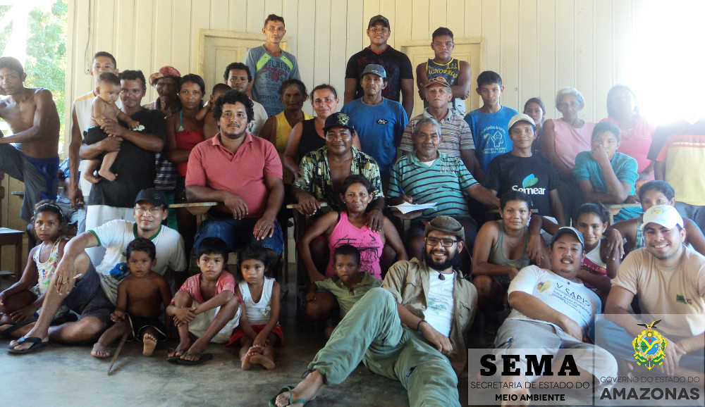
After identifying these issues, the area management understood that without the effective participation of these indigenous people in a shared management model for the Park, the conservation strategy for the Purus-Madeira interfluvial area would remain permanently incomplete, fragile and tending to perpetuate a conflict between the area belonging to the state of Amazonas and that of the indigenous inhabitants of the TI Cunhã-Sapucaia. Thus, as a way of using this situation to strengthen management of the conservation area, respecting and recognizing the existing constitutional rights of the Mura over the area, as part of the development of the Matupiri State Park Management Plan, the Special Indigenous Use Zone was created.
Conflict or potentiality?
The Terra Indígena Cunha-Sapucaia was approved in 2006. It covers 471,450 hectares, with a population of approximately 580 Mura indigenous people. According to the Matupiri State Park Management Plan (AMAZONAS, 2014), historical records show that the Mura, known for their ability to navigate rivers, lakes and streams, have inhabited the region of the Madeira, Japurá, Solimões, Negro and Trombetas rivers since the 17th century.
The TI Cunhã-Sapucaia has 11 villages officially recognized by FUNAI. However, the villages identified as the traditional users and historical protectors of the Matupiri river, an area within the boundaries of the Matupiri State Parke, are the villages of Piranha, Vila Nova, Sapucaia, Sapucainha, Tapagem and Corrêa. These villages are made up of approximately 90 families, and these indigenous residents claim the use of the PAREST area, on the basis of past use and protection. In this context, it should be noted that the indigenous people who use the resources of the Matupiri State Park have been doing so for at least five decades or more, at a time when the Park did not yet exist. The collection of forest products and fishing, together with subsistence hunting, are activities practised in the Park area.
The Matupiri State Park is an area of timber extraction for house and boat construction and repair. The species exploited in the Park for these purposes are: itaúba (Ocotea megaphylla (Meisn) Mez.), marupá (Simarouba amara Aubl.), louro-cedro (Ocotea rubra Mez.), angelim (Hymenolobium sericeum Ducke), among others. Among the non-timber products extracted are, in order of importance, brazil nuts, lianas, copaiba and andiroba oils, açaí, buriti, bacaba, patauá and bee honey. As regards fishing, the management plan identifies eighteen fishing areas within the Park, mapped by the Mura. Of these, 90% are intended for subsistence fishing. Another prominent economic activity among the indigenous inhabitants is sport fishing tourism. This activity has always been present in the TI, on the Igapó-Açú, Tupãna and Matupiri rivers, where this last is now shared with the RDS Matupiri and the Matupiri State Park. It should be noted that, as a consequence of the creation of the Matupiri State Park, there has been a significant reduction in this income, since the area where the activity took place has been reduced by almost a half. This should be stressed, as the Mura argue that the activity was one of the reasons that ensured the conservation of areas of the Park as their culture of river conservation kept the Matupiri as a high quality and important local site for sport fishing in the region.
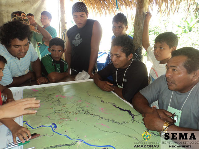
Given this local reality recorded by the socio-economic baseline study and by the mapping of natural resources use in the Park, the management plan provides for the creation within its zoning plan of an Indigenous Special Use Zone, as a solution to this overlap between indigenous constitutional rights and legislation regarding protected areas. Consultation of categories of zones in other Brazilian protected areas supports this solution; for example, those concerning ‘Conflictive Use Zones’ in the Guidelines for the Preparation of Management Plans of the Amazonas State Centre for Conservation Areas (AMAZONAS, 2010) and the ‘Zone of Indigenous Superimposition’ in the IBAMA Guidelines for Methodological Planning (IBAMA, 2002). However, both models were discarded: the first because it was understood that the conflict in the area was not caused by the Mura, but rather it was the creation of the PAREST that had imposed this situation on them. The second model, by conceding only a temporary prerogative over the area, on the assumption that the cultural practices involving the use of natural resources by the Mura would expire over time, would be in breach of their constitutional rights.
Examples were then sought from other Latin America cases to assist in the management of the Park. According to Maretti (2004), in Peru and Colombia, advances in implementing indigenous land rights have been achieved through the adoption of two prerogatives: recognition of a collective and permanent form of ownership, and recognition of capacity to govern autonomously. In Peru there is an equivalence between the biological values and the cultural characteristics of an area. In this way, zoning must ensure that its implementation does not affect pre-existing rights of indigenous groups established prior to creation of the protected area (SERNANP, 2010).
In Colombia, the definition of Parks also considers ‘historical or cultural manifestations’ as aspects as important as biological factors (COLOMBIA, 1974). A Colombian initiative, relevant to this study, concerns the recognition of indigenous leaders as public authorities with environmental powers over their demarcated areas, a necessary condition as regards indigenous areas overlapped by the National Park System, where the rights of indigenous peoples to use of the natural resources are respected, within the limitations imposed by the conservation of the protected area - see here (consulted on 28/03/2014).
Thus, starting from an understanding of such options and with the institutional backing of CEUC-AM who supported the initiative by preparing Terms of Agreement, zoning of the Matupiri State Park took place in two phases: first, contextualization, socioeconomic analysis, participatory mapping and drawing up the zoning took place. Following this, the proposed zoning was presented, in the form of maps prepared by the CEUC-AM. This was considered by the Mura and, following corrections and adjustments, validated. The result of this set of steps was the creation of the Special Indigenous Use Zone (ZUEI) (see map below).
The Park’s management plan states that the ZUEI is characterized as "(...) an arrangement whereby, through the development and signature of terms of commitment between the user population and the area’s management body, management of some natural resources central to the cultural reproduction of that population is enabled" (AMAZONAS, 2014, 286). The creation of the ZUEI can be considered as an initiative to reconcile the biological specificities of the Park with its political-historical-cultural characteristics, as the Park is an area of traditional use by the Mura population of the TICS.
As a result of the creation of the Special Indigenous Use Zone of the Matupiri State Park, we can observe:
- A partial resolution of the overlap of use of the Matupiri State Park by the community inhabiting the TI Cunha-Sapucaia;
- A reduction in the level of anxiety among the Mura in relation to management and implementation activities of the Matupiri State Park;
- A commitment by the Mura to the conservation of the entire Matupiri river basin, especially in the area of the Matupiri State Park, as this would remain accessible for their needs;
- The gaining of a solid partnership between the TI Cunhã-Sapucaia and Matupiri State Park, involving indigenous leaders and the CEUC;
- The presence and effective participation of the Mura, through their social and institutional representatives, in the Management Council of the Park;
- Compliance with international agreements concerning respect for traditional populations and indigenous peoples present in Conservation Areas, to which Brazil is a signatory, such as: ILO Convention 169, CBD Program of Work on Protected Areas (SECRETARIAT OF THE CONVENTION ON BIOLOGICAL DIVERSITY, 2004), Aichi Goals (SECRETARIAT OF THE CONVENTION ON BIOLOGICAL DIVERSITY, 2010) and IUCN World Parks Congress;
- Respect for national legal frameworks, such as the Constitution of the Federative Republic of Brazil, the National Strategic Plan for Protected Areas (Federal Decree No. 5.758, of April 13, 2006) and the National Policy for the Sustainable Development of Traditional Peoples and Communities (Federal Decree No. 6.040, of February 7, 2007);
- A guarantee of greater protection for areas and populations exposed to the impacts generated by the revitalization of the BR-319 highway, through biodiversity conservation and the socio-cultural stability of the Mura.
However, we need to consider how this area will be managed from now on. In this sense, a long and laborious journey has just begun, where the management body will have to invest efforts and expertise to maintain the conservation objectives of the Park and ensure the physical and cultural continuity of the Mura. The Conservation Areas in the state of Amazonas are inseparable from their human presence, whether this be indigenous, cabocla, riverbank or quilombola. Their presence in these areas is much more beneficial than detrimental to nature conservation, in both sustainable use and full protection areas. However, such benefits are only consolidated when these presences are seen as an additional ‘motor’ for reaching a complex and audacious goal together – the conservation of biodiversity.
Saiba Mais
- AMAZONAS. Secretaria de Estado do Meio Ambiente e Desenvolvimento Sustentável. Estudo de criação do Mosaico de UC Matupiri Igapó-Açú: Projeto Criação e Implementação de Unidades de Conservação Estaduais no Amazonas. Manaus, 2006. 134p.
- AMAZONAS. Secretaria de Estado do Meio Ambiente e Desenvolvimento Sustentável. Centro Estadual de Unidades de Conservação. Roteiro para a Elaboração de Planos de Gestão para as UC Estaduais do Amazonas. Manaus, 2010. 74p.
- AMAZONAS. Secretaria de Estado do Meio Ambiente e Desenvolvimento Sustentável. Centro Estadual de Unidades de Conservação – CEUC. Relatório sobre reunião de apresentação do CEUC e das UC estaduais RDS e PAREST Matupiri na TI Cunhã-Sapucaia. Manaus, 2012. 22p. Documento interno.
- AMAZONAS. Secretaria de Estado do Meio Ambiente e Desenvolvimento Sustentável. Centro Estadual de Unidades de Conservação. Plano de gestão do Parque Estadual do Matupiri. Manaus, 2014. 324p.
- BRASIL. Decreto nº s/n, de 1º de novembro de 2006. Homologa a demarcação administrativa da Terra Indígena Cunhã-Sapucaia, localizada nos Municípios de Autazes e Borba, Estado do Amazonas. Diário Oficial da União, Brasília (03 de novembro de 2006).
- COLOMBIA. Decreto nº 2811 de 18 de diciembre de 1974. Decreta el texto del Código Nacional de Recursos Naturales Renovables y de Protección al Medio Ambiente. República de Colombia. Bogotá: 18 de deciembre de 1974.
- INSTITUTO BRASILEIRO DO MEIO AMBIENTE E DOS RECURSOS RENOVÁVEIS - IBAMA. Roteiro metodológico de planejamento: Parque Nacional, Reserva Biológica e Estação Ecológica. Brasília, 2002. 136p.
- MARETTI, C. Conservação e valores. Relações entre áreas protegidas e indígenas: possíveis conflitos e soluções. In: RICARDO, F. (org). Terras Indígenas e Unidades de Conservação da Natureza: o desafio da sobreposição. São Paulo: Instituto Socioambiental, 2004, p. 85-98.
- PERU. Resolución Presidencial nº 218-2010, de 16 de noviembre de 2010. Establecen precisiones en el proceso de elaboración de los Planes Maestros de las Áreas Naturales Protegidas respecto a titulares de derechos otorgados conforme a Ley. República del Peru, Lima. Servicio Nacional de Áreas Naturales Protegidas por el Estado – SERNANP, 2010.
- SECRETARÍA DEL CONVENIO SOBRE LA DIVERSIDAD BIOLÓGICA - SCDB. Programa de Trabajo sobre Áreas Protegidas - Programa de Trabajo del CDB. Montreal, 2004. 34 p.
- SECRETARÍA DEL CONVENIO SOBRE LA DIVERSIDAD BIOLÓGICA - SCDB. Plan Estratégico para la Diversidad Biológica 2011-2020 - Metas de Aichi. Montreal, 2010. 2p
The lower negro river mosaic
Authorship: Thiago Mota Cardoso (Was researcher with IPÊ-Institute of Ecological Research / Instituto de Pesquisas Ecológicas) (2010)*
The Lower Negro River Protected Areas Mosaic is in the process of recognition and is being inserted into the Biosphere Reserve and Ecological Corridor of the Central Amazon. The region of the lower Negro River is characterized by a high biological and socio-cultural diversity. In addition, the Mosaic converges with the territory of citizenship, which bears witness to the potential of management and sustainable development of the territory.
The proposal for the creation of the LNRM arises within the scope of the Ecological Corridors project. Following much inter-institutional articulation, the project “Lower Negro River Protected Areas Mosaic” was developed and submitted by IPÊ – the Institute for Ecological Research – through Edict 01/2005 of the “Fundo Nacional do Meio Ambiente – FNMA” (National Environmental Fund). The following institutions participate in the construction: ICMBio, SDS, Fundação Vitória Amazônica (FVA), Fundação Almerinda Malaquias (FAM), Secretaria de Meio Ambiente de Manaus (SEMMA), Sindicato dos Trabalhadores Rurais (STRNA), Associação de Pescadores (APNA), Associação de Artesãos (AANA), Fórum Permanente de Defesa das Comunidades Ribeirinhas de Manaus (FOPEC), Associação dos Moradores do Unini (AMORU), WWF-Brasil, Programa Waimiri-Atroari (PWA), Associação de Turismo de Novo Airão, Associação de Piscicultores de Novo Airão, as well as community associations and riparian communities along the lower Negro River.
The creation of a mosaic contributes to the strengthening of public policies and integrated actions in a more amble territorial scale than that of just one protected area. The approach that is being used seeks to amplify the focus of this instrument, making it more effective with regards to the territory project. This focus requires a vision of participative territorial governance, forming a single body from a diverse group of social actors, facilitating the processes of action in concert, communication, interaction, and management of projects for territorial development and environmental conservation. It also demands conservation actions in the scale of landscapes, given that landscape is the fruit of interaction between society and the environment.
Socio-Environmental Characteristics of the Mosaic
The LNRM finds itself in the process of recognition. It covers 11 units of conservation, bodyized into three distinct sectors – as seen in the map below and in the table of UC’s. The Mosaic encompasses parts of six (6) different municipalities in the state of Amazonas (Manaus, Novo Airão, Iranduba, Manacapuru, Barcelos, and Presidente Figueiredo), for a total of 7,412,849 hectares. In addition to Units of Conservation, the Indigenous Land Waimiri-Atroari has been participating in the process of formation of the Mosaic, with the possibility existing of this territory being one of its components.
The region presents an important biological scenario, sheltering forest ecosystems of great relevance to conservation and sustainable use, such as igapó (flooded forest) forests, terra firm, meadows and campinaranas, and flooded scrubland (caatinga-igapós). This complex landscape matrix offers the region a great biodiversity, at the ecosystem, species, and genetic levels.
The LNRM has a network of social actors, where we must highlight traditional peoples such as riparians, indigenous peoples, fishermen, family farmers, and basket weavers, who live in the cities or on the edge of the rivers and streams. In the municipalities, people and institutions involved with tourism, extraction, the business sector, and governmental and non-governmental bodyizations all coexist, especially those responsible for the execution of policies pertinent to the Mosaic.
Component Units of Conservation of the Lower Negro River Mosaic:
| Name | Group | Managing Body | Year of Creation |
|---|---|---|---|
| PARNA do Jaú | Full Protection | ICMBio | 1980 |
| RESEX do Rio Unini | Sustainable Use | ICMBio | 2006 |
| PES do Rio Negro - Setor Norte | Full Protection | CEUC/SDS | 1995 and resurveyed 2001 |
| RDS do Amanã | Sustainable Use | CEUC/SDS | 1998 |
| PARNA de Anavilhanas | Full Protection | ICMBio |
1981, as an Ecological Station, recategorized in 2008 |
| RDS do Rio Negro | Sustainable Use | CEUC/SDS | 2009 |
| APA da Margem Direita do Rio Negro Setor Puduari-Solimões | Sustainable Use | CEUC/SDS | 1995 and resurveyed in 2001 |
| APA da Margem Esquerda do Rio Negro setor Aturiá-Apuauzinho | Sustainable Use | CEUC/SDS | 1995 and resurveyed in 2001 |
| APA da Margem Esquerda do Rio Negro setor Tarumã-açu-Tarumã-mirim | Sustainable Use | CEUC/SDS | 1995 and resurveyed in 2001 |
| PES do Rio Negro - Setor Sul | Full Protection | CEUC/SDS | 1995 and resurveyed in 2001 |
| RDS do Tupé | Sustainable Use | SEMMA/ Manaus | 2002 |
The creation of the Manaus Free Trade Zone, in the period of implantation of regional development policies, in the 1960’s, generated population increases, through intense migratory flows, and a new reordering of the use of space and of the region’s resources. Such policies, in spite of the economic benefits gained, contradictorily corresponded to the principal causes of social, economic, and environmental problems of the region of the mosaic. The current situation in the lower Negro River continues to be marked by socially unjust extractive processes that place the local population in situations of extreme difficulty.
The creation of units of conservation in the 1980’s and 1990’s, undertaken without popular consultation, generated enormous conflicts that have continued to the present day. Today, the protected areas are configured as fundamental instruments for territorial development and conservation. However, the land issue still constitutes an element of conflict, one that demands new and creative outlets in the territorial ordering of the region, which take into account the social, ecological, economic, and political contexts of the Negro River and its inhabitants and the convergence between conservation and quality of life.
Despite this, many riparians and indigenous peoples have started to bodyize and push for social rights and traditional access to natural resources and territory, as is the case of the negotiations of fishing accords, indigenous land claims, agrarian reform projects, both with and without the support of socio-environmental projects from local entities and NGO’s. The peoples that live in the basin of the Negro River possess diversified strategies of interaction with the ecosystems and of access to biodiversity. Traditionally, the main activities developed by this population are slash-and-burn agriculture, animal and vegetable extraction, exploitation of forest wood, hunting of wildlife, tourism, and arts and crafts, as well as salaried activities. The knowledge and practices of the inhabitants of the region generate the potential for sustainable territorial development, as well as for community-based ecotourism, non- and small scale-wood extraction, agricultural systems, tropical fish harvesting, culinary activities, and art.
Putting the Mosaic’s Pieces Together
The mosaic is in formation and follows the prerogative of the National System of Units of Conservation with regards to the form of creation and management, which demands the adhesion of the managers of the protected areas, the recognition by the Ministry of the Environment, and the conformation of a consultative council. At the moment the following actions have been undertaken:
- Mobilization of the local and regional actors (NGO’s, social movements, government, traditional and indigenous communities, and businesses);
- Undertaking of a series of informational workshops and building of the mosaic;
- Consultations with the consultative and deliberative councils that exist in the region;
- Elaboration of the dossier and request for recognition of the LNRM at the MMA;
- Elaboration of the Territorial Development Plan;
- Insertion in the Mosaics Network of the Franco-Brazilian Cooperation for the strengthening of the mosaics of protected areas.
The LNRM seeks to innovate the form of its construction, proposing concepts, methodologies, and forms of creative governance that make possible social participation, among which we cite:
- Have as a principle the conformation of covered areas the crossing of the criteria connectivity, adhesion, and territorial identity. This last one corresponds to an innovation and involves identifying the historical-cultural, economic, ecological, and local social principles that are articulated with the objectives of conservation of protected areas, allowing the definition of areas of the mosaic at the same time as a territory of action. This criterion is strategic towards the valorization and involvement of the communities and better articulation between the local actors.
- The principal space of gestation of a mosaic is its consultative council. To form it, it is important to involve the diversity of the social actors, given the construction of “pathways” to democratic and participative management through integrating and mobilizing themes. The proposal, developed in the precursor of the mosaic project, is that the council become a forum/regional network for debate and proposition for the conservation and sustainable development of the LNRM, with the participation of civil society and articulation with other spaces of territorial management, meaning a more fluid, open, and participative structure than that of a council founded on integrated administration among managers.
- According to the referrals from the II Mosaic Workshop, held in October of 2009, Technical Chambers will be created regimentally, with the aim of discussing more specific and detailed matters with the institutions of interest, and the protected areas would have actions articulated in three sub-regions.
- The consultative council of the LNRM is not hierarchally superior to the other councils. The council of the LNRM seeks to strengthen existing councils, and local initiatives, without overruling objectives, nor bureaucratizing the process. It is differentiated by its character of regional articulator, or rather, of mobilizer of social networks in the territory (government, associations, NGO’s, companies, forums) in order to establish processes of continual consultation and the definition of a territorial project at a broader scale.
- The elaboration of a plan of development with focus on products and services of socio-biodiversity, which should be agreed upon throughout the process of the mosaic’s governance. The plan of development of the mosaic has as its main goal ensuring the social inclusion and well-being of the local population, and at the same time, promoting the conservation of the biodiversity and landscape. Such an approach involves developing a vision where the local population contributes directly to the local economy through the enhancement of protected areas, maintenance of environmental services, and protection of historical and cultural heritage.
- The mosaic is perceived by the local communities and social movement as an opportunity to influence, and to be articulated in, networks of a larger scale.
Learning and Paths to Take
The LNRM is constituted as a tool of connectivity and territorial governance that can contribute to the strengthening of integrated and participative actions for the protection and conservation of ecosystems, of innumerous species threatened with extinction, and of biodiversity as a whole. However, these actions must converge with social and cultural capital of the traditional communities that inhabit the region, that possess other territorialities and profound knowledge about the territory.
The concept and building of territorial identity into a mosaic of protected areas, in addition to facilitating the process of governance, offers a sense of belonging to a determined place and could be the point of support for the building of the proposal for sustainable development. This process involves the change from a culture focused on unitary/hierarchal territory to a territory of integrated relations and democratic practices.
However, during the process of constructing the mosaic, its limits must be considered. In a certain way, a consultative council legally does not permit the making of more concrete decisions and is likewise quite often disputed by sectors with hierarchally distinct degrees of power and knowledge, blocking or forcing a consensus in such a way as to harm certain sectors. The lack of territorial ordering and the undefined land regulation makes it difficult to think in terms of a mosaic. The manager focused on his own unit persists as well, making an integrated project difficult. Finally, the mosaics are still embryonic projects, lacking a permanent public policy, with serious financial and resources deficiencies.
The LNRM, while a territory project, must remain attentive to public policies in the areas of education, health, transportation, and communication for the region and to the projects developed by social and environmental movements. Articulation with other projects of territorial management is fundamental. This transversality of policies is fundamental for the management of territory and continues being a goal to be realized.
The RESEXs in Terra do Meio (PA)
Authorship: Marcelo Salazar (engineer, joint coordinator of the Xingu-Altamira Program and ISA member), André Villas-Bôas (indigenist, coordinator of the Xingu-Altamira Program and founding member of ISA).
* Originally published as Chapter 2.3 “A experiência das Resex na Terra do Meio" in the book 'Áreas Protegidas'. Séries Integração > Transformação > Desenvolvimento. 2012. Fundo Vale.
The Instituto Socioambiental’s Xingu Program was created in 1995 with the mission of promoting the socioenvironmental sustainability of the Xingu basin and ensuring the rights of the region’s indigenous peoples and traditional populations. After almost ten years working exclusively with indigenous populations in the basin and hearing their concerns over the impact of the process of regional occupation, the Program expanded to include various challenges beyond indigenous borders.
The Terra do Meio, in Pará state, emerged as one of these challenges. After coordinating the preliminary studies in 2002, which informed the government’s decision to create a mosaic of conservation units, and witnessing the situation of abandonment and vulnerability in which the region’s extractivist populations lived, we could not avoid assuming the moral commitment to try to change the situation in the extractivist reserves (RESEXs) of Riozinho do Anfrísio, Iriri and Xingu. The social liabilities found in these RESEXs in 2002 were astonishing: very few families had citizenship documents (birth certificates, identity cards, tax registration), the illiteracy rate was higher than 90%, and medical care for emergencies and malaria infection was only available in neighbouring indigenous areas. Communication with the State and the market was mediated by the occasional regatões – river traders – who also provided the means of transport for local people and exchanged industrial goods for extractivist produce, largely following the barter system of the nineteenth century.
The journey from the RESEXs to Altamira in the dry season could take more than a week. The regional context was extremely harsh. The region had already been exposed to land grabbing and illegal logging, but in 2002, following the news that the government might create conservation units, the land invasions grew to unimaginable proportions. An industry of land grabbing swept the region, appropriating lands, expelling the traditional populations and opening up areas for pasture. In 2005, as part of this series of conflicts, Sister Dorothy Stang was murdered in Anapu. The same year 471km of tracks and 5,671 ha of deforestation were mapped in the territories of the RESEXs alone 1. In this context, working to ensure a dignified life and stable land ownership to those populations – historically once the stewards of a forest heritage covering millions of hectares – was the best socioenvironmental action to be undertaken at that moment. In partnership with the Live Produce and Preserve Foundation (Fundação Viver Produzir e Preservar: FVPP) based in Altamira, we channelled our actions towards ensuring the local population’s access to basic rights. The visit of the government’s mobile Citizen Registration program was organized, designed to allow people to obtain basic personal documents, and a strategy was defined to persuade the Altamira local government to provide basic health and education services, the main demands of the local population. In parallel a technical cooperation agreement was signed between ISA, the Public Prosecutor’s Office and ICMBio in order to promote land tenure security, looking to stem and expel the land grabbers from the recently created conservation units.
Initiatives were developed to help structure and promote local associations and work was begun on developing production chains of extractivist goods, looking to present options for improving the sustainable economic development of these populations. Market alternatives were developed by approaching different purchasers for Brazil nuts, rubber, copaiba and other produce, while technical solutions were designed for storing and processing babassu, andiroba and Brazil nuts, and latex production was restarted. Experiments were begun in implanting community working capital funds to support production. It is not an easy task to attract public policies to an isolated region, far from the major centres with low densities and a dispersed population. The cost of services is much higher compared to the cost of services to the urban population, and above all the electoral dividend fails to match investments.
In this context the institutions supporting the initiatives played a vital role, in particular the Fundo Vale, the Rainforest Foundation Norway and the Moore Foundation. Normally these institutions are reluctant to support actions that are the clear obligation of the State. Nonetheless the challenge was precisely to create a model of support services that could attract public policies normally not adapted to distinct realities like those of the Extractivist Reserves of the Terra do Meio. In collaboration with the local associations and ICMBio, poles of social inclusion and development were created: a set of structures designed to centralize services and facilitate the arrival of the State, technical assistance and commercial partners. The extractivists chose sites of reference within the RESEXs where the following were installed: (a) a Primary Healthcare Unit, with (b) an infirmary, (c) a Training Centre/School, (d) accommodation for students, (e) a house for teachers, (f) a support centre for local associations and partners, (g) the construction of a storage and processing building for local extractivist production, (h) a communications structure – including the installation of internet access and public telephony, complementing the radio systems already operating in the region, and (i) landing strips to facilitate emergency care through taskforces for specialized healthcare provision, speed up protection and monitoring activities, facilitate coordination with public authorities and establish private sector partners who recognize and value the strategic role of these populations, enabling them to learn about their realities and interact positively with the extractivist production of the RESEXs, without intermediaries and without having to spend long periods travelling.
Concomitantly, agreements were signed with the Altamira Health and Education Offices for them to take over the running and maintenance of these centres. All this work is very recent and the arrangement is still being consolidated: nonetheless, we know that the long-term sustainability of high quality services in remote areas depends on distinct kinds of public policies. Proposals are being prepared, therefore, to negotiate differentiated policies (healthcare, education and credit) with the federal government, which recognize the cultural specificities and costs arising from the situation of isolation, in conjunction with the Altamira local council, following the example of the policies already implemented in relation to indigenous populations. The structuration of these service poles is an important component of the model of assistance to the RESEXs currently being developed. It is fundamental, however, that these are coordinated with child and youth care centres, built in locations that bring together groups of families who live in different areas of river as a result of their own cultural motivations. It is also important for us to recognize that this spatial dispersal is a fundamental cultural dimension of the extractivist population’s identity and should be respected.
The aim, therefore, is not to centralize the population spatially in these service poles, only some of the more complex and costly services. Other sublocalities must also be included in the model and equipped with a structure providing basic healthcare, sanitation and education. The expectation is to create a central site without concentrating the population around these infrastructures. The biggest challenge faced by the RESEXs and the Terra do Meio Mosaic as a whole is being located within the region affected by construction of the Belo Monte Hydroelectric Dam, with the turmoil this work is causing, sending shockwaves through the RESEXs and the surrounding area. These impacts were ignored in the EIA-RIMA (Environmental Impact Study and Report) for the construction project and omitted from its mitigatory requirements.
Another major challenge increasingly felt in the region is the pressure caused by illegal logging, associated partly, though not solely, with regional investments and the population drawn to the Belo Monte site. In the Riozinho do Anfrísio RESEX, for example, the density of logging tracks was 150% higher in 2011 compared to 2005, when destruction in the region peaked. We can note a reduction in deforestation and an increase in selective logging, combined with the State’s enormous difficulty in responding to the invasion, placing at risk the integrity of these areas and their populations. Overcoming a historical social liability of this magnitude and guaranteeing the conditions for protecting the forests of the Terra do Meio RESEXs is not a short-term undertaking. The existence of focused and continuous policies, agreed with the local population, is essential to avoid this enormous liability continuing for decades longer.
Further information
- Áreas Protegidas. Séries Integração > Transformação > Desenvolvimento. 2012. Fundo Vale. 1ª edição. Rio de Janeiro.168p.
Notes and References
- INSTITUTO SOCIOAMBIENTAL. 2012. Relatório “Vetores de Pressão na Terra do Meio”, ISA, 2012. Em 2005, foram mapeados 7.655,7 km na região da Terra do Meio, com destaque para a região onde hoje é a APA Triunfo do Xingu e a Esec Terra do Meio.
Community management of invasive species
Authorship: Michele de Sá Dechoum, Eduardo L. Hettwer Giehl, Rafael Barbizan Sühs, Thiago César Lima Silveira e Sílvia R. Ziller
SUMMARY OF SCIENTIFIC ARTICLE - Biological Invasions, published online on 9 August 2018.
Citizen engagement in the management of non-native invasive pines: Does it make a difference?
In an article recently published in the journal Biological Invasions, a high scientific impact journal in the field of biological invasions, the authors show that a community management project can lead to the eradication of invasive pine trees in a Municipal Natural Park in Florianópolis, if the park’s neighbours collaborate
A programme to control invasive pines has been carried out since 2010 through a partnership between the Instituto Horus de Desenvolvimento e Conservação Ambiental and the Federal University of Santa Catarina, in the Municipal Natural Park of Dunas da Lagoa da Conceição (Florianópolis, Santa Catarina). In monthly control working parties, invasive plants of species introduced from North America are felled and dug up by volunteer helpers in this programme of landscape and ecosystem restoration. So far, nearly 350,000 pines have been eliminated. All resources required to carry out the programme have come from collective funding campaigns and donations from international institutions. The total financial saving to public coffers is estimated to be around R$137 million.
The main objectives of the article were to present the results of the programme and to simulate how the area would be in 2028 if control had not been started in 2010. The motivation for writing the article was both to show that it is possible to manage invasive alien species through citizen engagement, and to demonstrate to volunteers the importance to biodiversity conservation of persistence and continuity in their work.
Three scenarios were simulated. The first represents the state of the Park if nothing had been done following the existing situation in 2010 when the program was started. The second is a simulation of the continuity of control efforts within the park and the third is a simulation of control activities both within the park and on neighbouring private properties. In these properties, pines were planted for ornamental purposes and for dune containment about 30 or 40 years ago and were left there, representing the current main source of pine seeds borne by wind into the park.
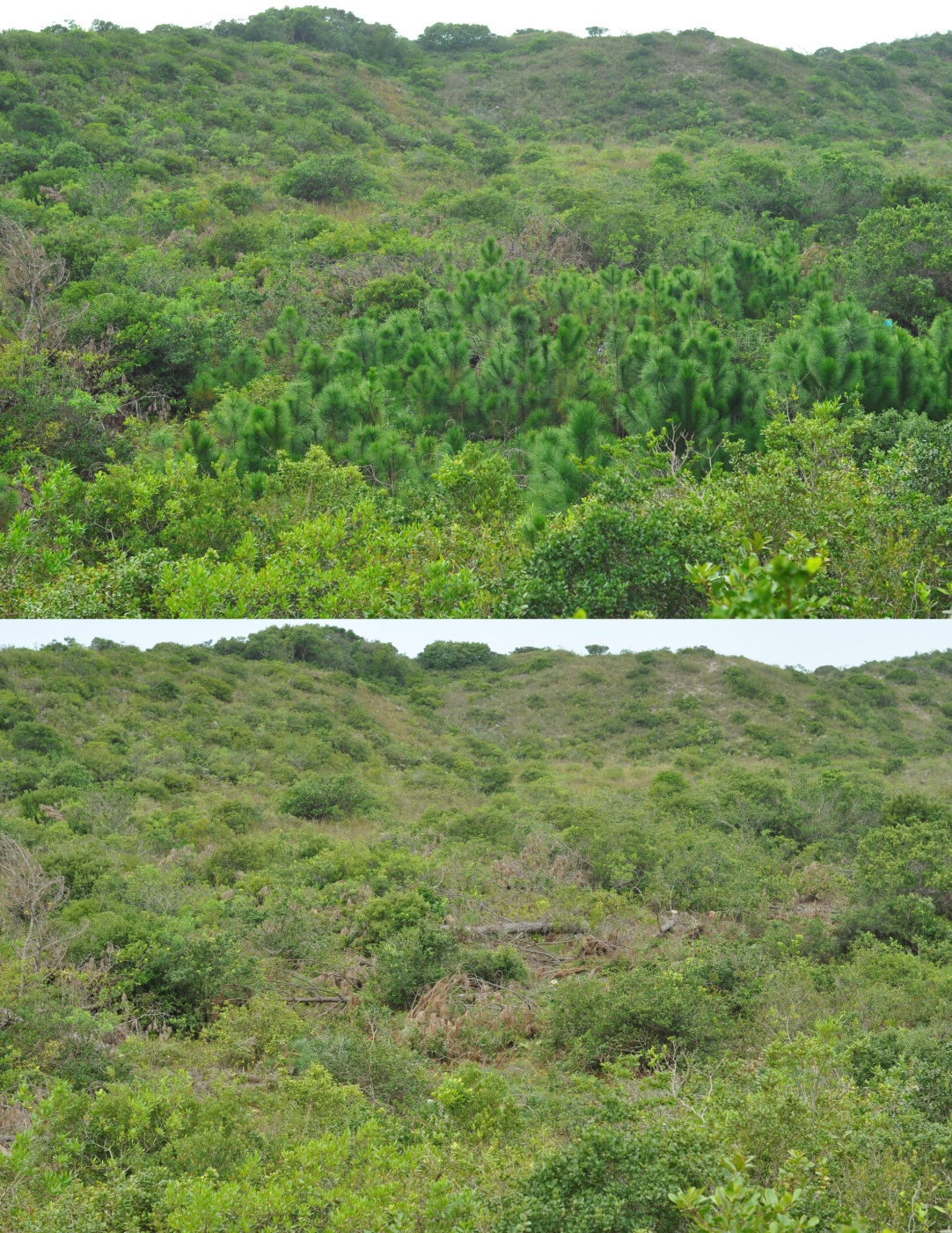
The results show that if the program had not been started (scenario 1), almost half of the habitats susceptible to biological invasion would be occupied by invading pine forests by 2028, accounting for about a third of the total area of the park. If the work were to continue just within the park (scenario 2), there would be a four-fold reduction in the size of the invaded area compared to scenario 1. And if the work was carried out in both the park and neighbouring properties (scenario 3) it will be possible to eradicate the pine trees inside the park by 2028, especially as a result of eliminating the larger trees on neighbouring properties. Therefore, for the next few years, it will be essential to gain the support and
collaboration of the residents surrounding the park. Municipal Law 9097/2012, regulated by Municipal Decree 17938/2017, requires the elimination of pines from private properties in the municipality by December 2019.
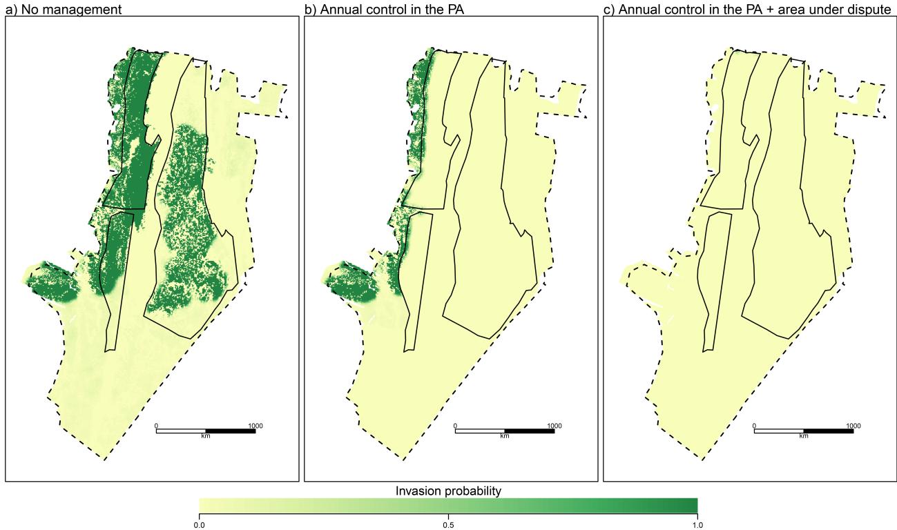
In addition to restoring habitats for local fauna and flora, community engagement in nature conservation can also be offered as one of the positive outcomes of the project. Since the beginning, almost 800 volunteers have participated in working parties and the number of new volunteers grows each time. The main form of communication about the working parties has been Facebook, where the dates are announced and personal invitations extended by existing volunteers to members of their networks.
Para saber mais
- Facebook: bit.ly/fb_institutohorus
- Youtube: http://bit.ly/institutohorus
The knowledge and practices of the beiradeiros of the Iriri River and Riozinho do Anfrísio at Pará
Seasons of the year
In the Terra do Meio 1, the seasons are defined by rain and river levels. There is no fixed date that marks the beginning of summer and winter, although the month may be used as a more general reference. When the rains are regular, intense and long lasting, the rivers begin to rise. This is “winter”. When the rains become scarcer, the rivers begin to fall again: this is “summer”.
Within the specific pattern of each season there are always small variations: there are years when the rains are late, others when they come early, one year brings a strong drought, and another heavy floods. There have always been strong droughts along the beiradão 2, but the 2015 drought made some of the older beiradeiros 3 say it was one of the worst, if not the worst, they had ever seen. Very severe droughts or floods cause serious damage.
In a drought the main problems are the difficulties of navigating the rivers, making travel and emergency removals impossible; the risk of losing one’s crops; the interruption of rubber tapping activities due to the vulnerability of the trees and the type of latex. For their part, floods inundate houses, destroy patios and vegetable patches, and can flood gardens.
The worst droughts and floods are historical, the older generation still remember them and tell the stories to the younger generations. They serve as a benchmark by which to judge current situations, make predictions and, in extreme cases, take the necessary measures to minimize impacts.
Seu Herculano notes that nowadays there is no longer a period when rivers are stable: they are always rising or falling.
"Previously the river stayed for a month at the same level, not like nowadays when the river is either rising or falling." Herculano Porto de Oliveira, 71, Bom Jardim, Riozinho do Anfrísio, 2015.
The transitional periods from one season to the next are nuanced; they are periods during which certain characteristics of summer and winter coexist. There are, for example, the "repiquetes", sudden floods that can happen both in the period of rising water and in that of falling water levels. There are also different moments within each season. Rubber tapper lore teaches that summer is divided into two parts: a first half-summer and a second half-summer.
The first period falls more or less between May and August. The second covers October, November and December. Between the two periods the “piroca” occurs, lasting about a month and coinciding with the peak of the drought, usually in September. However, it can also come earlier, in August. In this period, the rubber tapper stops tapping because the rubber trees are flowering and renewing their foliage, using all their latex for this process.
At the height of summer, the drought can last for more than a month. During this period, cloud formations can still be observed, but they soon dissipate, taking with them the hope of seeing the earth moistening, the plants around the house being watered, the latex of the rubber tree thinning. The first rains that fall announcing the end of the summer are usually short in duration and coverage; they are the so-called "mango rains", characterized by strong thunderstorms and for being only light and short. The mango rains coincide with the time when the mango trees are finishing producing their fruit and last until the heavy winter rains set in, causing ponds and lakes that had dried up during the dry season to reappear.
In general, the beginning of summer is considered to occur in May and the beginning of winter in November. However, this is not a consensus among all the beiradeiros. For example, some people think that summer itself begins only in June, when the dry season has set in and the river levels are falling rapidly, and the month of May is a transitional period in which aspects of winter and summer coexist. Likewise, some people consider that the first rains of October, although still timid, already trigger the beginning of the winter, rather than the torrential rains that begin between November and December. Another factor which interferes with defining the start of the seasons is the region in question. Being a vast territory, the Terra do Meio reveals climatic variations in specific regions, such that that the perceptions of those who live near the headwaters may not be the same as those living near the mouths of the great river.
Establishing a month to mark the start of a season can act as a reference point, but in the real world of the beiradão, a season only effectively begins when the appropriate climatic and ecological events occur. Thus, it is very common to hear expressions such as "this year summer is late", as a reference to the fact that the high waters lasted longer that year.
Over the course of a year, many transformations and ecological relationships can be perceived in the environment, and these are the perceptions that serve as the reference for measuring time. Many people know how to identify the signs that announce the change of season, the characteristics of the summer and winter seasons and the different periods within each season. Most of the signs that mark the seasons are shared, but some observations are private. In these cases, people respect these but do not feel compelled to agree.
This type of topic usually provokes long conversations in the beiradão, mainly between those who have an interest in and go deep into the details that most people do not notice. Seu Porrodó, for example, mentions the change in the foliage of the trees; he has already noticed that, during the height of the summer, the herds of wild pigs move away from the riverbank. Zé Simbereba agrees and adds that winter is best for hunting pigs, while summer is best for stand hunting. Seu Reginho looks at the dawn sky and knows that the summer has arrived when the morning star appears in a different location.
"Signs of summer? The trees. Their leaves begin to change the leaves: they go yellow and fall. The old leaves fall, and new leaves appear. You pay attention: all the trees in early summer start to change their leaves. Others start to flower, those where the leaves fall first. Out comes the new leaf and the flower. When the summer is very strong, the wild pigs disappear. Here, downstream, when the waters are dropping, they still attack a lot. But when summer sets in, you can forget it". Raimundo Pereira do Nascimento, "Porrodó", 57, Paulo Afonso, Riozinho do Anfrísio and Trairão, 2015.
"The dry season is good for stand hunting, for those who like to lie in wait. But the rainy season is better for the wild pig. You can hear the grunting from a long way away". Joseph"Simbereba", 59, Sitio Santo Estevão, Maribel, Iriri, 2015.
"I shoot by the planets. Because when you get to the start of summer, the star that’s called the morning star, you see her come out at dawn. And when it's getting to winter time, she’s over there [points to the point in the sky]. At six-o-clock she’s already at a certain height here. But not in summer, she starts to appear at five. When I get up in the early morning, I already know she’s out. She and seven stars. That she will light everything up, making a little patch of light so you can see, lightening things up a bit. Then I know that summer is starting.
The animals of the forest feel it as well, both the start of winter and the start of summer. For example, along the [rubber tapping] trail there’s a little bird people call the seringueiro [rubber tapper]. When you’re up at dawn you hear it singing, when you enter the forest, sometimes it’s drizzling and you hear it singing, then the rubber tapper says to himself that summer has arrived, because in winter it doesn’t sing". Reginaldo Pereira do Nascimento,"Reginho", 64, Boa Saúde, Riozinho do Anfrísio, 2015.
When it's time for the river to rise, it must rain in the headwaters, in the igarapés and gullies in the middle of the forest that had dried out in the summer. When the gullies are ‘throwing water into the river’, this is a sign that the level of the river will rise. The first rains announcing the winter are not yet enough to refill these dried-up watercourses. When the rains become stronger and longer lasting, the gullies go back to running in the forest and overflow, filling up the still low rivers with sheets of water resembling waterfalls. When navigating rivers in January, it is common to hear enthusiastic comments from the beiradeiros such as ‘the gullies are pouring water!’: a sign that the river is rising, that finally the dry season will end, and the forest will produce an abundance of food.
Seu José Simbereba notes that the croaking of certain frogs is a sign of the beginning of winter, while others sing the whole winter. He also mentions that the mango rains are those which occur at the start of winter.
Transitional periods from one season to the next are characterized by certain phenomena. One of these is the rainbow. José Simbereba acknowledges that the appearance of a rainbow can occur both at the change from the dry season to the rainy season, as well as the other way around. According to Seu Antônio Manelito, the rainbow ‘sucks’ the water from one place to another. So, when is time for the summer to start, the rainbow gathers the rain and leads it to another place. And when it's time for winter, the opposite is true: the rainbow gathers water from somewhere else and brings it to rain nearby.
As well as the signs of the change of season, weather predictions can also be made on the basis of observations of trees and animals. Many examples are given of ‘guessing’ when it's going to rain: the mutum-fava growls on rainy days in the second-mid-summer. If the sun is hot and it growls, this is because the weather will break, and it will rain. In addition to the mutum-fava, the song of the sabiá can also indicate rain. The rubber tapper relies heavily on such signals to avoid losing the latex gathered along his trail.
"The mutum-fava is very fond of growling in the second half-summer, on rainy days. There are these two that the rubber tapper does not want to hear when they sing on hot sunny days: the mutum-fava and the sabiá. When it begins to sing, hot sun, mutum growling, it's going to rain that day. The rubber tapper doesn’t like it because the rain comes and ruins the latex." José "Simbereba", 59, Sitio Santo Estevão, Maribel, Iriri, 2015.
"As for the winter, we know when it will be strong by the singing of the carretel, a frog. He is like this, a little square thing, with little ears. And he's ugly, but pretty at the same time; he’s interesting. When he sings 'Oh lass, now it’s the winter that’s arrived'. And he sings all winter long. When he stops singing, you know that the summer is coming. He shuts up, winter is over.
At the beginning of winter there are a lot of frogs croaking. There’s the one of the in-between period, not the carretel, another one, and then you know ‘the rains are coming, the frog is singing’. She announces that it’s going to rain, she goes 'uuuu'. She is a frog and lives in a hole, difficult to see. She’s striped, like a zebra. She is stripy overall, pretty, and sings inside the hole. When you get close, she stops; she’s smart. And she only sings when the rains start. Once the heavy rains arrive, she doesn’t sing anymore.
And then there’s the rainbow, it has two meanings: it announces the arrival of summer, that when you start seeing rainbows that’s a sign of summer. And when you see the rainbow you remember the commitment, that there is the alliance God made with man. The rainbow means that. But it can mean the passage into winter. Because the rain is thin and open at the rear. And so it´s like that picture. In a strong winter, the rainbow won’t appear. Because winter ends as it began: winter starts with mango rain (single cloud rain), fine rain, thunderstorm". José "Simbereba", 59, Sitio Santo Estevão, Maribel, Iriri, 2015.
1 Literally, ‘the land in-between’; the region between the Xingu and Tapajós rivers in the state of Pará
2 Literally, ‘big riverbank’; the name given to the non-urban margins of rivers in the Terra do Meio.
3 Although the beiradão is settled by different social groups, ‘beiradeiros’ are those inhabitants historically linked to the previous rubber-tapping industry and who have remained in the region establishing their own forms and land occupation and use.
Categories to describe rivers
The spaces that characterize rivers also include a series of categories defined by observation of their width, sinuosity and depth.
ESTIRÃO [‘big stretch’]: "Estirão is a place with no way volta [see below], only that stretch with no volta", Francineide Rocha Machado, 54, Praia Grande, Riozinho do Anfrísio, 2015; these are the widest stretches, not cerrado [see below]; navigable throughout the year.
CERRADO [‘closed’, ‘dense’]: "It’s a narrow stretch of river, the forest is closer to the edge, there are a lot of voltas and lots of stick and branches in the river, it is more difficult to move through", Francineide Rocha Machado, 54, Praia Grande, Riozinho do Anfrísio, 2015. "A denser place, always fallen branches; it’s where branches have fallen", Raimundinho. In years when the summer is very dry, the cerrados are almost impassable; in several places, canoes have to be dragged over branches and sand banks.
FURO [‘hole’, ‘tear’]: It's a short cut, narrower than the estirão. The furo connects two points of the river, shortening the distance. Many furos dry out in the summer, both on the Riozinho do Anfrísio and on the Rio Iriri. In summer, boats are forced to go the long way round, because the furo is dry.
VOLTA [‘[re]turn’, ‘way back’]: The bends in the river no longer used for navigation because there are furos offering a short cut; when the furos are permanent, because they don’t dry out in summer, these voltas are ‘forgotten', accessed only for fishing or hunting.
REMANSO [‘motionless’]: Places where the water is still. Landing places are generally located in areas of remanso.
RESSACA [‘rebound’, ‘undertow’]: A branch of a river that has no exit. Some of these branches, during periods of high water, can become a furo with an exit from the other end.
ILHA [‘island’]: "A piece of land on its own in the middle of the river, it’s got water on both sides and just that bit in the middle, like the one close by, near the whetstone", Francineide Rocha Machado, 54, Praia Grande, Riozinho do Anfrísio, 2015. Ilhas are not like restingas, which in summer are not surrounded by water.
POÇO [‘well’]: "A place that is deep and where there’s no rock. If there is rock, it’s at the bottom where no-one can see it", Francineide Rocha Machado, 54, Praia Grande, Riozinho do Anfrísio, 2015.
LOCA: These are underwater hiding places underneath stones that certain fish like to use.
SANGRADOR [‘trench’, ‘spillway’]: "The igarapé [stream] that flows straight into the river", Francineide Rocha Machado, 54, Praia Grande, Riozinho do Anfrísio, 2015.
CÔRREGO [‘brook’, ‘creek’]: The river; another name for the main course.
BAIXO DE PRAIA [‘beach depression’]: "Places that dry out and where you get a sandy beach at the river's edge, a low-lying beach". Areas of sand exposed at the river's edge in summer.
Variety and Food Security
In the beiradão, the different varieties of manioc [cassava] cultivated in the gardens are used for making flour, cake, porridge, tapioca and tucupi. Most are varieties of bitter manioc, whose juice is toxic (rich in prussic acid) and must be extracted or processed before consumption.
As well as a variety of types of bitter manioc and some types of sweet manioc, also known as macaxeira, forest gardens also contain maize, pumpkin or squash, maxixe, okra, various types of bean, sweet potato, various kinds of yam, sugarcane, watermelon, various types of banana and papaya. Some people also plant rice, peppers, cucumbers and tomatoes.
But agricultural activities are not restricted to the forest garden space, although these are the main food source. The patios around the houses are full of cultivated plants that also serve as food (as well as plants used as medicines). There are raised beds with spices, vegetables and fruit trees: onion, chicory, parsley, cilantro, chilli pepper, black pepper, cabbage, fork leaf hibiscus, cabbage, cupuaçu, mango, papaya, lemon, cacao, cashew, passion fruit and avocado are the most common.
"In addition to manioc and macaxeira, I plant cacao, cupuaçu, squash, watermelon, potato, banana, sugarcane, avocado, maize". Fernando Aguiar Rocha, "Garimpeiro", 28, Praia Grande, Riozinho do Anfrísio, 2015.
Having a large and diverse garden is a source of satisfaction and security for the family, which can feed itself even if hunting and fishing fail. The varieties of manioc and other foods in the garden depend on the interest of each individual or family in the management of the various types of plants present. Some people plant their garden with just the basics for producing flour and with well-adapted plants, which require relatively little effort and care, such as maize, squash, sweet potato, banana. Other people seek to diversify, planting tomato, cucumber, okra, maxixe, beans, fava, cabbage.
"Food comes from the garden. There are things you need to buy, but the garden provides macaxeira, there are yams, potatoes, beans, you have your fava, your banana, there’s sugarcane, pumpkin, you’ve got watermelon. So this is the great help you get from your garden". Reginaldo Pereira do Nascimento,"Reginho", 64, Boa Saúde, Riozinho do Anfrísio, 2015.
"I like to plant a garden because that’s where I get my food, where I get cassava, maize, watermelon, pumpkin, beans". Jackson Rodrigues da Silva, "Jacu", 61, Maribel, Rio Iriri, 2015.
"The garden crops are important, we give them away, we sell them, it's important for making someone happy. And for us too. Sometimes when we don’t have anything for lunch, we cook pumpkin in brazil-nut juice, with a gherkin, and it’s sorted". Francisco Ricardo Santos da Silva, Ricardo, 48, As Croas, Riozinho do Anfrísio, 2015.
The food security provided by the garden also involves raising animals. Part of the garden’s produce, mainly maize, but also macaxeira, goes to feeding chickens and ducks, ensuring the reproduction of these animals.
"The animals around the house that feed on garden produce are the ducks, the chickens. Our families are fed from the garden too, we plant our gardens for this". Reginaldo Pereira do Nascimento, "Reginho", 64, Boa Saúde, Riozinho do Anfrísio, 2015.
Manioc flour is the basis of the beiradeiro diet. You need to have an abundant garden so as to not end up "brefado". At the end of this section, the ways of preparing manioc flour are described.
1 Condiment made from manioc juice and chili peppers.
2 Cucumis anguria, a gherkin.
3 Theobroma grandiflorum, a relative of the cacao.
4 “Ficar no brefo” [to be ‘brefado’] is synonymous with running out of manioc flour.
Cutting Rubber
Rubber tapping was responsible for driving non-indigenous settlement in the Terra do Meio. All the families living in localities along the Iriri River and the Riozinho do Anfrísio are descended from rubber tappers from the first and second rubber cycles, periods during which residents of the river basin had no other secure source of income. Some families in the basin are descended from rubber tappers who worked at Fordlandia and crossed over from the Tapajós to the Xingu basin when the venture in Itaituba ended, at the same time as the Second World War. The extraction of latex for rubber production in Terra do Meio had production peaks throughout the 20th century, accompanying price oscillations in the international market. Estate bosses sought to exert control over their rubber tappers by demanding high production targets and prohibiting the sale of the rubber to other estate bosses.
"All that we produced we sold to them, to the boss. If we sold rubber on the side to anyone else, to another boss, ah, that you couldn’t do. He would be very angry; it would be risking him turning me out of my job to stop me selling on the side. I had to sell it to him". José Pessoa do Nascimento,"Jinu", 71, Altamira, 2014.
As Amazon rubber lost space in the international market and with rubber tappers adapting to the forest to the point of being barely dependent on the bosses, the control exercised over the production of the rubber tappers also became less intense. Rubber tappers who learned to open up an area and make their own trails could break the monopoly imposed by the bosses.
"This place of ours here [upper Riozinho] was not controlled by Anfrísio. My father, Otavio, would sell his rubber to whoever he wanted. There were some places that were Anfrísio’s, those where he had ordered trails to be opened, where he ordered the clearing of trails, out of his own pocket, without the rubber tapper paying for this, where these were cleared by the boss.
There was the time when they seized rubber from Moés, downstream, belonging to my father. By Frizan. So father went down to Altamira and the rubber was released. My father's trail was not opened by Frizan. He was the boss, but the place was not opened by him. The river, it belonged to the late Anfrísio, but not every place was his. With my father he had no dealings. Father sold his production to whoever he wanted. The boss was the late Frizan, but my father could find someone else to sell to, like Moés who came and did business with us for ages. Rubber from other rubber tappers Frizan seized, but ours he didn’t seize. To seize is to order the rubber to be confiscated. From my father, the first to buy were Frizan, Moés and then Antonio Manelito. He had several people who bought from him". Francisco Castro," Chico Caroço ", 55, Lajeado, Riozinho do Anfrísio, 2014.
Throughout the time of the rubber tappers in the Terra do Meio, a set of practices and knowledge about the job was built up and transmitted from one generation to the next. But at the same time there were changes to the tools, to the way of producing rubber, to the volume of production, to commercial trade relations.
In the 1960s and 70s, many rubber tappers devoted themselves to hunting cats [jaguars] to sell the pelts, as by then income from rubber was insufficient. In the 1980s, various dwellings and rubber trails had already been abandoned.
Entire families had decided to live in the city or in places closer to the feeder roads that access the Transamazonica Highway. Those who remained gradually replaced income from rubber production with other activities such as prospecting, fishing and felling mahogany (brazil nuts continued to be collected during the winter months).
With the reduced number of rubber tappers on the beiradão, another type of change is being felt by the older generation: there used to be an eagerness and excitement to cut rubber; rubber tappers wanted to make more rubber than each other, and this serve as a motivation for everyone.
"There was no point tapping rubber anymore, and this was the case for many of us. I couldn’t support the family. It was the price. You couldn’t buy groceries, still less anything else. Previously, with a kilo of rubber, you could buy a kilo of sugar and still have something left over. It got to the point where you needed four kilos of rubber to buy a kilo of sugar. We had to give it up in order to do something else to keep the family afloat, and to keep going. That is what happened.
Today’s younger generation doesn’t have that great joy of making rubber anymore, because it is not like in the old days. When it got close to this time of year, each bloke was already getting ready to start cutting rubber, tidying the trail, waiting to hit the path when it was dry and to cut. Each bloke wanted to cut more to make more rubber than anyone else. Nowadays there’s no longer that great enthusiasm for this, understand?” Francisco Castro, "Chico Caroço", 55, Lajeado, Riozinho do Anfrísio, 2014.
Although the activity has lost its economic importance, many people currently continue to cut rubber. This obstinacy for the craft relates to their ingrained values, identity as people of the beiradão, vocation for work with steady income, and the taste for the freedom of the forest. Talking to rubber tappers of the beiradão invariably brings these questions up.
"If it were not for rubber, people would not be here nor carrying on with the business and wanting it to grow. It is very important for this place, because it is one of the main activities here, the best rated. Rubber is one of the products that can never collapse, a material that can never come to an end, it is valuable not only to the community, but to the whole country. There are a lot of rubber areas that weren’t there before, but are there now, but rubber from here is natural rubber, rubber that has always existed in the Amazon. It is high quality, it’s good rubber". Francisco Castro, "Chico Caroço", 55, Lajeado, Riozinho do Anfrísio, 2014.
Chico Branco had stopped cutting rubber, but in recent years the price increase and the safe market in rubber to outside buyers have encouraged him to return to the activity. Prior to that, he was working in fishing and feels that cutting rubber in a forest environment is a calmer job than fishing.
"To walk in the forest is to walk calmly. I love walking in the forest. For myself, I don’t know about the others who tap rubber, but up to now what I have tapped has meant I have lacked for nothing, I can buy stuff. Everywhere I have worked has been with two things: tapping rubber and opening trails". Francisco Mendes, "Chico Branco", 49, Lajeiro, Rio Iriri.
"I think it's very good to cut rubber, I think it's good to walk in the forest. On my garden is good too, but the heat is very great. In the forest it's cool. I have stopped cutting now because there is no way I can, I sold my gun, I’ve ended up without a gun". Rizomar Soares, "Maneta", Paulo Afonso, Riozinho do Anfrísio, 2015.
Even those who leave rubber tapping show their respect for rubber trees. You often hear ‘I was raised on the latex of the rubber tree’, an allusion to the person’s own mother’s milk, as she depended on these trees to provide for her family. The experience of rubber tappers gained through the silent routine that characterizes the work of cutting rubber increases their perception and understanding of the forest and enriches the process of learning about the dynamic relationships between trees, animals and environments.
The business of rubber tapping was so important in the development of the way of life created on the beiradão that, even with its successive economic cycles, it was not superseded, symbolically or practically. The signs of the history of rubber tapping are still visible in the forest landscape, in the countless ‘scored’ trees everywhere. Incisions found at the top of rubber tree trunks are time markers, taking us back to the period of high productivity and revealing that for decades, in that same forest, at that same tree, a rubber tapper had invested his labour.
1 Moés was a rubber trader, but never became the boss of a rubber estate.
Canoes and other boats
The canoe is the principal boat of the beiradeiros of the Riozinho do Anfrísio and Rio Iriri 1. It can also be called a "casca" [‘shell’, ‘bark’] when referring specifically to a hollowed tree trunk into which benches and duckboards are fitted 2. Canoes were propelled exclusively by rowing until the 1970s, when the first rabeta 3 motors were introduced. This type of outboard motor has become an indispensable item for facilitating local transportation, being found almost in every beiradeiro location in the Terra do Meio.
Canoes are important tools for work and leisure, as well as being essential for making school education and health care possible. They are used to access more distant work sites, such as rubber trails, brazil nut tree stands, forest gardens and areas where copaiba, andiroba, thatch and fruit are collected. They transport students on their daily school journey and patients needing treatment at health posts or from practitioners of traditional medicine. They carry whole families to participate in parties and football matches, which are happen a lot on the beiradão.
Motorized canoes don’t usually travel as far as Altamira; this can be dangerous, especially if the canoe is heavily laden. Depending on the time of year, there are places of turbulence along the river and going through these with a loaded canoe can be risky, even with a good boatman at the helm. Travel by outboard to Altamira demands courage and obstinacy from the crew.
Rowing continues to be in frequent use. It is used for short journeys, for fishing, hunting and visiting places nearby. Older people like rowing long stretches because they can view the river better and take advantage of hunting opportunities that, because of the silence, arise more frequently. The younger generation, brought up with the outboard motor, tends to find rowing journeys too slow.
The most common type of canoe in the region is made out of a hollowed-out tree trunk, with curved sides shaped by fire, with a straight stern and prow. Canoes of hollowed-out logs without the use of fire are made from very large trees, and you practically don’t see this type of boat anymore in the Terra do Meio, although they are recognized to be better. One-piece canoes, with their integral prow and stern inlaid, have no cracks resulting from the process of opening it up, so they last longer. Although rare, two other types of canoe can also be found on the beiradão: the catraia and the three-plank canoe.
The catraia, made of planks, with higher sides and a triangular prow, is considered safer to travel on the Lower Iriri and Xingu rivers. Catraias built on the beiradão are not found, and this type of hull is generally brought in from another region.
The three-plank canoe has the single-plank horizontal floor and sides made of two planks, one each side, connecting the triangular prow to the straight stern. Only two three-plank canoes were found: one under construction at Riso da Noite, at boat building workshop of Tonheira and his sons 4 and one in Maribel.
Depending on its size, any canoe be propelled by paddle or by outboard motor. Very large canoes and catraias are heavy and wide, which practically rules out rowing. On the other hand, smaller canoes can’t take the weight of the motor on the stern. Catraias are more robust vessels, and even the smallest can be motorized. What determines the size of a canoe is its purpose. Small ones, 20 or 18 spans long, are made for rowing, and are called "canoas de marisco" 5. They carry one or two people and are used for fishing in the immediate vicinity. Canoas de marisco have a keel at the stern, keeping them balanced.
Large canoes, of more than 20 spans, are for longer journeys and are motorized. Such canoes have raised prows and no keel, and the longtail outboard itself serves as the rudder and provides balance. Of the large canoes, some are cargo boats. These have deeper hulls and can carry more weight without the gunwales dropping close to the water level. A cargo canoe that can carry 700 kilos is capable of carrying a family of eight and its luggage. Tonheira, master canoe builder on the Riozinho do Anfrísio, builds hulls with a capacity of up to a ton, but the navigability of such vessels is difficult in the summer, especially in the curved parts of the cerrados.
The size of a canoe can be measured in spans or by the load it can carry, expressed in kilos, number of people or in units such as sacks of brazil nuts or slabs of rubber.
"The biggest canoe I've ever made is this one of mine, 30 spans. She’s not well put together, but I carried four plus four, that’s eight, plus three plus three, that’s six, there were four sacks of my brazil nuts, of a crate and a half, four of cassava, of a crate and a half. We put two, three of his, big ones of two and a half, and three of mine of two and a half. And there was still room at the bottom for some three more sacks. Plus me, him and the motor all in that hull there. And she wasn’t overloaded, no, she was high in the water, we brought it all in only one trip from up there at the top of the creek, the brazil nut". Francisco Mariano Luna dos Santos, "Bode", 40, São Pedro, Riozinho do Anfrísio, 2015.
As well as canoes, the beiradeiros build boats and launches. These are covered vessels, used for long journeys, with a more powerful rabeta or an inboard motor. Boats can be made planks or out of large trunks, with reinforced sides, a triangular prow and a canvas or wood cover. Launches are large vessels able to carry tons of cargo, with a wooden wheelhouse where the helmsman is higher up, with a better view of the river; at the front there is a covered area for cargo and hammocks, and in the stern a deck where the passengers’ food is prepared. The boats that ferry school children on the Iriri are of this type, as are the boats of the fish dealers and the regatões 6 .
On the Riozinho do Anfrísio , stretches of cerrado (narrow parts of the river) limit the passage of large vessels. Therefore, student transport is provided by small boats (canoes or catraias with an awning, the so-called rabetão).
1 Brazil is possibly the country with the greatest diversity of boat types in the world. This naval heritage has developed over the centuries in each region, bearing in mind the immense length of its coastline and that the country possesses one of the largest reserves of fresh water on the planet (National Historic and Artistic Heritage Institute).
2 ‘Casca’ can also refer to metal and rowing boats.
3 Simple longtail outboard motor, also known as a mud motor.
4 The canoe under construction at Riso da Noite was an unusual order.
5 Lit: ‘shrimping canoes’, ‘seafood canoes’, in this case meaning fishing canoes.
6 ‘Regatão’: itinerant river trader.
Oil in the Northeast: an Account from Those Who Resist
Author: Alicia Morais, representative of the mangaba pickers segment at the National Council of Traditional Peoples and Communities, warrior of the mangabeira territories, in Indiaroba (Sergipe).
* Transcription of an interview made in October 2019 about the catastrophic situation in the Brazilian Northeast which lasted throughout the second semester of 2019, and the community’s role in overcoming it. See news on the topic here.
“Here in Sergipe everything was hit, everything……. Abais, Porto do Mato, Mangue Seco, which is already between Bahia and Sergipe....... rio Real, rio Piauí, all those beaches and rivers were hit with a lot of oil.”
Social movements mobilised to draw attention to the state, municipal and especially federal governments…. The oil has been here in SE for over 2 months and we have not seen a government position towards traditional communities (TC). We were visited by the Minister of the Environment, twice, but he did not have a position on the TCs, it was said that the government was trying to find out what the source was, but did not have a response, [and] there was no talk about taking any action. Communities have all already been directly impacted and affected in sales of shellfish, nobody wants to buy any fish or shellfish for fear of it being contaminated. And rightly so, because the mangroves have already been taken by this oil, so people automatically suspect that the shellfish and fish living in the mangroves are already contaminated.
Tourism has really fallen, by about 95%. Only tourists who do schooner trips are coming, but they don’t want to go in the sea, because there is no such possibility. We are doing our best to clean up the sea, the affected beaches, without help from the government, some organisations are mobilising, donating gloves, these things, but it is very little, the government has no position on that yet. People are cleaning up with their own hands, because they have to clean to survive, because there are people with no other means of income, their income is exclusively from fishing, extractivism. Even the mangabeira pickers, who live off fishing and extractivism, are also feeling it, because there are no tourists to buy their products, and you can’t sell a coconut, or anything, because you have no one to sell it to.
So, in a way, everybody is being hit directly. This pollution hits everyone. The people living in the communities, people who live from a cycle, a cycle that moves our way of life. So if the tourist doesn’t come, I can’t sell my product made of mangaba and other restinga fruits, and we really rely on the tourist for sales. No tourists, no sales. Shellfish is hit 100%. Another thing we are worried about is the residue we are picking up on the beaches: we are discarding it exposed, it’s the tar that is exposed and contaminates the environment… it melts in the sun and God knows what it will cause in the plantations… there is no way we can take that amount of tar… and put it where?
As far as I know, only one town hall is collecting the tar, the others aren’t. Here in Aracaju there have already been two public hearings provoked by the social movements, the mangaba pickers, shellfish gatherers, quilombolas, peasant women and fishermen and women. We held this hearing to shout out that traditional communities are in need of a government response in relation to this, because we need to continue surviving and resisting within our communities, it is not easy. The government has only shown concern with sea animals, like turtles, dolphins… It is very important that these animals survive, but we too, traditional peoples and communities who have lived in these areas for many, many years, need to continue living and surviving in our lifelong territory.
The only thing we hear that the President is going to do, which he hasn’t done yet, is to bring forward the off-season insurance (seguro defeso). Then I say to you: there are fishermen here who have gone without the insurance for three, four years… and he comes to tell us here that he will bring forward the insurance for December. So then he’s not bringing forward the insurance, he’s paying for one of the many late ones… and the off-season insurance is a right the fishermen already have, regardless of this environmental disaster. The off-season insurance is a fisherman’s right. Paying the insurance is not a favour, what needs to be done now is to indemnify the traditional communities so that we can continue feeding ourselves, paying our bills, surviving.
So, paying the off-season insurance is not going to solve the situation of the traditional communities, that is a fisherman’s right. Another thing, the off-season insurance here in Sergipe is only for shrimp, just one species of shrimp. And those fishermen who aren’t insured because they don’t fish shrimp, they fish mullet, sea bass, aratu, siri, crab… and these fishermen? were they not affected? That’s what we ask.
Another important thing to register: identity is not a profession. There are many mangaba pickers, for example, who identify as mangaba pickers, but no longer have the right to be fisherwomen, from being linked to the fishing colony, because they have to choose one profession, a segment. This is very tough, and is something that came from the government and many fishing colonies unfortunately adhered to. We are pickers, extractivists, we are many things in our territory… there isn’t mangaba all year round, it has a harvest. So what do I do during the off-season if I don’t get insurance for the mangaba? We who live in traditional communities, we don’t just do one thing: we fish, we harvest shellfish, fruit, we practice extractivism, we build our houses, we are manicurists, hairdressers. You could say builder, but not because we’re building our houses do we stop collecting shellfish, mangaba, being fisherwomen. We need to be resourceful to make ends meet, because we’re not diving in rivers of money.
The government needs to discover who is responsible and hold them to account for this disaster that has destroyed thousands of lives already.
Fisheries Management in the Brazilian Amazon
Autorship: Antonio Oviedo (doctor in sustainable development)
The participatory management of fisheries in the Amazon is locally known under the general term ‘fishing agreements’. These are generated and recognised by some Amazon communities and are valid for selected stretches of rivers and lakes. Agreements are a step in the direction of balancing individual and collective interests, generating benefits in both dimensions.
Fishing agreements are of increasing relevance to public policies which attempt to define access rights to aquatic resources in lakes and rivers. By incorporating users, agreements represent a more efficient way of solving many problems associated with fisheries management. Riparian communities can sustainably use common property resources, and this is particularly true in cases which involve resource depletion in the basin, conflict between user groups and appropriate policy design.
The modes of participatory management which evolved in the Amazon floodplains, especially in protected areas, are the result of processes of social learning which involve local initiatives, governments, universities, NGOs and international financing agencies. Social learning among actors has created opportunities for a better understanding of innovation in resource conservation and for smoothing the hierarchy between actors. It also created space for the application of traditional knowledge to the process of innovation. Its implementation over the last three decades has progressed enough to allow for examination of the main components of this emerging system.
Areas Exposed to Flooding in the Amazon
Every year, the waters of the Amazon river and its affluents burst the banks of their extensive lower sections and flood an immense area, estimated to be 64,591,108 hectares. These are the most extensive floodplains on the planet. During almost six months of the year, waters rise between 10 and 15 metres, flooding the surrounding forest and creating a unique aquatic ecosystem which is dependent on these periodic floods. Floodplains are used by some notable animals, such as the world’s largest freshwater fish, the pirarucu (Arapaima gigas), the Amazon river dolphin (Inia geoffrensis), the giant otter (Pteronura brasiliensis), the black caiman (Melanosuchus niger) and the Amazon manatee (Trichechus inunguis), as well as dozens of fish species which feed on fruits and live in the trunks of partially submerged trees. Researchers have classified hundreds of species of fish and birds, a large variety of mammals, reptiles and amphibians, as well as an exceptional diversity of trees which live in, or depend on, this unique ecosystem.
From the point of view of the Amazon riparian populations, the floodplain landscape has four main components: the main river channels, the natural dykes which border those channels, the permanent floodplain lakes which occupy a large part of the interior of the floodplains, and seasonally flooded pastures which cover a transition zone between the dykes and lakes. The lakes actually form networks which vary in size and duration (some dry up during the season without flooding). They can cover quite broad areas and vary considerably in size, environmental characteristics and abundance of resources.
Land tenure reflects resource use patterns. Properties are measured in linear metres of their facades along flooded rivers and extend inland to include lakes or canals. This system ensures that every family will have access to the four landscape components mentioned previously. Although private property is recognised, there is a gradual shift from private to collective use as property moves away from natural dykes towards lakes. The dykes, where all household infrastructure is concentrated, are clearly demarcated. Pastures, although nominally considered to be private property, tend to be treated as a common resource where all residents can place their livestock. Inland lakes are also considered to be the common property of those who own land around their shores, whether communities or large livestock farmers.
Public policy aimed at the conservation of aquatic and fishing resources in the Amazon region have become polarised between State intervention and its omission. Community-based solutions have been underestimated because of the prevalence of individualistic behaviour and practice, typical of situations in which state regulations are most effective. In this context, the metaphor of the ‘tragedy of the commons’ proposed by Hardin 1 is an important reference. The implementation of strategies which integrate conservation and development is a real challenge in this type of natural environment.
By historical standards, the fish is a crucial component in the diet of riparian populations. More modern techniques for capture and conservation and more efficient modes of transport have allowed fishing to move from the limited spheres of subsistence markets to larger commercial markets. As a result, quantity and quality of capture in the region has declined since the 1990s. Stocks of some of the more traditional species, such as the pirarucu (Arapaima gigas), tambaqui (Colossoma macropomum), and piramutaba (Brachyplatystoma vaillantii) are suffering the consequences of overfishing. Stocks of regionally important species, such as the mandi (Pimelodus spp.) in the state of Acre, are also threatened by overfishing.
Evolution of Fisheries Management Public Policy
The basis for fisheries management in Brazil was established during the 1960s and kept until the end of the 1990s by SUDEPE and its successor agency, IBAMA. This model was aimed at increasing production, with little or no regard for the sustainability of fish stocks. It did not address social, cultural or environmental dimensions. This mode of regulation was based on incomplete statistics and reflected the weak regulatory control over fishing activity.
However, since the mid-1980s, the process of national re-democratisation brought about changes in the role of government. There was a strong tendency towards decentralisation of much public policy which was previously the sole responsibility of the federal government. In a country of continental proportions, the end of the military dictatorship led to the belief that governability would be more effective if it was more focused at regional and local levels. Laws and norms on issues such as forest exploitation, hunting, fishing, land use, conservation, environmental protection and pollution control became increasingly decentralised. This stood as an opportunity to introduce more effective government action in terms of regulation, enforcement and control.
IBAMA was created in 1989 and inherited, among other functions, SUDEPE’s role in regulating fishing. In 1992 the Department of Fishing and Aquaculture implemented the Hydrographic Basin Fishing Organization Program. Actions focused on regulations for fishing activity, including addressing spatial planning. However, a view emerged of the need to include relevant federal, state and municipal institutions and civil society organizations in the decision-making process.
Conducted by IBAMA, the IARA Project - Management of Fishing Resources of the Middle Amazon - was important for achieving improvements in management. It was implemented in Pará and Amazonas, from 1991 to 1995. Other organisations collaborated - research institutions, local governments and fishing colonies - and the project created a significant socioeconomic and environmental database, strengthening the role of local institutions.
From 1996, local IBAMA offices were granted more autonomy to define fishing regulations. One example is the ordinance issued by the IBAMA office in the state of Amazonas, in 2002, addressing sport, recreational and subsistence fishing. Another example, from the same year, is the regulation which established the zoning of lakes in the municipality of Lábrea, defining which ones should be banned for stock maintenance and reproduction, as well as rules for users and penalties. Decentralisation reached the municipal level, as for example with the municipality of Silves. In 2000, IBAMA issued a local ordinance on the zoning of lakes under its jurisdiction. Different lakes were assigned to different functions, such as animal husbandry, subsistence fishing and commercial fishing. The same statute created a Municipal Control Council responsible for monitoring and enforcing sanctions. In 2005, the municipal governments of Manoel Urbano and Feijó, and Kaxinawa indigenous lands from the rivers Purus and Tarauacá organised a forum of local fishing community representatives to collect subsidies to draft fishing agreements to be submitted to IBAMA. The proposals established rules for fisheries management and specific regulations for the management of pirarucu in selected lakes.
In 2000, IBAMA took an important step in the sense of implementing participatory fisheries management in the Amazon. With support from international organisations, the Ministry of the Environment and IBAMA started Pró-Várzea - the Natural Floodplains Resource Management Project. With the aim of creating a technical and political basis for the conservation and management of floodplain resources, Pró-Várzea identified land use planning and land tenure as strategic issues for participatory management. The project defended the need for a new land policy which would jointly recognise individual and collective rights to use floodplain lakes and pastures. This new policy should also strengthen the co-management institutions developed over the previous decade.
Concerned with the depletion of their fisheries, communities began to pressure IBAMA to block commercial fishing and negotiate fishing rules. In 2003, IBAMA issued an ordinance which defined criteria for regulating fishing agreements. The agreements were defined as “a set of specific norms, resulting from consensus agreements between users of fishing resources found in a given geographical area, or [...] a set of rules established by riparian communities, with the aim of defining the access and forms of use of fishing resources in a specific region”. IBAMA Ordinance 29/2002 paved the way for its integration into the formal regulatory framework. It prohibits rules which exclude ‘forasteiros’ (freeriders) but supports the adoption of rules accepted by both locals and ‘forasteiros’.
At the beginning of the 2000s, the basis for a public policy which could implement the fishing agreements was totally operational, with a number of fishing agreements being regulated by IBAMA through normative instructions. IBAMA ordinance 29/2002 recognised fisheries based in communities and paved the way for their integration into the formal regulatory framework.
In 2001, IBAMA created a Voluntary Environmental Agent Program, which helps its activities in the domains of education and management of protected environmental areas. This measure was extended to voluntary community agents engaged in the implementation of fishing agreements 2. The program began investing in training and capacity building for volunteer agents, but ended after several conflicts involving IBAMA, volunteer agents and community members.
In July 2006, INCRA began a new land use and land tenure policy in the floodplain areas. In Santarém, a new settlement model called the Agroextractivist Settlement Project was adopted, originally designed to benefit traditionally colonised areas in which local populations were involved in both extractivism and agriculture. A condition imposed by the Public Prosecution Service for this new model was that it should include pre-existing fishing agreements and institutions. Existing local institutions designed for the management of floodplain resources are thus being adapted to the new policy and institutional framework for fisheries management.
Since 2017, the fisheries management policy has been shared between the Ministry of the Environment and the Ministry of Agriculture, Livestock and Supply. Federal Law 140/2011 specifies that the rights to regulate fishing in the state domain belong to the state government which may exercise them or grant them to local institutions. In addition, fisheries management in the Conservation Units is regulated by the National System of Conservation Units (SNUC, Law 9.985/2000) and in their management plans, and in indigenou lands it is coordinated by FUNAI, based on the National Policy of Territorial and Environmental Management of Indigenous Lands (PNGATI) and the Indigenous Land Management Plans (PGTAs). In the case of management of the pirarucu, a species listed as endangered by the Convention on International Trade in Endangered Species of Wild Fauna and Flora (CITES), the federal and state governments have established policies for management, minimum size, transportation, processing and subsidies for the provision of environmental services.
Advances in Participatory Management
Various studies have shown promising results from the fishing agreements, where interviews and quantitative results indicate improvements in participatory management, conflict resolution and greater fishing productivity 3. However, challenges in enforcement and sanctions remain. Below is a description of some ongoing initiatives.
In the lower Amazonas region, the municipality of Santarém is an example where fishing agreements were regulated to control fishing pressure on local lake systems. Rarely are limits specified for fish volumes or minimum fish sizes, which are difficult measures to implement. Although some agreements seek to ban commercial fishing entirely, most seek to inhibit it. The main concern of floodplain fishermen is to maintain productivity at a satisfactory level using the equipment at their disposal.
An important characteristic of the agreements is that, in contrast with conventional policy, which protects fish during the spawning season, the majority of them target the low-water season, when the fish are trapped in smaller bodies of water and are thus more vulnerable to overexploitation. Local fishermen believe that the rise of water levels, which coincides with the spawning season, provides natural adequate protection. Typical proposed measures for the low-water season include a ban on gillnets and in some cases, restrictions on fish sales outside the communities.
Agreements in force in Santarém include rules on the use of floodplains for fishing, agriculture and livestock. One example is the ‘Buffalo Agreements’, which adapt the fisheries co-management approach to pasture management. Under supervision of the Public Prosecutor’s Office, ‘Terms of Adjustment of Conduct’ are negotiated between cattle owners and other residents, defining rules for cattle and buffalo raising in the floodplains. These agreements set deadlines for the permanence of cattle on community pastures and specify compensation for damage caused by cattle to crops. Studies focusing on the pirarucu show that production in managed lakes in the region was almost 5 times higher than unmanaged lakes. In general, lakes protected by agreements in Santarém have 60% higher productivity than unmanaged lakes.
At the Mamirauá Sustainable Development Reserve, fishing agreements and pirarucu management measures began in 1999. Over time and in view of the positive results, new communities and regions integrated into the comanagement system. Fishermen currently report a significant increase in the adult population of pirarucus in managed lakes - from 4,500 to 12,000 individuals. The lessons learned from RDS Mamirauá were replicated in over 30 protected areas in the Amazon, such as RDS Cujubim, RDS Piagaçu Purus, RDS Uacari, RESEX do Médio Purus and RDSM Peixe Boi. The results are very positive for the pirarucu productive chain. For example, in the Extractivist Reserves of Baixo Juruá and Rio Jutaí, pirarucu stocks grew by almost 150% in both conservation units. According to ICMBio, the average accumulated growth of pirarucu stocks in the conservation units involved was 99% between 2012 and 2016.
In the Sustainable Development Reserve of Amanã, where the São José sector is located 4, a fishing management plan established the zoning of the Pantaleão lake system, determining lakes for commercial exploitation, lakes for subsistence and those of permanent protection. Outside fishermen, licensed by the Union of Fishermen of Tefé and Alvarães, can benefit from commercial exploitation of the fishery if they agree to implement the regulated management rules. The agreements also set out rules for the management of pirarucu, defining fishing quotas and monitoring and surveillance operations. Revenue from fish sales is divided between management group members and communities according to their contribution to collective actions.
The Alto Purus Project began operating in 2003 in the municipalities of Manoel Urbano, Sena Madureira, Feijó and Tarauacá, along the Purus and Tarauacá rivers. Municipal forums, which bring together fishermen colonies, IBAMA, the government of the state of Acre, municipalities and NGOs, approve the proposals of fishing agreements and set up a voluntary monitoring system. The results show an increase in fishing productivity, as well as a stable pirarucu population 5 e 6.
Indigenous lands have also contributed with promising sustainable management fishing models. One example is the management of pirarucu by a set of indigenous lands - Acapuri de Cima, Deni, Macarrão, Paumari do Lago Manissuã and Rio Tapauá - which has now been used for nearly 10 years and has become the main source of income for the communities. The management plan adopted by the communities, and the pirarucu fishing and sale quota authorisations, ensure an income which confers more autonomy and infrastructure to guarantee management quality, as well as implementing surveillance operations on the territory (which represents around 60% of production costs). The management of the pirarucu has also helped empower women. They now participate in all stages of the fishery, from counting stocks to processing fish.
Looking to the Future
When compared to conventional systems, participatory management systems tend to have rather high opportunity costs from the point of view of users and institution actions. They must actively participate in the process of management, attend meetings, create rules, maintain infrastructure and patrol lakes. In the Amazon region, these activities tend to be very expensive, for several reasons. Many lake systems are enormous, and fuel is expensive and difficult to obtain.
A second challenge is the requirement that local lakes remain open to outsiders. With the exception of protected areas and floodplain settlement projects (projetos de assentamento na várzea - PAEs), the fishing agreements specify how and when to fish, but they cannot specify who can fish. Brazilian law considers all bodies of water open to free navigation. However, this interpretation confuses two fundamentally different issues: navigation rights and access rights to fish in the water. Navigation does not have a specific effect on the resource, while fishing does.
Efficient mechanisms for punishing offenders and resolving conflicts constitute a further challenge for the success of participatory management. Volunteer community workers and IBAMA field teams have not been able to overcome this challenge This can partly be attributed to a lack of resources for carrying out enforcement operations, but more importantly, it is a reflection of the fact that IBAMA agents are reluctant to share authority with community members.
Finally, we have accountability mechanisms for monitoring and evaluating fishing conditions and impact of the rules. Gathering information is a vital part of creating a local feeling of ownership and understanding of how regulations help achieve collective goals. Information is also essential to performance indicators, so users see the effects of their initiatives, reinforcing their motivation to manage the system. Fishing agreements generally do not include procedures for gathering information. The perception of riparian communities is mainly based on empirical and non-systematic observations. This context opens up numerous future perspectives on innovation and development of adaptive technologies for accountability.
Over the last two decades there has been considerable progress in the creation of models for participatory fishing management in the Amazon. Spatial planning and management initiatives in the region reveal examples of how various actors - communities, fishing colonies, NGOs, meatpackers, government agencies and international cooperation agencies - can work together to develop a new approach to public policies for sustainable development in the region, protecting local resources and means of subsistence, as well as expanding market opportunities. They also illustrate participants’ ability to learn from the process and adjust the model.
The implementation of fishing agreements is a long term process. There is no single solution for the Amazon. However, there is a network of fishing institutions and agreements - formal and informal - operating in many different and complementary areas. The current legal and institutional framework is appropriate for participatory solutions, but still lacks governmental action to provide legal certainty and advice to these initiatives.
Saiba Mais
- AMARAL, E., DE SOUSA, I.S., GONÇALVES, A.C.T., BRAGA, R., FERRAZ, P., CARVALHO, G.Manejo de Pirarucus (Arapaima gigas) em Lagos de Várzea de Uso Exclusivo de Pescadores Urbanos. Série Protocolos de Manejo de Recursos Naturais 1, Tefé, AM, 2011.
- AYRES, D.L. A implantação de uma unidade de conservação em área de várzea: a experiência de Mamirauá. In: Eds. D'INCAO, M.A. and SILVEIRA, I. M., eds. Amazônia e a crise da modernização. Belém, Pará: Museu Paraense Emílio Goeldi, p. 403-409, 1994.
- CASTELLO, L., PINEDO-VASQUEZ, M. and VIANA, J. P. . Participatory conservation and local knowledge in the Amazon várzea: the pirarucu management scheme in Mamirauá. In: PINEDO-VASQUEZ, M., RUFFINO, M., PADOCH, C. J. BRONDÍZIO, E.S. (eds). The Amazon Varzea: The Decade Past And The Decade Ahead, pp. 261-276. New York: Springer-Verlag, 2011b.
- OVIEDO, A.F.P. A gestão ambiental comunitária da pesca na Amazônia: o estudo de caso do alto Purus. PhD dissertation. Centro de Desenvolvimento Sustentável . Brasília: Universidade de Brasília, 2006.
- OVIEDO, A.F.P. Social Learning and Community Adaptation: Local level study of environmental impacts and adaptation to climate change. Annals 5th Community based Adaptation Conference. Dhaka: IIED, 2011.
- OVIEDO, A.F.P. and RUFFINO, M.L. Addressing common demands of community fisheries in the Brazilian Amazon. Annals Second International Symposium on the management of large rivers for fisheries. LARS2. Phnom Penh, p. 118-136, 2003.
- OVIEDO, A.F.P. and CROSSA, M.N. Manejo do pirarucu - sustentabilidade nos lagos do Acre. WWF-Brasil, Brasília, p. 67, 2011.
Notas e Referências
- The tragedy of the commons. Science, 162, p. 1243-1248, 1968.
- IBAMA. Manual Dos Agentes Ambientais Colaboradores. MMA. Brasília: IBAMA, 2001.
- ALMEIDA, Oriana T.; LORENZEN, Kai; MCGRATH, D. G. Fishing agreements in the lower Amazon: for gain and restraint. Fisheries Management and Ecology, v. 16, n. 1, p. 61-67, 2009.
- MANEJO DE PIRARUCUS (Arapaima gigas) EM LAGOS DE VÁRZEA DE USO COMPARTILHADO ENTRE PESCADORES URBANOS E RIBEIRINHOS. Diponível aqui.
- OVIEDO, Antonio Francisco Perrone. Pescadores de Manoel Urbano e a construção de um território de pesca numa perspectiva etnoecológica. REVISTA CIÊNCIAS DA SOCIEDADE, v. 1, n. 2, p. 103-126, 2018.
- Cartilha MANEJO DO PIRARUCU NA TERRA INDÍGENA PRAIA DO CARAPANÃ - POVO HUNI KUĨ - Disponível aqui.